Bumbunga, South Australia facts for kids
Quick facts for kids BumbungaSouth Australia |
|||||||||||||||
|---|---|---|---|---|---|---|---|---|---|---|---|---|---|---|---|
| Postcode(s) | 5520 | ||||||||||||||
| Location | 125 km (78 mi) north of Adelaide | ||||||||||||||
| LGA(s) | Wakefield Regional Council | ||||||||||||||
| State electorate(s) | Narungga | ||||||||||||||
| Federal Division(s) | Grey | ||||||||||||||
|
|||||||||||||||
Bumbunga is a small place in the Mid North region of South Australia. It is about 125 kilometers (78 miles) north of Adelaide. Bumbunga is very close to Lake Bumbunga, a unique salt lake. The name "Bumbunga" comes from an old Indigenous word, parnpangka. This word means 'rain water lake' and refers to Lake Bumbunga.
Local decisions for Bumbunga are made by the Wakefield Regional Council. For state government, Bumbunga is part of the Narungga area. For federal government, it is in the Grey area.
Contents
Exploring Bumbunga's Environment
The land around Bumbunga is mostly flat plains. It sits at an average height of 130 meters (427 feet) above sea level. This area has salt lakes and some sand dunes.
The land is covered with grasslands. Farmers use these lands to grow cereals like wheat. They also use it for grazing livestock, such as sheep or cattle. Near the salt lakes, there are low shrubs. These areas are also used for grazing animals.
A Look at Bumbunga's History
The land where Bumbunga is located traditionally belongs to the Kaurna Indigenous group. The first European settlers arrived in the area between 1847 and 1849. This happened because farming was quickly expanding northwards.
An old book from 1866 described a large farm called "Hummock's Run." This farm was about 28 miles (45 kilometers) north of Port Wakefield. It included farming spots like Bumbunga. The area had salt lakes, thick bushes, grassy plains, and hills.
The Province of Bumbunga
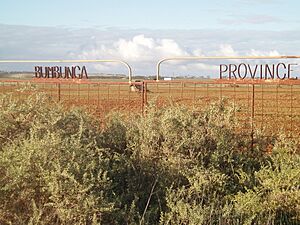
For about ten years, in the 1970s and 1980s, Bumbunga was home to a special place. It was called the Province of Bumbunga. This was a "micronation," which is like a very small, self-declared country. It was not officially recognized by other countries.
Bumbunga's Railway Connection
The Bumbunga railway siding was built in the early 1920s. A siding is a short track next to a main railway line. This siding was part of the Port Pirie railway line. In 1926, a 5-mile (8-kilometer) railway branch line was added. This line went from Bumbunga to the salt works at Lochiel. The salt works are on the southwestern shore of Lake Bumbunga.
Salt Lake Hamlet
Around 1905, a small village called Salt Lake existed. It was located on Salt Lake Road. This road is now the border between Bumbunga and Snowtown. The village was about 750 meters (800 yards) north of Lake Bumbunga.
The Salt Lake hamlet had a school. It also had a small cemetery that you can still see today. The cemetery is on Salt Lake Road, about 1.1 kilometers (0.7 miles) east of Augusta Highway.
 | Emma Amos |
 | Edward Mitchell Bannister |
 | Larry D. Alexander |
 | Ernie Barnes |


