Walker River (Northern Territory) facts for kids
Quick facts for kids Walker |
|
|---|---|
|
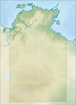
Location of the Walker River mouth in the Northern Territory
|
|
| Country | Australia |
| Territory | Northern Territory |
| Physical characteristics | |
| Main source | Mitchell Ranges Arnhem Land, Australia 315 m (1,033 ft) |
| River mouth | Blue Mud Bay Gulf of Carpentaria, Australia 13°35′21″S 135°49′58″E / 13.58917°S 135.83278°E |
| Length | 119 km (74 mi) |
| Basin features | |
| Basin size | 9,731 km2 (3,757 sq mi) |
| Tributaries |
|
The Walker River is a cool river in the Northern Territory, Australia. It flows for about 119 kilometers (74 miles). This river is an important part of the landscape in this area. It eventually flows into the ocean.
Contents
Where the River Flows
The Walker River starts in the Mitchell Ranges. Imagine it as tiny streams coming together high up. From there, it flows mostly south. It passes between two mountains called Mount Ramsay and Mount Fleming.
The river then goes through a pretty spot known as Fairy Glen. After that, it reaches a flat area called a plain. It then cuts through the Bath Range, passing under Mount Rankine. The river then turns and flows towards the east.
Journey to the Sea
As the Walker River continues its journey, it passes by some Aboriginal communities. These include Marrkalawa and Andanangki. The river then flows past the Coast Range. Finally, it empties into Blue Mud Bay.
Blue Mud Bay is part of the larger Gulf of Carpentaria. This gulf is an arm of the Arafura Sea. So, the river's water eventually mixes with the ocean.
River's Size and Surroundings
The area that collects water for the Walker River is huge. It covers about 9,731 square kilometers (3,757 square miles). This area is called a river catchment. It's like a giant bowl that catches all the rain and sends it to the river.
The Walker River's catchment is located between other river systems. To the north, there's the Koolatong River. To the west, you'll find the Goyder River. And to the south, there's the Roper River.
The River Mouth
Where the river meets the sea, it forms an estuary. This part of the river is very natural and clean. It has a special feature called a tidal delta. This means the tides play a big role in shaping the land here.
The open water area of the estuary is about 29.5 hectares (73 acres). It's mostly shaped by the river's flow. However, the tides also create a delta with one main channel. Around this area, you'll find about 30.9 hectares (76 acres) covered with mangrove trees. Mangroves are special trees that grow in salty water.
River's Past
The land around the Walker River has a long history. The traditional owners of this area are the Nunggubuju peoples. They are Indigenous Australians who have lived here for thousands of years. They have a deep connection to the land and the river.
How the River Got Its Name
The Walker River was named by an explorer named David Lindsay. He explored this region, known as Arnhem Land, in 1883. Lindsay named the river after a man called Thomas Walker.
Thomas Walker was the leader of a group looking for valuable minerals in Blue Mud Bay. Sadly, he lost his life during a conflict with local people in 1875. David Lindsay chose to name the river in his memory.
 | John T. Biggers |
 | Thomas Blackshear |
 | Mark Bradford |
 | Beverly Buchanan |


