Walverden Water facts for kids
Quick facts for kids Walverden Water |
|
|---|---|

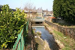
Walverden Water and the Leeds Road bridge.
|
|
| Country | England |
| Physical characteristics | |
| Main source | Walverden Reservoir, southeast of Nelson, Lancashire. 173.7 m (570 ft) |
| River mouth | Pendle Water, west of Nelson. 114 m (375 ft) |
| Length | 2.6 mi (4.2 km) |
| Basin features | |
| Basin size | 5.04 square miles (1,304.23 ha) |
Walverden Water is a small river in Lancashire, England. It flows for about 4.2 kilometers (2.6 miles). The area of land that collects water for the river is about 1304 hectares (5 square miles).
Contents
Journey of Walverden Water
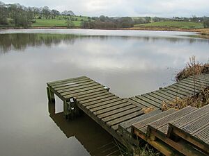
The Walverden Water starts at Walverden Reservoir. This reservoir gets its water from Catlow Brook. Catlow Brook comes from the Coldwell Reservoirs near Boulsworth Hill. From the reservoir, the river flows northwest into the town of Nelson.
It goes under Scholefield Mill and through Walverden Park. Soon after, it enters a series of culverts. These are like tunnels that carry the river underground. It passes through the town center and under the East Lancashire railway line bridge. It also goes under the A56 Leeds Road bridge.
The river then comes out at Bradley Road. Here, it collects water from Bradley Syke. It turns north, then west, and goes underground again. Finally, it enters a tunnel under the Leeds and Liverpool Canal and the M65 motorway. It comes out near Nelson and Colne College and soon flows into Pendle Water.
History of Walverden Water
What's in a Name?
The name Walverden Water might come from old English words. Wælla means stream, fyrhþ means a wooded area, and denu means valley. So, it could mean "stream in the wooded valley." The word "Water" is often used for streams, especially in places like southern Scotland.
Old Boundaries and Mills
Long ago, Walverden Water marked the border between two important areas. These were the manor of Ightenhill and the manor of Colne. It also split the old area of Marsden into two parts: Great Marsden and Little Marsden.
In 1311, the lord of Clitheroe Castle had a mill on the river. This mill was likely near where Clough Head Beck joins the river. There is also proof of an old fulling mill close to the reservoir. A fulling mill was used to clean and thicken cloth. Records from the Duchy of Lancaster show that Richard Towneley was stopped from running his corn mill in 1482. This was because it caused problems for the king's mills in Burnley and Colne.
Mills and Industry
The first map of the area, made in 1848, showed a corn mill with a pond. This was in the small village of Bradley, which is now the center of Nelson. As Nelson grew into a town known for its mills, water power was replaced by steam engines. However, these engines still needed a lot of water.
Several cotton mills were built next to the river. These included Walverden Mill (before 1850), Victoria Mill (1857), and Vale Street Shed (1867).
Building the Reservoir
In 1866, a law was passed to build a special reservoir to store water. Building was delayed because all the offers to build it were too expensive. It was finished by 1869. This reservoir could hold about 1.1 million liters (250,000 gallons) of water.
After the reservoir was built, even more cotton mills appeared along the river. These included Brook Street Mills (by 1884), Bradley Shed (by 1890), and Marsden Mill (by 1909). The Premier Dye Works also used the river's water from before 1909 until 1963.
River Care
In 2010, a company was fined because sewage leaked into the river for four days. This caused a lot of pollution. To help prevent floods, a project was completed in 2011. This project raised flood walls and fixed parts of the river. Some underground sections were also opened up.
 | Kyle Baker |
 | Joseph Yoakum |
 | Laura Wheeler Waring |
 | Henry Ossawa Tanner |


