Nelson, Lancashire facts for kids
Quick facts for kids Nelson |
|
|---|---|
| Town and civil parish | |
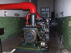
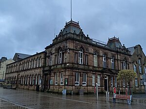
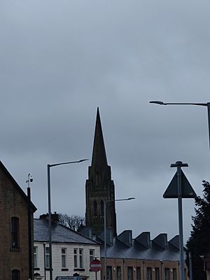
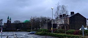
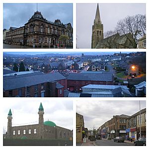 Clockwise from top left: Nelson Town Hall; St Mary's Church; Skyline of Nelson; Nelson Central Mosque; Scotland Road |
|
| Area | 4.64 km2 (1.79 sq mi) |
| Population | 29,135 (2011 Census) |
| • Density | 16,187/sq mi (6,250/km2) |
| OS grid reference | SD856376 |
| • London | 182.74 miles (294 km) SSE |
| Civil parish |
|
| District |
|
| Shire county | |
| Region | |
| Country | England |
| Sovereign state | United Kingdom |
| Post town | NELSON |
| Postcode district | BB9 |
| Dialling code | 01282 |
| Police | Lancashire |
| Fire | Lancashire |
| Ambulance | North West |
| EU Parliament | North West England |
| UK Parliament |
|
| Website | Pendle Borough Council |
Nelson is a town in Lancashire, England. It is part of the Borough of Pendle. In 2011, about 29,135 people lived there. Nelson is about 3 miles (5 km) north of Burnley and 2 miles (3 km) south-west of Colne. The town grew a lot during the Industrial Revolution as a place where many factories, especially cotton mills, were built.
Contents
History of Nelson
Early Beginnings
Long ago, in the Iron Age, there was a hillfort called Castercliff near Nelson. A hillfort is a type of fort built on a hill. The modern town of Nelson grew from two old areas called Little Marsden and Great Marsden.
A river called Walverden Water flows through the area. It joins another river, Pendle Water. In 1311, there was a mill on the river, used for grinding grain. There was also an old mill for making cloth thicker, called a fulling mill.
The Pendle Witches
The nearby Forest of Pendle is famous for the Pendle witch trials of 1612. These were trials where people were accused of being witches. In 1634, another person accused of witchcraft, Margaret Johnson, said she met her magical helper in Marsden.
Growth as a Mill Town
Factories started appearing in Nelson very early. The Ecroyd family built a small mill in 1740. They built a bigger water-powered mill in 1780.
The town really grew when the Leeds and Liverpool Canal arrived in 1796. Then, the East Lancashire Railway Line came in 1849. These transport links helped Nelson become an industrial town. Its main business was making cotton cloth.
The first map of the area from 1848 shows three small villages: Marsden, Hebson, and Bradley. These villages grew together to form Nelson. The name "Nelson" was chosen to avoid confusion with another town called Marsden in West Yorkshire. It was named after the famous Admiral Lord Nelson.
By 1891, Nelson had 57 cotton factories. The biggest one had 1,950 looms, which are machines for weaving cloth. The cotton industry was very important. By 1910, over 12,000 local workers were part of the Nelson and District Power-Loom Weavers' Association. This was a group that helped workers.
Coal Mining
Nelson is also part of the Burnley Coalfield. This means there was coal in the ground. People dug for coal here as early as 1465. There was a coal mine called Clough Head Colliery. It had some accidents, including explosions that sadly killed workers.
Modern Nelson
In the 20th century, Nelson became known for making sweets like Jelly Babies and Victory V. A big holiday company, Airtours (now part of Thomas Cook), also started here. However, the textile industry has mostly disappeared. This has led to lower house prices and more people looking for jobs in the town.
How Nelson is Governed
Local Government
Nelson became an official town with its own council in 1890. This was granted by Queen Victoria.
In the early 1900s, Nelson was known for its strong left wing politics. People called it "Little Moscow" because the local council often supported workers' rights. For example, the council took control of gas and water services to help the public. They also refused to celebrate King George V's special anniversary in 1935. Instead, they spent money on free meals for schoolchildren and people who didn't have jobs.
Since 1974, Nelson has been part of the Borough of Pendle. In 2008, a new Nelson civil parish was created. This means Nelson now has three levels of local government:
- Lancashire County Council (for the whole county)
- Pendle Borough Council (for the Pendle area)
- Nelson Town Council (just for Nelson)
The Nelson Town Council has 24 councillors. The main offices for the town and borough councils are at Nelson Town Hall.
Local Representatives
Nelson is divided into four areas called wards for local elections. These are Bradley, Brierfield East & Clover Hill, Marsden & Southfield, and Whitefield & Walverden.
The person who represents Nelson in the national Parliament is called a Member of Parliament (MP). The current MP for the area, Pendle and Clitheroe, is Jonathan Hinder. He was first elected in 2024.
Population and People
| Year | 1911 | 1921 | 1931 | 1939 | 1951 | 1961 | 1971 | 2001 | 2011 | ||||||||||||
|---|---|---|---|---|---|---|---|---|---|---|---|---|---|---|---|---|---|---|---|---|---|
| Population | 39,479 | 39,841 | 38,304 | 34,803 | 34,384 | 32,292 | 31,286 | 28,998 | 29,135 | ||||||||||||
The 2011 Census showed that Nelson civil parish had a population of 29,135 people. Nelson is part of a larger built-up area that had about 149,422 people in 2011.
In 2011, the population of Nelson was made up of different groups:
- 52.8% White (44% White British)
- 45.4% Asian
- 1.5% Mixed
- 0.1% Black
- 0.2% Other
The main religious groups are Christian (39.0%) and Muslim (37.6%). About 59.9% of adults aged 16 to 74 are working.
Economy and Businesses
Nelson's town centre has many well-known shops. These include Boots, Specsavers, Home Bargains, Peacocks, and Greggs.
The Pendle Rise Shopping Centre has been a main shopping spot for over 50 years. It opened in 1967. Below it is Nelson Market, a covered market.
In 2011, the main road through the town centre was reopened to traffic. It used to be just for people walking. This was done to help local shops. In 2012, Nelson received £100,000 to help improve its shopping area.
The biggest business area is Lomeshaye, near the M65 motorway. It has over 80 businesses and employs about 4,000 people. There is also the Lomeshaye Business Village, which has smaller businesses in an old cotton mill.
Getting Around Nelson
Nelson is connected by the M65 motorway. This road goes west to places like Burnley and Preston, and north-east to Colne. Other main roads are the A56 and the A682.
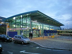
In 2008, a new bus and train station called the Nelson Interchange opened. It cost £4.5 million and has many features like cycle stands, electronic information, and a direct link to the train station.
Trains from Nelson go west to Blackpool South and east to Colne. These trains run every hour, seven days a week.
The main bus company in Nelson is Burnley Bus Company. You can also catch a National Express coach to London from the Interchange. There's a special bus service called the X43 Witch Way. It goes to Manchester city centre and has comfortable double-decker buses with WiFi.
Sports and Fun
Football
Nelson F.C. is the local football team. They were part of the Football League from 1921 to 1931. A cool fact: Nelson F.C. was the first English team to beat Real Madrid in Spain, back in 1923!
Cricket
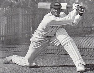
Nelson Cricket Club started in 1861. They have won the Lancashire League championship 21 times. A famous West Indian cricketer, Learie Constantine, played for Nelson from 1929 to 1938. He later became a very important person and chose to be known as Baron Constantine of Nelson.
Other Sports
- Speedway racing used to happen at Seedhill Stadium from 1967 to 1970. The local team was called the Nelson Admirals.
- Golf is popular in Nelson. There are two golf clubs: Marsdon Park Golf Club and Nelson Golf Club.
- Wrestling is also available, with the Nelson Wrestling Club being part of the British Wrestling Association.
Parks and Recreation
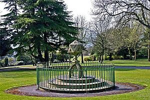
Nelson has several parks, including Victoria Park and Marsden Park. Groups like the Heritage Trust for the North West work to restore old buildings. They have helped save a whole street of old Victorian workers' houses, a former school, and a cotton mill. They also plan to open St Mary's Church as an exhibition centre.
Media and News
Nelson is mentioned in the 1991 song "It's Grim Up North" by the band KLF.
For local news and TV, people in Nelson watch BBC North West and ITV Granada.
Local radio stations include Capital Manchester and Lancashire and BBC Radio Lancashire. There's also Pendle Community Radio, which is mainly for the local Asian community. Nelson has two local newspapers: the Nelson Leader, published on Fridays, and the daily Lancashire Telegraph.
Famous People from Nelson
Many interesting people have connections to Nelson:
- Bernie Calvert (born 1942), musician from the band The Hollies.
- Learie Constantine (1901−1971), a famous West Indian cricketer and politician.
- David Fishwick (born 1971), a well-known businessman.
- Tony Hicks (born 1945), musician from The Hollies.
- Jimmy Hogan (1882−1974), a famous footballer and manager.
- Ted Koppel (born 1940), a British-American broadcast journalist, was born here.
- Eric Knowles (born 1953), an expert on antiques.
- Mike Phelan (born 1962), a footballer and coach.
- John Simm (born 1970), a well-known actor.
- Nicola Wheeler (born 1974), an actress in the TV show Emmerdale, lived in Nelson.
See also
 In Spanish: Nelson (Lancashire) para niños
 | Lonnie Johnson |
 | Granville Woods |
 | Lewis Howard Latimer |
 | James West |


