Wanda, Minnesota facts for kids
Quick facts for kids
Wanda
|
|
|---|---|

Cities and townships of Redwood County
|
|
| Country | United States |
| State | Minnesota |
| County | Redwood |
| Area | |
| • Total | 0.26 sq mi (0.68 km2) |
| • Land | 0.26 sq mi (0.67 km2) |
| • Water | 0.00 sq mi (0.01 km2) |
| Elevation | 1,086 ft (331 m) |
| Population
(2020)
|
|
| • Total | 72 |
| • Density | 277.99/sq mi (107.28/km2) |
| Time zone | UTC-6 (Central (CST)) |
| • Summer (DST) | UTC-5 (CDT) |
| ZIP code |
56294
|
| Area code(s) | 507 |
| FIPS code | 27-68008 |
| GNIS feature ID | 2397190 |
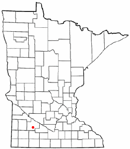
Wanda is a small city located in Redwood County, Minnesota, in the United States. In 2010, about 84 people lived there. By 2020, the population was 72.
Contents
A Look Back: Wanda's Story
Wanda was officially planned and laid out in 1899. This process is called "platting." The city's name comes from the Ojibwe language. It means "forgetfulness."
A post office has been open in Wanda since 1900. The city officially became a city in 1901.
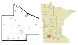
Where is Wanda?
The United States Census Bureau says that Wanda covers about 0.26 square miles (0.67 square kilometers). All of this area is land.
Wanda is located west of U.S. Highway 71. It is also north of U.S. Highway 14. County Highway 17 connects Wanda to County Highway 4. County Highway 4 is less than one mile north of Wanda. This road then leads to U.S. Highway 71, which is about four miles to the east.
Who Lives in Wanda?
| Historical population | |||
|---|---|---|---|
| Census | Pop. | %± | |
| 1910 | 129 | — | |
| 1920 | 185 | 43.4% | |
| 1930 | 151 | −18.4% | |
| 1940 | 191 | 26.5% | |
| 1950 | 178 | −6.8% | |
| 1960 | 160 | −10.1% | |
| 1970 | 124 | −22.5% | |
| 1980 | 118 | −4.8% | |
| 1990 | 103 | −12.7% | |
| 2000 | 103 | 0.0% | |
| 2010 | 84 | −18.4% | |
| 2020 | 72 | −14.3% | |
| U.S. Decennial Census | |||
Wanda's Population in 2010
According to the census taken in 2010, 84 people lived in Wanda. These people made up 39 households. A household is a group of people living in the same home. Out of these, 25 were families.
The city had a population density of about 323 people per square mile. This means that for every square mile, there were about 323 people. There were 41 housing units in total.
All of the people living in Wanda were identified as White.
Households and Families
Out of the 39 households, about 20.5% had children under 18 living with them. More than half, 51.3%, were married couples living together. About 5.1% had a female head of the house with no husband present. And 7.7% had a male head of the house with no wife present.
About 35.9% of all households were made up of just one person. Some of these were people aged 65 or older living alone. The average household had 2.15 people. The average family had 2.76 people.
Age in Wanda
The average age of people in Wanda was 50.5 years old. About 22.6% of residents were under 18 years old. A small group, 3.7%, were between 18 and 24. About 17.8% were between 25 and 44. The largest group, 39.3%, were between 45 and 64 years old. Finally, 16.7% were 65 years old or older.
The city had a nearly even split between genders. About 48.8% of the population was male, and 51.2% was female.
See also
 In Spanish: Wanda (Minnesota) para niños
 | Percy Lavon Julian |
 | Katherine Johnson |
 | George Washington Carver |
 | Annie Easley |


