Watts, Oklahoma facts for kids
Quick facts for kids
Watts, Oklahoma
|
|
|---|---|

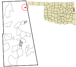
Location within Adair County and the state of Oklahoma
|
|
| Country | United States |
| State | Oklahoma |
| County | Adair |
| Area | |
| • Total | 0.53 sq mi (1.38 km2) |
| • Land | 0.53 sq mi (1.38 km2) |
| • Water | 0.00 sq mi (0.00 km2) |
| Elevation | 984 ft (300 m) |
| Population
(2020)
|
|
| • Total | 227 |
| • Density | 426.69/sq mi (164.71/km2) |
| Time zone | UTC-6 (Central (CST)) |
| • Summer (DST) | UTC-5 (CDT) |
| ZIP code |
74964
|
| Area code(s) | 539/918 |
| FIPS code | 40-79100 |
| GNIS feature ID | 2413456 |
Watts is a small town located in northern Adair County, Oklahoma, in the United States. It was named after John Watts, also known as Young Tassel. He was a important Chickamauga Cherokee chief who passed away in 1802. In 2020, the town had a population of 227 people.
Contents
History of Watts
Watts is located close to where Old Fort Wayne was built in 1838. A railroad company called the Kansas City Southern Railway (KCS) built train tracks through this area between 1895 and 1896.
In 1912, KCS moved its main operations from Stillwell to Watts Switch. This new spot was about one mile north of a community called Ballard. Many businesses and people from Ballard moved to the new Watts area. This included shop owners, people who liked to gamble, land sellers, construction workers, and railroad employees.
Early Businesses and Growth
Watts quickly grew into a busy town. Frank C. Adair and Frank Howard started the Guarantee Bank. After Oklahoma became a state, Frank Adair became the first sheriff of Adair County.
Many other businesses opened in Watts. Hotels and boarding houses provided places to stay for workers and travelers. A lumberyard, a hardware store, and two places for horses (livery stables) also opened. Three doctors started their practices in town, and two drug stores helped people get medicine. A bakery and a cigar factory also opened, showing the town was doing well. The local newspaper, the Watts Watchman, began publishing in the 1910s. A post office was set up inside a store on March 30, 1912.
Decline of the Town
Watts began to shrink even before the Great Depression started. The KCS railroad faced tough times between World War I and World War II. Because of this, KCS started to close down its facilities in Watts. They removed the roundhouse (where trains were repaired), coal chute, water pump station, icehouse, and water tower. The train station, which was the last part of their operations, was taken down in the 1980s. Many workers lost their jobs and had to move to find work elsewhere.
The first official population count for Watts was 396 people in 1920. This number went down to 267 by 1950. It then went up to 326 in 1970, but dropped again to 303 in 1990. By 2000, Watts only had two feed mill businesses. Most people who worked lived in Watts but traveled to other towns for their jobs. Many commuted to Siloam Springs, Arkansas, which is only about 6 miles (10 km) north.
Geography
Watts is located in a part of Oklahoma that is entirely land. The United States Census Bureau says the town covers about 0.4 square miles (1.0 km²).
The town is situated on U.S. Highway 59. It is about 9 miles (14 km) north of Westville.
A nearby stream called Ballard Creek flows into the Illinois River.
Population Information
| Historical population | |||
|---|---|---|---|
| Census | Pop. | %± | |
| 1920 | 396 | — | |
| 1930 | 353 | −10.9% | |
| 1940 | 307 | −13.0% | |
| 1950 | 267 | −13.0% | |
| 1960 | 268 | 0.4% | |
| 1970 | 326 | 21.6% | |
| 1980 | 316 | −3.1% | |
| 1990 | 303 | −4.1% | |
| 2000 | 316 | 4.3% | |
| 2010 | 324 | 2.5% | |
| 2020 | 227 | −29.9% | |
| U.S. Decennial Census | |||
In the year 2000, there were 316 people living in Watts. These people lived in 103 households, and 73 of these were families. The town had about 861 people per square mile (332 per km²). There were 120 homes in total.
Most of the people in Watts were White (66.14%). About a quarter of the population (24.68%) were Native American. A small number were African American (0.32%) or Asian (0.63%). Some people were from other races (1.58%) or from two or more races (6.65%). About 3.16% of the population identified as Hispanic or Latino.
About 36.9% of households had children under 18 living with them. Most households (58.3%) were married couples living together. About 14.6% of households had someone living alone who was 65 years old or older. The average household had 2.76 people.
The median age in Watts was 35 years old. This means half the people were younger than 35 and half were older. About 27.2% of the population was under 18 years old. About 12.3% of the population was 65 years or older.
The median income for a household in Watts was $26,417. This means half the households earned more than this amount and half earned less. About 19.7% of the population and 9.6% of families lived below the poverty line.
See also
 In Spanish: Watts (Oklahoma) para niños
 | Laphonza Butler |
 | Daisy Bates |
 | Elizabeth Piper Ensley |

