Weiser River facts for kids
Quick facts for kids Weiser River |
|
|---|---|

|
|
|
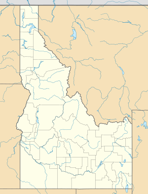
Location of the mouth of the Weiser River in Idaho
|
|
| Country | United States |
| State | Idaho |
| Counties | Adams, Washington, Valley |
| Physical characteristics | |
| Main source | northwest of New Meadows, Adams County, Idaho 4,174 ft (1,272 m) 45°01′13″N 116°26′05″W / 45.02028°N 116.43472°W |
| River mouth | Snake River near Weiser, Washington County, Idaho 2,096 ft (639 m) 44°14′19″N 116°58′20″W / 44.23861°N 116.97222°W |
| Length | 103 mi (166 km) |
| Basin features | |
| Basin size | 1,660 sq mi (4,300 km2) |
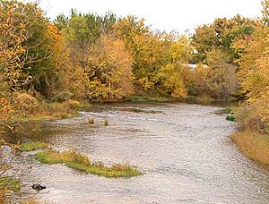
The Weiser River is a river in western Idaho, United States. It flows for about 103-mile-long (166 km). This river is a branch, or tributary, of the larger Snake River.
The Weiser River helps drain a large area of about 1,660 square miles (4,300 km2). This area includes mountains and rolling hills. Many small streams also flow into the Weiser River. This region is found south and east of Hells Canyon, near the border between Idaho and Oregon.
Contents
Where the Weiser River Flows
The Weiser River starts in northern Adams County. Its source is in the Seven Devils Mountains. This is about 10 miles (16 km) west of a town called New Meadows. The river begins its journey within the Payette National Forest.
River's Path and Towns
The river generally flows toward the southwest. It travels between two mountain ranges. These are the Cuddy Mountains to the west and the West Mountains to the east. As it flows, the Weiser River passes by the towns of Council and Cambridge.
In southern Washington County, the river turns west. It flows this way for its last 10 miles (16 km). Here, it enters a wider valley known as the Weiser Cove. This valley is at the edge of the Snake River Plain. Finally, the Weiser River joins the Snake River from the east, near the town of Weiser.
Other Rivers and Elevation
The Weiser River has a smaller river that flows into it. This is the Little Weiser River. It joins the Weiser River from the east. This meeting point is about 2 miles (3 km) southwest of Cambridge.
The river starts very high up, at about 8,000 feet (2,400 m) above sea level. By the time it reaches the Snake River, its elevation is much lower, around 2,090 feet (640 m). This big drop in height means the water flows downhill.
For much of its journey, the Weiser River flows through narrow mountain paths. Sometimes, it opens up into wider valleys. These valleys are often used for ranching, like the one near Midvale.
How the River is Used
The Weiser River flows freely without any dams blocking it. However, its water is used for irrigation. This means people use the river water to help grow crops. This happens near its mouth, upstream from Weiser. Water is also used from its smaller branches higher up the river.
Long ago, a train track followed the river's path. This was the Pacific and Idaho Northern Railroad. It ran from Weiser all the way to New Meadows.
Naming the Weiser River
Both the Weiser River and the town of Weiser are named after a person. They are named for Private Peter M. Weiser. He was part of the famous Lewis and Clark Expedition. This expedition explored the western United States between 1804 and 1806.
 | Aaron Henry |
 | T. R. M. Howard |
 | Jesse Jackson |


