Werrington County, New South Wales facts for kids
Quick facts for kids Werrington CountySydney, New South Wales |
|||||||||||||||
|---|---|---|---|---|---|---|---|---|---|---|---|---|---|---|---|
| Population | 3,645 (2016 census) | ||||||||||||||
| • Density | 1,744/km2 (4,520/sq mi) | ||||||||||||||
| Postcode(s) | 2747 | ||||||||||||||
| Elevation | 40 m (131 ft) | ||||||||||||||
| Area | 2.09 km2 (0.8 sq mi) | ||||||||||||||
| Location | 50 km (31 mi) west of Sydney CBD | ||||||||||||||
| LGA(s) | Penrith City Council | ||||||||||||||
| State electorate(s) | Londonderry | ||||||||||||||
| Federal Division(s) | Lindsay | ||||||||||||||
|
|||||||||||||||
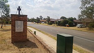
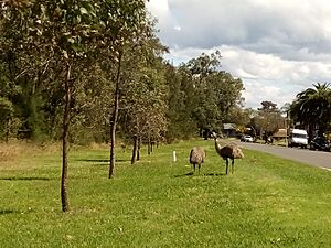
Werrington County is a suburb located in Sydney, New South Wales, Australia. It is about 50 kilometres (31 miles) west of the main city centre of Sydney. This area is part of the City of Penrith and is known for its homes, mostly separate houses.
Werrington County is also part of the traditional lands of the Indigenous Australian Darug people. It is located within the Deerubbin Local Aboriginal Land Council Area.
Contents
History of Werrington County
First Peoples: Aboriginal Culture
Before European settlers arrived, the land now known as Werrington County was home to the Mulgoa people. They were part of the Darug Nation and spoke the Darug language. These people lived by hunting and gathering food, following their ancient laws and beliefs from the Dreamtime. Their homes were simple bark huts called 'gunyahs'. They hunted animals like kangaroos and emus for food. They also gathered plants such as yams and berries.
In 1788, the First Fleet arrived in Australia. Soon after, a serious smallpox disease spread, which greatly reduced the number of local Indigenous people. This made it easier for the new settlers to take over their land.
European Settlement and Growth
Werrington County began as a land grant in 1806. This land was given to Mary King, who was the youngest daughter of Governor Philip Gidley King. For many years, Werrington County was used as farmland. Then, in the early 1980s, the land was divided into smaller lots. These lots were sold for building homes and businesses, turning the area into the suburb we see today.
Geography and Nature
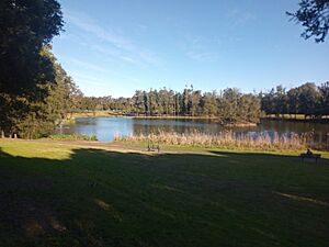
Werrington County is located on higher ground compared to many other suburbs in the Penrith area. Werrington Creek flows along the eastern side of the suburb. You can also find Werrington Lakes in the southwestern part of the suburb.
Shopping and Services
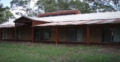
Werrington County has several useful places for its residents. There is a Child Care centre and the Werrington County Shopping Village. You can also find Caltex and 7-Eleven petrol stations. For sports and fun, there's The Henry Sports Club, which offers tennis, golf, and squash facilities. The Namatjira Neighbourhood Centre is also located here.
If you need more shopping options, the St Marys Shopping Centre is just a short drive away in St Marys, New South Wales. This centre has over 40 different shops, including a Woolworths supermarket.
Who Lives Here? Demographics
According to the 2016 Census, 3,645 people lived in Werrington County. The average weekly income for households was $1,605. This was higher than the national average of $1,234.
About 50.2% of the people were male and 49.8% were female. The average age of residents was 36 years old. Most people (81.2%) were born in Australia. Other countries of birth included England (4.1%), New Zealand (1.4%), and Scotland (1.2%).
The most common backgrounds people identified with were Australian (32.3%) and English (28.2%). Many people also had Irish (8.4%) or Scottish (6.1%) roots. About 4.7% of residents identified as Aboriginal and/or Torres Strait Islander.
For religion, the top choices were Catholic (35.8%) and Anglican (27.1%). About 16.0% of people said they had no religion. Most people (89.2%) spoke only English at home. Other languages spoken included Spanish (0.8%) and Greek (0.6%).
Local Schools
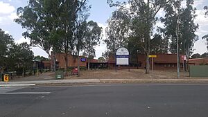
Werrington County Public School is a primary school located on John Batman Avenue. It opened in 1982 and was officially celebrated in 1993. The school is well-regarded in the Penrith area. For high school, the closest option is Cambridge Park High School in Cambridge Park, New South Wales.
Parks and Green Spaces
Werrington County has five parks that cover almost 29% of its total area. These include Shaw Park, Ellison Reserve, and the Werrington Lakes Flora & Fauna Reserve. These places offer great spots for outdoor activities and enjoying nature.
Healthcare Services
The nearest hospital is Nepean Hospital in Penrith. This hospital offers many different medical services. Werrington County also has a Medical Centre located at the Werrington County Shopping Village for local healthcare needs.
Getting Around: Transport
Werrington County has good transport connections. You can easily reach Penrith by driving west on Dunheved Road or using the Great Western Highway. The suburb is close to the M4 Western Motorway, which can be accessed via Kent Road. This motorway is useful for residents travelling towards the Sydney CBD.
The closest train station is Werrington railway station. It is on the T1 Western Line and offers direct train services to the Sydney CBD.
Busways provides three bus services that run through the Werrington County area:
- Route 780 travels along Dunheved Road, passing the Werrington County Shopping Village. It then goes to either Penrith or Mount Druitt (via Ropes Crossing).
- Route 782 travels around Greenbank Drive and Henry Lawson Avenue. It then goes to either Penrith or St Marys.
- Route 785 goes through Cambridge Park to Werrington railway station, covering some parts of Werrington County.
Local Government and Representation
At the local level, Werrington County is part of the north ward of the Penrith City Council. This council is responsible for local services and decisions.
For state government, Werrington County is part of the Electoral district of Londonderry. This area is represented by Prue Car, who is a member of the Labor Party.
At the federal level, Werrington County is in the Division of Lindsay. This area is represented by Melissa McIntosh from the Liberal Party.
Werrington County is also located within the Deerubbin Local Aboriginal Land Council Area.
 | Janet Taylor Pickett |
 | Synthia Saint James |
 | Howardena Pindell |
 | Faith Ringgold |


