
M4 Motorway (Sydney) facts for kids
Quick facts for kids M4 MotorwayNew South Wales |
|
|---|---|
 |
|
| Aerial view looking east in December 2010 | |
| General information | |
| Type | Motorway |
| Length | 54.8 km (34 mi) |
| Opened | 1971–1993 (Glenbrook–Strathfield) 2019–2023 (Strathfield–Rozelle) |
| Gazetted | February 1977 |
| Route number(s) | |
| Former route number |
|
| Major junctions | |
| West end | Glenbrook, Sydney |
|
|
| East end | Rozelle, Sydney |
| Location(s) | |
| Major suburbs | Penrith, Prospect, Parramatta, Granville, Clyde, Auburn, Homebush, Concord |
| Highway system | |
| Highways in Australia National Highway • Freeways in Australia Highways in New South Wales |
|
The M4 Motorway is a major road in Sydney, Australia. It is about 55 kilometres long and helps drivers travel across the city. Parts of the M4 require a toll, which is a fee you pay to use the road. It is a dual carriageway, meaning it has two separate roads for traffic going in opposite directions.
The M4 Motorway is made of two main parts:
- Western Motorway: This is the older part. It was built between 1971 and 1993. It connects Glenbrook to Concord. In 2017, a section of this road was made wider and started charging a toll as part of the WestConnex project.
- East Motorway: This is a newer tunnel that extends the M4 from Homebush to Rozelle. It was finished between 2019 and 2023. This extension connects to other major roads like the M8 Motorway and the Anzac Bridge.
Contents
Where Does the M4 Motorway Go?
The M4 Motorway starts in Glenbrook, near the Blue Mountains. It begins as a four-lane road and gets wider as it goes east. It crosses the Nepean River and passes through areas like Regentville and Erskine Park.
Near Prospect, the M4 passes under the Westlink M7 at a large interchange called the Light Horse Interchange. As it continues east through Parramatta, the road starts charging a toll. The motorway then enters tunnels and goes underground, eventually ending in Rozelle. Here, it connects to the Western Distributor, which leads into the city.
There is also a special M4 cycleway for bikes. It runs next to the M4 Motorway between Sydney Olympic Park and South Wentworthville.
How the M4 Motorway Was Built
Roads like the M4 don't just appear; they are carefully planned and built over many years. The first main road going west from Sydney was the Great Western Highway. Over time, plans were made to build a new, faster road, which became the M4.
Building the Western Freeway
The Western Freeway, which is now part of the M4, was built in several steps. The first part opened in 1971, connecting Emu Plains and Regentville. More sections opened in the 1970s and 1980s, helping drivers bypass busy towns.
In 1976, the Premier of New South Wales, Neville Wran, promised to stop building the freeway in some areas. This meant that land set aside for the road was sold off. However, other sections continued to open, connecting places like Mays Hill, Parramatta, and Auburn. A large elevated section, the Granville Viaduct, opened in 1986, helping to connect different parts of the freeway.
Becoming the Western Motorway
In 1985, there wasn't enough money to finish the freeway. So, in 1989, a special project started. A group of companies helped pay for the road's construction. In return, they were allowed to charge a toll (a fee) for using a section of the road. This section was between James Ruse Drive and Silverwater Road. When the toll started in 1992, the road's name changed to Western Motorway. The toll was removed on February 15, 2010, when the government took back control of the motorway.
The motorway was originally four lanes wide. It was made wider to six lanes between 1998 and 2000 to help with traffic. Even with more lanes, it can still get very busy.
The M4 was planned to go all the way into the Sydney central business district (CBD). However, due to protests and the need to protect historic sites like Lennox Bridge, the western end of the road was stopped at Emu Plains for a while. In 1993, a new section opened, bypassing a narrow and winding part of the Great Western Highway.
In 2013, the government announced plans to make the M4 a "Smart Motorway." This means adding better signs, traffic lights on ramps to control traffic flow, and systems to manage speed and incidents.
The road's name and route numbers have changed over the years. It was first National Route 32, then Freeway Route F4, then Metroad 4, and finally, in 2013, it became the M4.
As part of the WestConnex project, the section between Church Street in Parramatta and Concord was widened starting in 2015. To help pay for this, tolls were brought back on this section from August 15, 2017.
The M4 East Tunnel
 |
|
| WestConnex M4 Tunnel western exit at Homebush | |
| Overview | |
|---|---|
| Route | M4 Motorway |
| Start | Haberfield (east) |
| End | Homebush (west) |
| Operation | |
| Work begun | 2015 |
| Owner | WestConnex |
| Operator | Sydney Motorway Corporation |
| Toll | $4.41 (2020 dollars, subject to indexing, each way) |
| Technical | |
| Construction |
|
| Length | 5.6 kilometres (3.5 mi) |
| Number of lanes | 3 in each direction |
| Operating speed | 80 kilometres per hour (50 mph) (variable speed limit) |
For many years, people wanted to extend the M4 further east into Sydney. In the 1990s, there were ideas to extend it to Ashfield. In 2002, the government suggested a $7 billion plan for an M4 East tunnel. They looked at different options, including shorter or longer tunnels.
The idea for the M4 East tunnel was put on hold in 2005 due to public concerns. However, in 2012, the NSW government decided to go ahead with the WestConnex project. This project included widening the existing M4 and building a new tunnel extension from North Strathfield to Taverners Hill.
In 2015, companies like Leighton Contractors, Samsung, and John Holland Group were chosen to design and build the WestConnex M4 Tunnel. This 5.5-kilometre tunnel runs about 35 metres under Parramatta Road. It was paid for by grants from the NSW and Australian governments, as well as tolls from users. The M4 East tunnel opened on July 13, 2019. Tolls are charged for using both the M4 East Tunnel and the widened section of the M4 between Parramatta and Homebush. These tolls are expected to continue until 2060.
M4 and M8 Extensions
The WestConnex project also included a new connection from the end of the M4 at Haberfield to the M8 Motorway at St Peters. This part of the project also included a large interchange at Rozelle, connecting to the Anzac Bridge and Victoria Road. This new section helps reduce travel times and takes heavy trucks off local streets in inner Sydney.
These new connections opened in stages in 2023. The M4 route was extended to meet the M8, and then further extended to Rozelle and the Anzac Bridge.
M4 Smart Motorway Project
In 2019, the NSW government announced the M4 Smart Motorway Project. This project aims to improve traffic flow on the untolled section of the M4 between Lapstone and Mays Hill. It involves making on and off-ramps wider. It also includes installing overhead signs that show variable speed limits. Traffic lights will be added to on-ramps to control how many cars enter the motorway during busy times.
Paying to Use the M4 Motorway
Some parts of the M4 Motorway charge a toll, which is a fee for using the road. This is part of the WestConnex project. Toll points are located at different entrances and exits along the tolled sections.
The toll usually includes:
- A flagfall: This is a basic fee.
- A charge per kilometre: This is an extra fee based on how far you travel on the tolled section.
Tolls for large vehicles like trucks are three times higher than for cars and motorcycles. The toll prices usually go up each year, either by 4% or based on the consumer price index (CPI), whichever is higher. This will continue until 2040.
A toll was previously charged on the M4 between James Ruse Drive and Silverwater Road. However, this toll was removed on February 16, 2010, when the state government took over the road.
Exits and interchanges
| LGA | Location | km | mi | Destinations | Notes |
|---|---|---|---|---|---|
| Blue Mountains | Glenbrook | 0 | 0.0 | Western end of motorway and route M4; Road continues as Great Western Highway |
|
| Blue Mountains–Penrith boundary | Glenbrook–Emu Plains–Leonay tripoint | 0.6 | 0.37 | Blue Mountains railway line | |
| Penrith | Emu Plains–Leonay boundary | 1.7 | 1.1 | Offset dumbbell interchange | |
| Nepean River | 2.6 | 1.6 | Regentville Bridge | ||
| Penrith | Jamisontown–Regentville boundary | 4.0 | 2.5 | Mulgoa Road – Mulgoa, Penrith | Diamond interchange |
| Glenmore Park–South Penrith–Orchard Hills tripoint | 7.5 | 4.7 | Single-point urban interchange | ||
| Orchard Hills–Claremont Meadows boundary | 12.7 | 7.9 | Kent Road – Orchard Hills, Werrington | Half-diamond interchange, eastbound entrance and westbound exit only | |
| South Creek | 13.2 | 8.2 | Bridge over the river (no known name) | ||
| Penrith | Orchard Hills–St Clair–St Marys tripoint | 13.7 | 8.5 | Mamre Road – St Marys, Badgerys Creek | Partial cloverleaf interchange |
| Erskine Park–Colyton boundary | 17.2 | 10.7 | Roper Road (north) – Mt Druitt, Lethbridge Park Erskine Park Road (south) – Erskine Park |
Partial cloverleaf interchange, eastbound and westbound entrance, westbound exit only | |
| Blacktown | Eastern Creek–Minchinbury boundary | 21.6 | 13.4 | Wallgrove Road – Horsley Park, Rooty Hill | Diamond interchange |
| Light Horse Interchange: modified four-level stack interchange; tolled entrance to and exit from M7 | |||||
| Huntingwood–Blacktown–Prospect tripoint | 25.5 | 15.8 | Reservoir Road – Pemulwuy, Blacktown, Sydney Motorsport Park, Prospect Reservoir | Partial diamond and partial cloverleaf interchange | |
| Prospect | 27.4 | 17.0 | Prospect Highway – Pemulwuy, Prospect, Wet'n'Wild, Prospect Reservoir | Partial offset dumbbell interchange | |
| Parramatta | Greystanes–South Wentworthville boundary | 32.0 | 19.9 | Diamond interchange | |
| South Wentworthville–Merrylands boundary | 33.7 | 20.9 | Eastbound entrance ramp from Great Western Highway; Westbound exit via Coleman Street |
||
| Merrylands | 34.6 | 21.5 | Burnett Street – Merrylands, Parramatta | Eastbound entrance and westbound exit only | |
| Holroyd | 35.9 | 22.3 | Western boundary of toll road | ||
| Holroyd–Granville boundary | 36.2 | 22.5 | Woodville Road (south) – Villawood |
Eastbound exit and westbound entrance only No right turn from Church Street into westbound entrance ramp |
|
| Clyde | 37.7 | 23.4 | James Ruse Drive (north) – Rose Hill, North Parramatta, Northmead | Eastbound exit to the north only, westbound entrance from the north only | |
| 37.8 | 23.5 | James Ruse Drive – Rose Hill, North Parramatta, Northmead, to Great Western Highway | Eastbound entrance and westbound exit only | ||
| Duck River | 38.8 | 24.1 | Bridge over the river (no known name) | ||
| Cumberland | Auburn–Lidcombe boundary | 40.4 | 25.1 | Diamond interchange | |
| Haslams Creek | 41.2 | 25.6 | Bridge over the river (no known name) | ||
| Cumberland | Lidcombe | 41.6 | 25.8 | Hill Road – Lidcombe, Wentworth Point, Sydney Olympic Park | Eastbound exit to the north, eastbound and westbound entrances from the north only |
| Homebush West | 43.3 | 26.9 | Offset diamond interchange hybrid; westbound entrance from the north is via a loop | ||
| Strathfield | Homebush | 44.0 | 27.3 | M4 Western Motorway eastern terminus; M4 East western terminus | M4 East Tunnel entrance/exit |
| 45.0 | 28.0 | Westbound entrance only | |||
| Powells Creek | 45.1 | 28.0 | Tunnel under creek, bridge over the creek (no known name) | ||
| Strathfield | North Strathfield | 45.5 | 28.3 | Sydney Street (to Concord Road) – North Strathfield, Strathfield, Concord | Surface entrance and exit: Eastbound exit to the north and south, westbound entrance from the north only |
| Concord Road – North Strathfield, Strathfield, Concord | Tunnel entrance and exit: Eastbound entrance and westbound exit only |
||||
| North Strathfield–Concord boundary | 45.9 | 28.5 | Westbound entrance from and eastbound exit to east only Eastern terminus of surface-level roadway |
||
| Iron Cove Creek | 48.9 | 30.4 | Tunnel under the creek | ||
| Inner West | Haberfield | 49.3 | 30.6 | M4 East eastern terminus; M4–M8 Link western terminus | |
| Westbound entrance from and eastbound exit to the north only Eastbound entrance from and westbound exit to the south only |
|||||
| Haberfield–Ashfield boundary | 49.6 | 30.8 | Westbound entrance from and eastbound exit to the east only | ||
| Hawthorne Canal | 51.2 | 31.8 | Tunnel under the canal | ||
| Inner West | Leichhardt | 52.1 | 32.4 | M4–M8 Link continues along the M8 Motorway Rozelle Interchange western terminus |
|
| Lilyfield | 53.1 | 33.0 | Eastern boundary of toll road | ||
| Western Harbour Tunnel – North Sydney, Warringah Freeway | Under construction Westbound entrance and eastbound exit only |
||||
| Rozelle | 54.2 | 33.7 | Iron Cove Link, to |
Eastbound entrance and westbound exit only | |
| 54.4 | 33.8 | Rozelle Interchange eastern terminus | Tunnel entrance/exit | ||
| 54.8 | 34.1 | Eastern terminus of motorway and route M4, continues west as route A4 along Western Distributor | |||
| 1.000 mi = 1.609 km; 1.000 km = 0.621 mi | |||||
Images for kids
-
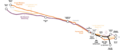
Comparison of historical, current and proposed alignments for principal road between Sydney CBD and the Nepean River
-
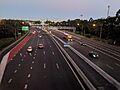
M4 Motorway looking East from the Olympic Park line
-
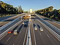
M4 Tunnel entrance at North Strathfield looking east


