Municipality of Strathfield facts for kids
Quick facts for kids Municipality of StrathfieldNew South Wales |
|||||||||||||||
|---|---|---|---|---|---|---|---|---|---|---|---|---|---|---|---|
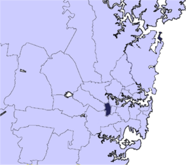
Location in Metropolitan Sydney
|
|||||||||||||||
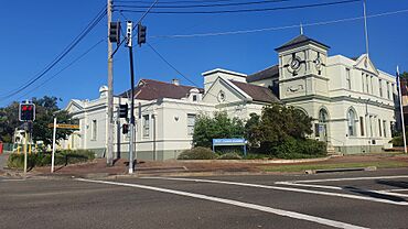
Strathfield Council
|
|||||||||||||||
| Population | 45,593 (2021 census) | ||||||||||||||
| • Density | 3,234/km2 (8,380/sq mi) | ||||||||||||||
| Established | 2 June 1885 | ||||||||||||||
| Area | 14.1 km2 (5.4 sq mi) | ||||||||||||||
| Mayor | Karen Pensabene | ||||||||||||||
| Council seat | Strathfield | ||||||||||||||
| Region | Metropolitan Sydney | ||||||||||||||
| State electorate(s) |
|
||||||||||||||
| Federal Division(s) | |||||||||||||||
 |
|||||||||||||||
| Website | Municipality of Strathfield | ||||||||||||||
|
|||||||||||||||
The Municipality of Strathfield is a special area in Sydney, New South Wales, Australia. It has its own local government, which is like a mini-government for the community. This council helps manage local services and facilities.
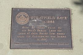
The Municipality of Strathfield was officially created on 2 June 1885. Back then, it included parts of three smaller areas: Redmire, Homebush, and Druitt Town. The name "Strathfield" was chosen for the new council. A year later, the suburb of Redmire and its railway station were also renamed Strathfield.
Today, the Strathfield area covers about 14.1 square kilometers. In 2021, around 45,593 people lived here. It's a mix of homes and town centers. You'll find many historic places, parks, and schools. There are also university campuses nearby, like Australian Catholic University and the University of Sydney.
The leader of the Strathfield Council is the Mayor, Karen Pensabene. She works with other elected members called Councillors to make decisions for the community.
Contents
History of Strathfield Council
The Municipality of Strathfield was officially announced on 2 June 1885. This happened after people living in the Redmire area asked for their own local government. Some residents from Homebush and Druitt Town were against this idea. They worried that the wealthier people from Redmire would have too much control. But despite their concerns, the Municipality was formed.
The Strathfield Council built its main office, called the Council Chambers, in 1887. Before that, from 1885 to 1887, the council worked out of different private homes in Strathfield.
Over the years, the Strathfield Council area grew bigger. In 1892, the suburb of Flemington was added. This included the Flemington village in the north. Also, a part of the area south of Cook's River was added. After these additions, the entire council area became known as "Strathfield." The boundaries of the suburb of Strathfield today are very similar to the council's boundaries in 1892.
How Strathfield's Boundaries Changed
In 1947, the Municipality of Homebush joined with Strathfield. This added parts of Flemington and Homebush that were north of the railway line. The old village centers of Flemington and Homebush, south of the railway, were then combined with the new areas. This created the suburbs of Flemington, Homebush West, and Homebush as we know them today.
In 1949, a western part of the Municipality of Enfield was also added to Strathfield. This brought in the suburbs of Strathfield South, eastern Greenacre, and northern Belfield.
Later, in 1992, a small section in the north of Strathfield was given to Auburn Council. This land became part of the Sydney Olympic Park. In return, Strathfield Council received the area around the former Ford factory building from Auburn.
Most recently, in 2023, the northern part of Belfield that was within Strathfield's boundaries became part of Strathfield South. This change made the boundaries simpler, as Cook's River separated these areas.
Past Plans to Merge Councils
Throughout history, there have been talks about combining local councils in Sydney. One big idea was the 'Greater Sydney Movement' in 1913. This movement wanted to merge all of Sydney into one large local government area.
More recently, in 2015, the NSW Government suggested merging Strathfield Council with the Burwood and Canada Bay Councils. This would have created a much larger council. However, Strathfield Council took legal action against this plan. The court found some problems with the merger report. Because of this, the NSW Government stopped the merger proposal in 2017. So, Strathfield, Burwood, and Canada Bay Councils remained separate.
Geography and Landscape
The Strathfield Council area is located in Sydney. It covers about 14.1 square kilometers. The suburbs within it include Strathfield, Strathfield South, Homebush, Homebush West, Flemington, and parts of Greenacre.
The area's borders are defined by several landmarks. Homebush Bay Drive is to the north. Powells Creek, The Boulevarde, and Coronation Parade are to the east. Punchbowl Road and Juno Parade form the southern border. Roberts Road, Chullora rail yards, Rookwood Cemetery, and the Sydney Olympic Park Rail line are to the west.
Like other parts of Sydney's Inner West, Strathfield's landscape is shaped by rivers. The Parramatta River is to the north, and the Cooks River is to the south. Smaller creeks flow through the municipality towards these rivers. Many of these creeks are now straightened and covered, like canals. The two largest creeks are Powells Creek and Saleyards Creek. They both flow into the Parramatta River. The Cooks River itself is a small waterway in this area.
How Strathfield Council Works
Strathfield Municipal Council has seven councillors. These councillors are elected by the community to represent them. They serve for a fixed four-year term. The mayor and deputy mayor are chosen by the councillors every two years.
The most recent election for the council was on 4 December 2021. Here's how the council is made up:
| Party | Councillors | |
|---|---|---|
| Australian Labor Party | 3 | |
| Strathfield Independents | 2 | |
| Nella Hall Independents | 1 | |
| Independent | 1 | |
| Total | 7 | |
The councillors elected in 2021 are:
| Councillor | Party | Notes | |
|---|---|---|---|
| Nella Hall | Nella Hall Independents | Deputy Mayor 2017–2018, 2021 | |
| Karen Pensabene | Labor | Deputy Mayor 2020–2021, 2022-2023. Mayor 2023-current | |
| Matthew Blackmore | Strathfield Independents | Deputy Mayor 2018–2020. Mayor 2022-2023; Deputy Mayor 2023. | |
| Sharangan Maheswaran | Labor | ||
| Raj Datta | Labor | ||
| Benjamin Cai | Independent | Deputy Mayor 2023 | |
| Sandy Reddy | Strathfield Independents | Deputy Mayor 2023-Current | |
People of Strathfield
In 2021, there were 45,593 people living in the Strathfield area. About 51.2% were male and 48.8% were female. A small number, 0.4%, were Aboriginal and Torres Strait Islander people. The average age of people in Strathfield was 33 years old, which is younger than the national average of 38 years.
About 14.9% of the population were children aged 0-14 years. People aged 65 and over made up 12.0% of the population. Many people in Strathfield are married (48.9%), while 8.0% are divorced or separated. The largest group of people in Strathfield, based on their family background, are of Chinese heritage.
The number of people living in Strathfield has grown a lot over the past 20 years. In 2001, there were only 27,777 residents. By 2021, the population had almost doubled! This growth is much faster than the average for Australia.
In 2021, the average weekly income for households in Strathfield was 21% higher than the national average. This means people in Strathfield generally earn more than the average Australian household.
Important Historic Places
The Municipality of Strathfield has several places that are listed for their historical importance. These sites are protected because they tell us about the past. Some of these include:
- Homebush, Great Southern and Western railway: Homebush railway station
- South Strathfield, St Anne's Square: St Anne's Roman Catholic Church, South Strathfield
- Strathfield, Great Southern and Western railway: Strathfield rail underbridges
- Strathfield, Great Southern and Western railway: Strathfield railway station
Council Buildings and Services
The Strathfield Council runs a main library on Rochester Street in Homebush. The old library building was taken down in 2002, and a brand new one opened in 2004.
Before that, the main library was on Parramatta Road in Homebush. This library was part of the old Homebush Municipality before it joined Strathfield in 1947. It was the main library until 1967. Then, a library on High Street became the main one. The Parramatta Road library closed in 1976 after the Rochester Street library opened.
There used to be another branch library on High Street in Strathfield South. It was rebuilt and opened in 2008. However, this branch library closed in 2019. It was turned into a community center, but it still has some book lockers for library services.
The main community center for the municipality is the Strathfield Community Centre. It's located at 1B Bates Street, Homebush, inside Airey Park.
The council also bought the old South Strathfield Bowling Club. They fixed it up and opened it as a community center in 2012. It was named the Eve Dutton Community Centre, after the first female mayor of Strathfield. This center helps older people and those with disabilities. It also hosts services like Meals on Wheels and community transport.
Community and Culture
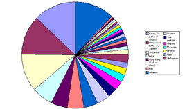
Strathfield is home to many different groups of people. About 48% of the population was born outside Australia. Because of this, there are many services for new immigrants and international students in the area.
For example, the Russian Ethnic Community Council of NSW Inc (RECNSW) helps Russian-speaking immigrants. The Sydney Tamil Resource Centre Inc (STRC) provides support for Tamil immigrants.
You'll also find many restaurants and shops that reflect the different cultures in Strathfield. The Strathfield town center has many Korean restaurants and shops. The Flemington village center has Chinese and Vietnamese places. The Homebush village center offers a mix of Chinese, Korean, Indian, Greek, and Lebanese food.
Strathfield also has various community groups. There's a Rotary club that helps the community with different projects. There's also a Musical Society that puts on two shows a year at the Latvian Theatre in Strathfield. The Strathfield Lantern Club Voluntary raises money for the Royal Institute for Deaf and Blind Children.
A famous song by Radio Birdman, called Murder City Nights, even mentions Woodward Road in Strathfield!
 | Jewel Prestage |
 | Ella Baker |
 | Fannie Lou Hamer |


