Carlingford, New South Wales facts for kids
Quick facts for kids CarlingfordSydney, New South Wales |
|||||||||||||||
|---|---|---|---|---|---|---|---|---|---|---|---|---|---|---|---|
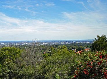
The view from Mobbs Hill has been a noted feature of the district for generations
|
|||||||||||||||
| Population | 28,044 (2021 census) | ||||||||||||||
| • Density | 3,550/km2 (9,200/sq mi) | ||||||||||||||
| Postcode(s) | 2118 | ||||||||||||||
| Elevation | 129 m (423 ft) | ||||||||||||||
| Area | 7.9 km2 (3.1 sq mi) | ||||||||||||||
| Location | 22 km (14 mi) NW of Sydney CBD | ||||||||||||||
| LGA(s) | City of Parramatta | ||||||||||||||
| State electorate(s) | Epping | ||||||||||||||
| Federal Division(s) | |||||||||||||||
|
|||||||||||||||
Carlingford is a suburb in Sydney, New South Wales, Australia. It is about 22 kilometres north-west of the Sydney central business district. Carlingford is part of the City of Parramatta local government area. It sits where Northern Sydney and Western Sydney meet. Sometimes, people also call it part of the Hills District.
Contents
History of Carlingford
Early Aboriginal Life
Before Europeans arrived in 1788, the Wallumedegal people lived in the Carlingford area. They were part of the Eora language group. Their name likely came from wallumai, meaning snapper fish, and matta, meaning 'place' or 'waterplace'.
These people used "fire-stick farming" to clear land. This created grasslands that attracted animals for hunting. Early explorers saw these grasslands near the Parramatta River. The area also had thick Blue Gum High Forest.
After the First Fleet arrived, Aboriginal people moved to new areas. Illnesses also greatly reduced their numbers. By 1827, very few Aboriginal people remained in the area.
How Carlingford Got Its Name
The name Carlingford became official on July 16, 1883. It was used for the post office at Mobbs Hill. One story says a local, Frederick Cox, heard an employee compare Mobbs Hill to Carlingford, County Louth in Ireland. Another idea is that it was named after Lord Carlingford, a British official.
Before 1883, the area had many different names. These names changed as the land was used differently. Some old names included "The Ponds" and "The Eastern Farms". "The Northern Boundary" referred to settlements north of Parramatta. The "Field of Mars" was also used broadly.
"North Brush" described the bush north of the Parramatta River. Brush Farm got its name from this. Mobbs Hill was named after the Mobbs family.
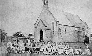
The area was also called Pennant Hills for a while. St Paul's Church, built on Mobbs Hill in 1850, was first called Pennant Hills. The local school also started as Pennant Hills South Public School. It changed to Carlingford Public School in 1887. When the railway opened in 1896, the station was called Pennant Hills. It became Carlingford Station in 1901.
From Bush to Orchards
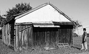
In the 1790s, land grants were given for farms in the Carlingford area. Early settlers worked hard to clear the land. Many struggled with farming. By the 1830s, fruit growing became the main industry. Large estates were divided into smaller farms. Orange, citrus, and stone fruit orchards were common. Families like the Mobbs and Eyles became well-known.
Timber cutting was another activity from around 1817. A government sawmill operated until about 1830. Timber was sent to the Pennant Hills Wharf. A quarry at Dundas also started in the 1830s.
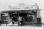
By 1900, Carlingford had a railway, a public school, and shops. It was ready to become a successful farming area again.
Carlingford in the 20th Century
After Australia became a nation in 1901, the Carlingford railway line was taken over by the state. New nurseries and market gardens grew. Technology improved with a wireless station in 1912 and electricity in 1922. Water pipes were laid in 1908. A water reservoir was built on Mobbs Hill in 1916.
A Mechanics' Institute and Memorial Hall opened in 1924. It was a place for social events and school activities. The Great Depression in the 1930s made life hard for many.
Children's Homes
In 1923, the Wesley Mission opened the Dalmar Children's Homes. This property had cottages, a hospital, and gardens. Today, it is the Alan Walker Retirement Village.
Several other children's homes were also in Carlingford. These were run by the Anglican Diocese of Sydney. The land where these homes stood is now used for housing. The Church of England Boys' Home is now the regional base for the Church of Jesus Christ of Latter-day Saints. The Girls' Home is now Anglicare's Kingsdene Special School.
Growing into a City Suburb
After World War II, Sydney grew fast. Carlingford changed from a rural area to a busy suburb. James Ruse Agricultural High School, opened in 1959, shows this change. It has a large farm, which is unusual for a school in a city suburb. Newer houses and apartment buildings were built.
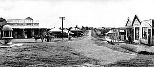
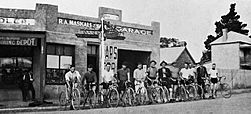
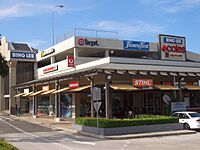
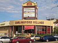
The first big shopping centre, Carlingford Village, opened in 1965. It later became Carlingford Court. Another centre, "The Orchard," opened in the 1970s and is now Carlingford Village. The old shops and houses on Mobbs Hill were taken down to build these centres. Carlingford has changed a lot from its farming past.
Carlingford's Heritage
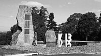
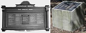
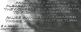
Carlingford has many important historical sites. These include Aboriginal sites, old houses, churches, and war memorials. Some are listed on the NSW State Heritage Register. Many old sites have been lost due to new developments.
Some heritage sites in Carlingford include:
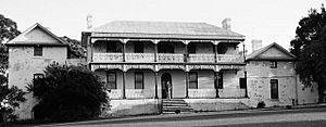
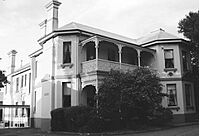
- Barrengarry House (c.1888), now part of James Ruse Agricultural High School.
- Blaxland House, Brush Farm (c.1820), in Eastwood.
- Carlingford Public School building (1887).
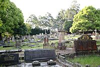
- Carlingford Cemetery (1850).
- Mobbs Hill Reservoir (1916).
- Former St Paul's Anglican Church (1850).
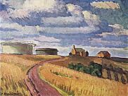
Carlingford was a favourite place for landscape painters in the 1930s and 1940s. Artists like Roland Wakelin painted scenes of the area. His paintings show the hills, houses, and farms of Carlingford.
Shopping in Carlingford
Carlingford has several shopping areas. The main ones are on Pennant Hills Road.
- Carlingford Court opened in 1965. It has supermarkets, department stores, and specialty shops.
- Carlingford Village opened in the 1970s. It has many Asian food shops.
There are also smaller shopping strips. These are located on Mobbs Lane and Carmen Drive.
Getting Around Carlingford
Roads
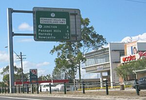
Most people in Carlingford travel by car. The Cumberland Highway, also known as Pennant Hills Road, goes through Carlingford. It is a major road for people travelling north or south. The M2 Hills Motorway also runs through northern Carlingford. It provides a route to the city.
Buses
Many bus routes serve Carlingford. Major bus stops are at Carlingford Court and Carlingford Railway Station. Buses connect Carlingford to places like Epping, Parramatta, and Macquarie Park.
Rail
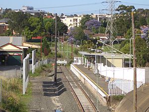
Carlingford railway station used to be the end of the Carlingford railway line. This line opened in 1896. Trains ran to Clyde station, where passengers would change for city services. The service was not used by many people.
The railway line closed on January 5, 2020. It is being converted into part of the Parramatta Light Rail project. This new light rail is expected to open in late 2024. A bus service, Route 535, now replaces the train.
Schools in Carlingford
Carlingford has many schools for students.
- Carlingford High School
- Carlingford Public School
- Carlingford West Public School
- Cumberland High School
- James Ruse Agricultural High School (a selective school)
- Murray Farm Public School
- Roselea Public School
- St Gerard's Primary Catholic School
Places of Worship
Carlingford has many churches for different Christian groups. These include:
- Carlingford Uniting Church
- Marsden Road Uniting Church
- Carlingford Baptist Church
- Carlingford Presbyterian Church
- Carlingford St. Gerard Majella Catholic Church
- St. Paul's Anglican Church
- Carlingford Iglesia Ni Cristo Church of Christ
- Carlingford C3 Church
Other places of worship include:
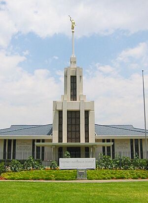
- The Sydney Australia Temple of the Church of Jesus Christ of Latter-day Saints.
- Man Su Vihara, a Mahāyāna Buddhist temple.
Sports in Carlingford
Carlingford has many sports clubs. These clubs play various sports in the area.
- Carlingford Baseball
- Carlingford Bowling Sports & Recreation Club
- Carlingford Comets Netball Club
- Carlingford Cougars Junior Rugby League Football Club
- Carlingford Netball Club
- Carlingford United Football Club
- Carlingford Waratah Cricket Club
- Roselea Football Club
- Roselea Ladybirds Netball Club
Services in Carlingford
Carlingford has a telephone exchange for phone services. A large electricity substation is also located here. It helps provide power to the area.
Population of Carlingford
In the 2021 Australian census, Carlingford had 28,044 residents. The median age was 38 years old. Children up to 14 years old made up 20.8% of the population. People aged 65 and over made up 16.0%.
Many people in Carlingford were born overseas. In 2021, 42.0% were born in Australia. Other countries of birth included China (19.4%), Hong Kong (4.9%), India (4.9%), and South Korea (4.5%).
English is spoken at home by 32.9% of people. Other common languages include Mandarin (22.1%), Cantonese (13.2%), and Korean (6.3%).
Regarding religion, 39.0% of people said they had no religion. 14.9% were Catholic, and 6.6% were Anglican.
 | Emma Amos |
 | Edward Mitchell Bannister |
 | Larry D. Alexander |
 | Ernie Barnes |


