
Eastwood, New South Wales facts for kids
Quick facts for kids EastwoodSydney, New South Wales |
|||||||||||||||
|---|---|---|---|---|---|---|---|---|---|---|---|---|---|---|---|

Skyline of the main commercial area with Eastwood Shopping Centre
(pictured in 2023) |
|||||||||||||||
| Population | 18,695 (2021 census) | ||||||||||||||
| • Density | 3,600/km2 (9,300/sq mi) | ||||||||||||||
| Postcode(s) | 2122 | ||||||||||||||
| Elevation | 66 m (217 ft) | ||||||||||||||
| Area | 5.2 km2 (2.0 sq mi) | ||||||||||||||
| Location | 17 km (11 mi) NW of Sydney CBD | ||||||||||||||
| LGA(s) |
|
||||||||||||||
| Region | Northern Sydney | ||||||||||||||
| State electorate(s) |
|
||||||||||||||
| Federal Division(s) | Bennelong | ||||||||||||||
|
|||||||||||||||
Eastwood is a lively suburb in Sydney, Australia. It's located about 17 kilometres north-west of the main city centre. Eastwood is special because it's part of two local government areas: the City of Ryde and the City of Parramatta. It's also on the Sydney Trains Northern Line, making it easy to get around.
Eastwood is well-known for its diverse community. Many people from East Asia, Italy, and other places have made Eastwood their home. It used to be a separate town, but as Sydney grew, Eastwood became part of the big city.
The area was first settled by Europeans after the First Fleet arrived in 1788. Before that, the Wallumettagal people lived here. An early settler, William Rutledge, named the area "Eastwood." Today, it's a large suburban hub with over 18,000 people and a busy shopping area. Many immigrants have lived here for a long time, with over half the population born in Asia. People from China and South Korea have especially changed the shopping areas in recent years.
Eastwood is also famous for the Granny Smith apple! This apple was first grown here by accident by Maria Ann Smith. Every October, Eastwood celebrates this with the annual Granny Smith Festival. It's a huge party with rides, market stalls, street shows, parades, and even an apple-baking contest. The festival ends with amazing fireworks. Recently, the festival has included Chinese dragon dancers and other Asian traditions, showing off the area's diverse culture. Eastwood also celebrates Lunar New Year with both Chinese and Korean traditions.
Contents
Geography of Eastwood
Eastwood is located on the edge of the Hornsby Plateau. This means the land slopes down towards areas like Dundas Valley and Denistone to the west and south. To the north, you'll find Epping, a busy transport hub. To the east is Marsfield. Eastwood is mostly a residential area, meaning it has lots of homes. The main shopping area is located around the railway line, between Rowe Street and Rutledge Street.
History of Eastwood

The Aboriginal tribe called the Wallumedegal lived in this area long ago. They lived between the Lane Cove River and Parramatta River. The land was originally covered in thick forests.
European settlers arrived in Eastwood shortly after the First Fleet in 1788. The land was given to marines and soldiers. In 1835, William Rutledge bought a large piece of land and built 'Eastwood House' in 1840. This house is now part of Marist College Eastwood.
In 1886, a railway line opened, and a station was built here. It was first called Dundas, but a year later, it was renamed Eastwood after the Eastwood Estate.
The main shopping area was updated in the early 1980s. Rowe Street, which used to have a level crossing over the railway, became a pedestrian mall. A new, bigger bridge was built for cars to cross the railway line.
Shopping and Food in Eastwood

Eastwood's main shopping area is right around the Eastwood railway station.
The Eastwood Shopping Centre was built in 1976. It used to have big stores like Target and Woolworths. Now, Woolworths is the main store.
Eastwood Village (which used to be called Westfield Eastwood) is another shopping centre. It opened in 1964.
Eastwood Plaza is on Rowe Street, which is a street just for people walking. It has a fountain and many cafes with outdoor seating. Eastwood is famous for its Asian shops and restaurants. You can find many Chinese, Vietnamese, Cantonese, Singaporean, Hong Kong, and Korean restaurants and supermarkets here.
Getting Around Eastwood

Eastwood has good public transport. The Eastwood railway station is on the Main Northern railway line. It takes about 30–35 minutes to get to Central Station in Sydney.
Many Busways buses also leave from the station. These buses can take you to places like Parramatta, Macquarie Park, Macquarie University, and Ryde. Eastwood is also well-connected by roads, like the A6 (Marsden Road) and Victoria Road.
Even with all these options, most people in Eastwood still travel to work by car.
Famous Places in Eastwood

- Brush Farm House on Marsden Road: This was once the home of Gregory Blaxland, one of the explorers who crossed the Blue Mountains. It's a very old and important building.
- Eastwood House: This was the home of Edward Terry, who owned much of the land Eastwood is built on. It's now part of Marist College Eastwood.
- Eastwood Park Grandstand and Pavilion: These buildings are from the 1930s. The croquet pavilion is still used by the Eastwood Croquet Club.
- Ripley (14 Auld Avenue): This house was built in 1907 and is a great example of the Federation Arts and Crafts style of architecture.
- Ryde Hospital: This is a public hospital in Eastwood.
- Eastwood Library: You can find the library on the corner of Hillview Road and West Parade. It has cool mural artworks by a street artist named Heesco.
- Corrective Services Academy: This is a training centre for prison officers.
Eastwood once had a lake, which is why some roads are named "Lakeside Road." This lake was later turned into an oval, which is now used for soccer games and by local schools. It still sometimes floods after heavy rain.
Nature and Parks
Darvall Park and Brush Farm Park are beautiful natural areas in Eastwood. Volunteers work hard to protect the special Blue Gum High Forest and rainforest plants here. You can find rare trees like the largest known tree heath at Brush Farm Park. Even though it's in a big city, Brush Farm has amazing animals, including powerful owls, emerald doves, and even green tree snakes!
Homes in Eastwood
Eastwood has many different types of homes. At the 2021 census, most homes were separate houses (52.8%). There are also flats, units, and townhouses. Most homes are for families.
You'll see many Californian Bungalow and Federation style homes, especially closer to the train station. Further away, you'll find more homes built after World War II. While most of Eastwood has one or two-storey houses, the area near the town centre has buildings up to seven storeys tall. Some old industrial areas, like the former brickworks, have been turned into new housing estates.
Churches in Eastwood
Eastwood has many churches for different faiths:
- Christ Evangelical Centre of Australia (CECA)
- Eastwood Baptist Church
- Exclusive Brethren Church
- Lakeside Road Uniting Church
- Macquarie Chapel
- St Kevin's Catholic Church
- St Philip's Anglican Church
- Cornerstone Presbyterian Community Church Eastwood
- St Georges Anglican Church
- St Dunstan's Anglican Church
- The Church of Jesus Christ of Latter-day Saints
- The Crusader Union of Australia (Crusaders)
Schools in Eastwood
Eastwood has several schools for different age groups:
Primary Schools
- Eastwood Heights Public School
- Eastwood Public School
- St Kevins Eastwood (a Catholic primary school)
High Schools
- Marist College Eastwood
Culture and Events

Eastwood is famous for being the birthplace of the Granny Smith apple. This is celebrated every October with the Granny Smith Festival. Over 60,000 people come to this festival each year! You can learn more about Maria Ann Smith, who grew the first Granny Smith apple, on historical websites.
Population and People
Eastwood is a large suburb in northern Sydney with over 18,000 residents. Over the last few decades, Eastwood has become very multicultural. In the 1960s, people from southern European countries like Italy and Greece started settling here. From the 1980s onwards, many Chinese and Koreans moved to the area.
Demographics
At the 2021 census, Eastwood had 18,695 people. Here's a look at who lives there:
- Age: The average age in Eastwood is 39 years old. There are slightly more young adults (20-34) than the national average.
- Background: The most common backgrounds people identified with were Chinese (48.8%), English (11.6%), and Australian (10.7%). Less than half (37.6%) of Eastwood residents were born in Australia. Many people were born in China (25.9%), South Korea (6.8%), and Hong Kong (4.5%).
- Languages: Only 30.0% of residents spoke only English at home. Other common languages spoken were Mandarin (28.3%), Cantonese (14.5%), and Korean (8.3%).
- Religion: Many people (45.2%) said they had "No Religion." Other common religions were Catholic (15.1%), Buddhism (6.6%), and Anglican (5.9%).
- Income: The average weekly household income in Eastwood was $1,945, which is a bit higher than the national average.
Famous Residents
- The band All Mankind, known for their song "Break the Spell," live in Eastwood.
Former Residents
- Natalie Bennett – a former leader of the Green Party of England and Wales.
- Reg Campbell – a portrait painter.
- Jordan Gusman – a middle-distance runner.
- Lenny Hayes – a former Australian rules football player.
- Geoffrey Robertson – a human rights lawyer and author.
- Aziz Shavershian – a bodybuilder and internet personality.
- Maria Ann Smith – the orchardist who grew the first Granny Smith apples.
Images for kids
-
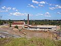
The old Eastwood Brickworks site, now a housing estate.

