West Branch Mad River facts for kids
Quick facts for kids West Branch Mad River |
|
|---|---|

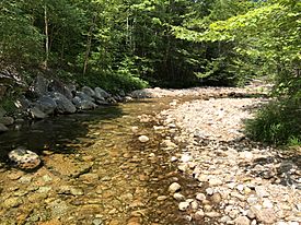
The West Branch upstream from the West Branch Road bridge in Waterville Valley
|
|
| Country | United States |
| State | New Hampshire |
| County | Grafton |
| Town | Waterville Valley |
| Physical characteristics | |
| Main source | Mount Tecumseh Waterville Valley 3,200 ft (980 m) 43°58′19″N 71°33′28″W / 43.97194°N 71.55778°W |
| River mouth | Mad River Waterville Valley 1,454 ft (443 m) 43°57′18″N 71°30′44″W / 43.95500°N 71.51222°W |
| Length | 3.2 mi (5.1 km) |
| Basin features | |
| Tributaries |
|
The West Branch of the Mad River is a small stream in the White Mountains of New Hampshire, United States. It is about 3.2-mile-long (5.1 km). This stream is a tributary, which means it flows into a larger river. The West Branch flows into the Mad River.
The Mad River then joins the Pemigewasset River. All these rivers are part of a larger watershed that eventually leads to the Merrimack River. A watershed is an area of land where all the water drains into a common river or lake.
Where the River Begins
The West Branch Mad River starts high up on the northern side of Mount Tecumseh. This mountain is one of the major peaks in the White Mountains. From there, the stream flows downhill into an area called Thornton Gap. This gap is located between Mount Tecumseh and another big mountain, Mount Osceola.
The River's Journey
As the West Branch flows, it turns towards the east. A road called Tripoli Road runs alongside it for a while. Further along its path, another small stream called Osceola Brook joins the West Branch from the north. After this, the West Branch turns south. It flows into the flat, open area where the village of Waterville Valley is located.
Where the River Ends
The West Branch Mad River meets the main Mad River very close to the center of the Waterville Valley resort. This is where its journey ends, as its waters become part of the larger Mad River system.
 | Claudette Colvin |
 | Myrlie Evers-Williams |
 | Alberta Odell Jones |


