
Mount Tecumseh facts for kids
Quick facts for kids Mount Tecumseh |
|
|---|---|

Mt. Tecumseh as seen from Middle Tripyramid
|
|
| Highest point | |
| Elevation | 3,997 ft (1,218 m) |
| Prominence | 1,723 ft (525 m) |
| Listing | White Mountain 4000-Footers |
| Geography | |
| Location | Grafton County, New Hampshire, U.S. |
| Topo map | USGS Waterville Valley |
Mount Tecumseh is a mountain located in Grafton County, New Hampshire. It is part of the famous White Mountains range. This mountain gets its name from Tecumseh, a brave leader of the Shawnee people who lived a long time ago (around 1768–1813).
Water from the east side of Mount Tecumseh flows into the Mad River. On the west side, water drains into several smaller streams. All these rivers and streams eventually join the Pemigewasset River. The Pemigewasset River then flows into the Merrimack River, which finally reaches the Gulf of Maine in Massachusetts.
Mount Tecumseh is also home to the Waterville Valley Resort. This is one of the biggest places in New Hampshire where people can go skiing and enjoy winter sports!
How Tall is Mount Tecumseh?
For a long time, people thought Mount Tecumseh was 4,003 feet tall. This made it the shortest mountain on the Appalachian Mountain Club's list of "four-thousand footers." These are mountains that are 4,000 feet or taller.
However, in July 2019, a new survey was done. A special marker on the top of the mountain now shows its true height is 3,997 feet. This means it's just a little bit shorter than 4,000 feet!

Images for kids
-
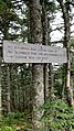
A sign on the trail up to the summit of Mt. Tecumseh.

