
West Rockhill Township, Pennsylvania facts for kids
Quick facts for kids
West Rockhill Township
|
||
|---|---|---|
|
Township
|
||

Township Municipal Offices
|
||
|
||

Location of West Rockhill Township in Bucks County
|
||

West Rockhill Township
Location in Pennsylvania

West Rockhill Township
Location in the United States
|
||
| Country | United States | |
| State | Pennsylvania | |
| County | Bucks | |
| Area | ||
| • Total | 16.43 sq mi (42.6 km2) | |
| • Land | 16.28 sq mi (42.2 km2) | |
| • Water | 0.15 sq mi (0.4 km2) | |
| Elevation | 489 ft (149 m) | |
| Population
(2010)
|
||
| • Total | 5,256 | |
| • Estimate
(2016)
|
5,248 | |
| • Density | 319.90/sq mi (123.52/km2) | |
| Time zone | UTC-5 (EST) | |
| • Summer (DST) | UTC-4 (EDT) | |
| Area code(s) | 215, 267 and 445 | |
| FIPS code | 42-017-83960 | |

West Rockhill Township is a small community located in Bucks County, Pennsylvania, in the United States. It's a type of local government area called a township.
This area has a long history! The original Rockhill Township was created way back in 1740. Later, in 1890, it was split into two parts: West Rockhill Township and East Rockhill Township.
According to the 2010 census, about 5,256 people live here. Students in West Rockhill Township attend schools in the Pennridge School District.
Contents
Exploring West Rockhill's Geography
West Rockhill Township covers an area of about 16.4 square miles. Most of this area is land, with a small part being water.
Waterways and Natural Features
The township is part of the Delaware watershed. This means that most of its water eventually flows into the Delaware River. Many creeks and rivers flow through or from West Rockhill. These include the East Branch Perkiomen Creek and Unami Creek, which lead to the Perkiomen Creek and then the Schuylkill River. In the northeast, water flows through Threemile Run and Lake Nockamixon to the Tohickon Creek, which goes to the Delaware River.
Other cool natural spots are Butter Creek, Ingram Hill, Mill Creek, Ridge Valley Creek, and Rock Hill.
Local Villages in West Rockhill
West Rockhill Township is home to several small villages. These include Almont, Argus, Derstein, Knockthopher, Naceville, Rich Hill, Ridge Valley, Rocky Ridge, Smoketown, and White Horse.
Neighboring Towns and Townships
West Rockhill Township shares its borders with several other communities:
- To the northwest: Milford Township
- To the north: Richland Township
- To the northeast: East Rockhill Township
- To the east: Perkasie and Sellersville
- To the southeast: Hilltown Township
- To the south: Telford, Franconia Township, and Salford Township
- To the west: Marlborough Township
Understanding the Population of West Rockhill
| Historical population | |||
|---|---|---|---|
| Census | Pop. | %± | |
| 1930 | 1,390 | — | |
| 1940 | 1,645 | 18.3% | |
| 1950 | 2,020 | 22.8% | |
| 1960 | 2,484 | 23.0% | |
| 1970 | 3,270 | 31.6% | |
| 1980 | 3,776 | 15.5% | |
| 1990 | 4,518 | 19.7% | |
| 2000 | 4,233 | −6.3% | |
| 2010 | 5,256 | 24.2% | |
| 2020 | 5,439 | 3.5% | |
The population of West Rockhill Township has grown over the years. In 1930, there were 1,390 people, and by 2020, the population had increased to 5,439.
Diversity in West Rockhill
In 2010, most residents (95.0%) were White. Other groups included Black or African American (1.1%), Native American (0.2%), and Asian (1.4%). About 0.9% of people identified as two or more races. People of Hispanic or Latino background made up 1.4% of the population.
Age Groups in the Township
In 2000, about 20.9% of the population was under 18 years old. People aged 65 or older made up 21.3% of the population. The average age in the township was 43 years old.
West Rockhill's Climate and Weather
West Rockhill Township experiences a humid continental climate. This means it has hot summers and gets rain all year round.
Summer and Winter Weather
In summer, it can get very hot and humid. The "heat index" (how hot it feels with humidity) can sometimes reach 100°F (38°C) or more. July is usually the wettest month, with many thunderstorms.
Winters can be very cold and windy. The "wind chill" (how cold it feels with wind) can drop below 0°F (-18°C). The coldest temperature expected each year is around -1.6°F (-18.7°C).
Snowfall and Seasons
On average, West Rockhill gets between 30 and 36 inches (76 and 91 cm) of snow from November to April. February is usually the snowiest month. This is when "nor'easters," which are big winter storms, are most common.
| Climate data for West Rockhill Township, Bucks County, Pennsylvania (1981 – 2010 averages) | |||||||||||||
|---|---|---|---|---|---|---|---|---|---|---|---|---|---|
| Month | Jan | Feb | Mar | Apr | May | Jun | Jul | Aug | Sep | Oct | Nov | Dec | Year |
| Mean daily maximum °F (°C) | 37.9 (3.3) |
41.2 (5.1) |
49.6 (9.8) |
61.8 (16.6) |
71.9 (22.2) |
80.5 (26.9) |
84.5 (29.2) |
82.9 (28.3) |
76.0 (24.4) |
64.4 (18.0) |
53.4 (11.9) |
42.0 (5.6) |
62.3 (16.8) |
| Daily mean °F (°C) | 29.2 (−1.6) |
31.9 (−0.1) |
39.6 (4.2) |
50.5 (10.3) |
60.3 (15.7) |
69.3 (20.7) |
73.8 (23.2) |
72.2 (22.3) |
64.8 (18.2) |
53.2 (11.8) |
43.5 (6.4) |
33.6 (0.9) |
51.9 (11.1) |
| Mean daily minimum °F (°C) | 20.6 (−6.3) |
22.6 (−5.2) |
29.5 (−1.4) |
39.1 (3.9) |
48.6 (9.2) |
58.2 (14.6) |
63.0 (17.2) |
61.5 (16.4) |
53.6 (12.0) |
42.0 (5.6) |
33.6 (0.9) |
25.2 (−3.8) |
41.5 (5.3) |
| Average precipitation inches (mm) | 3.46 (88) |
2.84 (72) |
3.84 (98) |
4.09 (104) |
4.34 (110) |
4.37 (111) |
4.76 (121) |
3.88 (99) |
4.57 (116) |
4.32 (110) |
3.74 (95) |
3.96 (101) |
48.17 (1,224) |
| Average relative humidity (%) | 68.7 | 65.4 | 60.9 | 59.5 | 63.6 | 69.5 | 69.3 | 72.1 | 72.9 | 71.4 | 70.7 | 70.7 | 67.9 |
| Average dew point °F (°C) | 20.2 (−6.6) |
21.6 (−5.8) |
27.2 (−2.7) |
36.9 (2.7) |
47.9 (8.8) |
58.9 (14.9) |
63.1 (17.3) |
62.7 (17.1) |
55.9 (13.3) |
44.2 (6.8) |
34.6 (1.4) |
25.1 (−3.8) |
41.6 (5.3) |
| Source: PRISM Climate Group | |||||||||||||
Transportation in West Rockhill
_from_the_overpass_for_Lawn_Avenue_in_West_Rockhill_Township,_Bucks_County,_Pennsylvania.jpg)
West Rockhill Township has many public roads, totaling about 67.71 miles. Some are kept up by the Pennsylvania Turnpike Commission, some by the Pennsylvania Department of Transportation (PennDOT), and the rest by the township itself.
Major Roads and Highways
Pennsylvania Route 309 is the main highway in West Rockhill. It's known as the Sellersville Bypass and runs through the eastern part of the township. Pennsylvania Route 152 starts in the southeastern part of the township, connecting to PA 309. Pennsylvania Route 563 follows Ridge Road through the middle of the township.
A small part of the Pennsylvania Turnpike's Northeast Extension (which is I-476) goes through the far western tip of the township. However, there are no exits or entrances for this highway within West Rockhill.
Public Transportation
If you need to get around using public transport, the southern tip of West Rockhill Township is served by SEPTA bus Route 132. This bus route travels between the Montgomery Mall and Telford.
Local Ecology: Plants and Trees
The natural plant life in West Rockhill Township would mostly be an Appalachian Oak forest. This means that if the land were left untouched, you would find many oak trees and other Hardwood trees growing there.
Images for kids
-
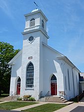
Jerusalem Lutheran Church.
-
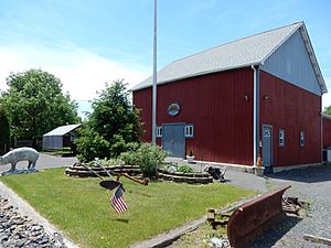
Ridge Rd.
-
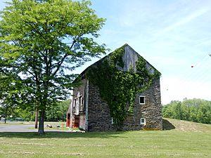
Barn on Ridge Rd.


See also
 In Spanish: Municipio de West Rockhill para niños
