Telford, Pennsylvania facts for kids
Quick facts for kids
Telford, Pennsylvania
|
||
|---|---|---|

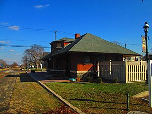
The former Reading Railroad and SEPTA station in Telford
|
||
|
||

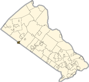
Location in Bucks County, Pennsylvania
|
||
| Country | United States | |
| State | Pennsylvania | |
| Counties | Bucks, Montgomery | |
| Settled | 1719 | |
| Incorporated | 1886 | |
| Area | ||
| • Total | 1.01 sq mi (2.61 km2) | |
| • Land | 1.01 sq mi (2.61 km2) | |
| • Water | 0.00 sq mi (0.00 km2) | |
| Elevation | 423 ft (129 m) | |
| Population
(2010)
|
||
| • Total | 4,872 | |
| • Estimate
(2019)
|
4,894 | |
| • Density | 4,859.98/sq mi (1,876.06/km2) | |
| Time zone | UTC-5 (EST) | |
| • Summer (DST) | UTC-4 (EDT) | |
| ZIP Code |
18969
|
|
| Area code(s) | 215, 267, and 445 | |
| FIPS code | 42-76304 | |
Telford is a small town, also called a borough, located in the state of Pennsylvania in the United States. It's unique because it sits across two different counties: Bucks County and Montgomery County.
In 2010, about 4,872 people lived in Telford. Most of them, 2,665 people, lived in the Montgomery County part. The other 2,207 people lived in the Bucks County part.
Contents
Discovering Telford's History
Early Settlement and Name Change
Long ago, the land around Telford was home to the Lenape people. Then, in 1719, families called Mennonites started to settle here. They came from a place in Europe called the Palatinate of the Rhine.
For a while, the area was known as Hendrick's Blacksmith. Later, it was called County Line. In 1857, a new railroad station was built. The North Pennsylvania Railroad Company decided to name the station Telford. They chose this name to honor a famous civil engineer named Thomas Telford. That's how the town got its current name!
How Telford Became a Borough
A borough is like a small town with its own local government. The area we know as Telford today actually started as two separate boroughs.
The first part, the Borough of Telford, was officially created on November 10, 1886. About ten years later, on December 27, 1897, the Borough of West Telford was formed in Montgomery County.
In 1934, these two boroughs decided to join together. People in both towns voted on November 6, 1934, and they all agreed! So, on January 11, 1935, the governor at the time, Gifford Pinchot, made it official. The two boroughs became one, forming the Telford we know today.
Telford's Location and Size
Telford is located at coordinates 40.324786 degrees North and -75.328045 degrees West. It sits at an elevation of about 449 feet (137 meters) above sea level.
The town is quite small. It covers a total area of about 1.0 square mile (2.6 square kilometers). All of this area is land, with no large bodies of water inside the borough limits.
Getting Around Telford
Telford has many public roads for cars and trucks. As of 2018, there were about 13.94 miles (22.43 kilometers) of public roads. Some of these roads are kept up by the state, and others by the borough itself.
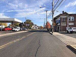
Main Street and Church Road are two important roads that go through Telford. While no major highways go directly through the town, State Route 309 and State Route 563 are nearby.
Train Lines and Public Transport
A train track runs through Telford, going north and south. This line used to be part of the Reading Company and was used for passenger trains by SEPTA until 1981.
Today, these tracks are still used to carry goods by freight trains. Sometimes, special scenic train rides also use the line. There's even talk about bringing back passenger train service to nearby towns like Quakertown. The old Telford station building is still there, but it's empty.
If you need to get around without a car, SEPTA Suburban Bus Route 132 starts in Telford. It travels to the Montgomery Mall in Montgomeryville, stopping in towns like Souderton and Lansdale along the way.
From 1901 to 1951, an electric trolley called the Liberty Bell Limited also ran through Telford. It connected Telford to Allentown in the north and Philadelphia in the south. During World War II, many people used it because gas was hard to get. But after the war, fewer people rode it, and it was replaced by buses in 1951.
Telford's Population and People
| Historical population | |||
|---|---|---|---|
| Census | Pop. | %± | |
| 1890 | 125 | — | |
| 1900 | 181 | 44.8% | |
| 1910 | 207 | 14.4% | |
| 1920 | 313 | 51.2% | |
| 1930 | 412 | 31.6% | |
| 1940 | 1,747 | 324.0% | |
| 1950 | 2,042 | 16.9% | |
| 1960 | 2,763 | 35.3% | |
| 1970 | 3,409 | 23.4% | |
| 1980 | 3,507 | 2.9% | |
| 1990 | 4,238 | 20.8% | |
| 2000 | 4,680 | 10.4% | |
| 2010 | 4,872 | 4.1% | |
| 2020 | 4,928 | 1.1% | |
In the year 2000, about 4,681 people lived in Telford. These people lived in 1,930 households, and 1,200 of those were families. The town had about 4,618 people per square mile.
Most of the people in Telford were White (92.48%). There were also people who were Black (1.30%), Asian (3.76%), and from other racial backgrounds. About 3.61% of the population was Hispanic or Latino.
Age and Income in Telford
In 2000, about 23% of the people in Telford were under 18 years old. About 18% were 65 years or older. The average age of people in Telford was 37 years old.
The average income for a household in Telford was about $45,451 in 2000. For families, the average income was higher, around $56,809. By 2008, the average household income had increased to an estimated $58,350.
Telford's Climate and Weather
Telford has a climate known as a Hot-summer Humid continental climate. This means it has warm, humid summers and cold winters.
Summer Weather
In summer, temperatures can get quite high. The hottest temperature ever recorded since 1981 was 101.5 degrees Fahrenheit (38.6 degrees Celsius) on July 22, 2011. Sometimes, it can feel even hotter due to high humidity. The wettest month is usually July, which is when most thunderstorms happen.
Winter Weather
Winters in Telford are cold. The coldest temperature recorded since 1981 was -12.3 degrees Fahrenheit (-24.6 degrees Celsius) on January 21, 1994. It can also feel much colder when the wind blows, with wind chill values dropping very low.
Telford usually gets between 30 and 36 inches (76 to 91 centimeters) of snow each winter. Big snowstorms, where more than 12 inches (30 centimeters) of snow fall, happen every few years. These often occur during large winter storms called nor'easters.
| Climate data for Telford, Elevation 413 ft (126 m), 1981-2010 normals, extremes 1981-2018 | |||||||||||||
|---|---|---|---|---|---|---|---|---|---|---|---|---|---|
| Month | Jan | Feb | Mar | Apr | May | Jun | Jul | Aug | Sep | Oct | Nov | Dec | Year |
| Record high °F (°C) | 70.7 (21.5) |
78.1 (25.6) |
86.1 (30.1) |
92.9 (33.8) |
94.5 (34.7) |
95.8 (35.4) |
101.7 (38.7) |
99.7 (37.6) |
97.2 (36.2) |
88.4 (31.3) |
80.4 (26.9) |
76.0 (24.4) |
101.7 (38.7) |
| Mean daily maximum °F (°C) | 38.4 (3.6) |
41.7 (5.4) |
50.0 (10.0) |
62.2 (16.8) |
72.3 (22.4) |
81.0 (27.2) |
85.0 (29.4) |
83.4 (28.6) |
76.5 (24.7) |
64.9 (18.3) |
53.9 (12.2) |
42.5 (5.8) |
62.7 (17.1) |
| Daily mean °F (°C) | 29.7 (−1.3) |
32.5 (0.3) |
40.1 (4.5) |
50.9 (10.5) |
60.7 (15.9) |
69.8 (21.0) |
74.3 (23.5) |
72.7 (22.6) |
65.3 (18.5) |
53.6 (12.0) |
43.9 (6.6) |
34.0 (1.1) |
52.4 (11.3) |
| Mean daily minimum °F (°C) | 21.0 (−6.1) |
23.2 (−4.9) |
30.1 (−1.1) |
39.7 (4.3) |
49.1 (9.5) |
58.7 (14.8) |
63.6 (17.6) |
62.0 (16.7) |
54.1 (12.3) |
42.2 (5.7) |
33.9 (1.1) |
25.5 (−3.6) |
42.0 (5.6) |
| Record low °F (°C) | −12.3 (−24.6) |
−4.9 (−20.5) |
2.0 (−16.7) |
16.8 (−8.4) |
30.0 (−1.1) |
40.4 (4.7) |
47.1 (8.4) |
41.7 (5.4) |
34.4 (1.3) |
23.1 (−4.9) |
10.2 (−12.1) |
−2.5 (−19.2) |
−12.3 (−24.6) |
| Average precipitation inches (mm) | 3.40 (86) |
2.81 (71) |
3.87 (98) |
4.05 (103) |
4.31 (109) |
4.34 (110) |
4.73 (120) |
3.91 (99) |
4.54 (115) |
4.26 (108) |
3.69 (94) |
3.92 (100) |
47.83 (1,215) |
| Average relative humidity (%) | 67.9 | 64.3 | 60.2 | 59.0 | 63.4 | 68.6 | 68.8 | 71.4 | 72.4 | 71.2 | 69.9 | 69.9 | 67.3 |
| Average dew point °F (°C) | 20.4 (−6.4) |
21.8 (−5.7) |
27.4 (−2.6) |
37.1 (2.8) |
48.2 (9.0) |
59.0 (15.0) |
63.4 (17.4) |
62.9 (17.2) |
56.2 (13.4) |
44.5 (6.9) |
34.7 (1.5) |
25.2 (−3.8) |
41.8 (5.4) |
| Source: PRISM | |||||||||||||
Nature and Plants in Telford
Telford's natural environment is mostly made up of Appalachian Oak forests. This means you'd see many different kinds of Hardwood trees.
The area is in a plant hardiness zone called 6b. This zone helps gardeners know which plants can survive the winter temperatures. In Telford, the average coldest temperature in winter is about -1.7 degrees Fahrenheit (-18.7 degrees Celsius).
Spring flowers usually start to bloom around April 13. In the fall, the leaves on the trees change to beautiful colors, usually peaking around October 27.
Famous People from Telford
Telford has been home to some notable people:
- Erik Kratz: A professional baseball catcher who was born in Telford in 1980.
- Alex McArthur: An actor known for his lead role in the "Desperado" TV film series. He was born in Telford in March 1957.
- Jim Herman: A professional golfer on the PGA Tour. He lives in Telford and is a member of the Indian Valley Country Club.
See also
 In Spanish: Telford (Pensilvania) para niños
 | Aurelia Browder |
 | Nannie Helen Burroughs |
 | Michelle Alexander |


