West Roxbury Parkway facts for kids

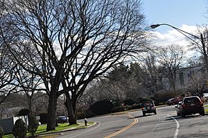
The parkway approaching a rotary in West Roxbury
|
|
| Maintained by | Boston Transportation Department |
|---|---|
| Length | 2.6 mi (4.2 km) |
| Location | Boston, Massachusetts (West Roxbury and Chestnut Hill neighborhoods) |
| South end | Washington Street / Enneking Parkway in West Roxbury |
| North end | Newton Street in Chestnut Hill |
|
West Roxbury Parkway, Metropolitan Park System of Greater Boston
|
|
| Location | Brookline and Boston, Massachusetts |
| Built | 1919 |
| Architect | Eliot, Charles |
| MPS | Metropolitan Park System of Greater Boston MPS |
| NRHP reference No. | 05001528 |
| Added to NRHP | January 19, 2006 |
The West Roxbury Parkway is a special road in Boston, Massachusetts. It's called a "parkway" because it's designed to be a scenic route, often with green spaces and trees along its sides. This historic road runs for about 2.6 miles. It starts at Washington Street in West Roxbury and ends at Horace James Circle in Brookline.
The parkway is important because it connects two cool nature areas: Stony Brook Reservation and Hammond Pond Reservation. It was built a long time ago, between 1919 and 1929. Because of its history and design, it was added to the National Register of Historic Places in 2006. This means it's recognized as a special place worth preserving.
Unlike some other parkways in the area, the West Roxbury Parkway was built with the help of the City of Boston. Today, the city still helps take care of it.
Near the northern part of the Stony Brook Reservation, the parkway goes through Bellevue Hill Park. The roads around Bellevue Hill Park, like Bellevue Hill Road, are also considered part of the West Roxbury Parkway's historic importance. The West Roxbury Parkway also crosses another important road called the Veterans of Foreign Wars Parkway.
Building the Parkway
Even though plans for the parkway started early, in 1894, building didn't begin until 1919. The very first part, from Washington Street to Belgrade Avenue, was finished then.
In 1920, the parkway was extended to Centre Street. This was a big deal because it gave people easier access to the Arnold Arboretum. The Arboretum is a famous garden with many different kinds of trees and plants. Connecting to it was one of the main goals for building the parkway.
The road kept growing! By 1924, it reached Weld Street. The very last section, which goes to Newton Street in Brookline, was completed in 1929. Also in 1924, Bellevue Hill Road, which runs alongside part of the parkway, was finished.
In the 1930s, four roundabouts (called "rotaries") were built along the parkway. These rotaries helped traffic flow smoothly where the parkway met other busy streets like Centre Street, the VFW Parkway, Grove Street, and Newton Street. The rotary at Newton Street is actually considered part of the Hammond Pond Parkway.
Where the Parkway Connects
The entire West Roxbury Parkway is located in Boston, Suffolk County.
| Location | Mile | Roads intersected | Notes | |
|---|---|---|---|---|
| West Roxbury | 0.0 | Washington Street / Enneking Parkway south – Dedham, Forest Hills, Boston | ||
| West Roxbury/Chestnut Hill border | 1.6 | VFW Parkway – Downtown Boston, Cambridge | ||
| Chestnut Hill | 2.6 | Newton Street | To Hammond Pond Parkway | |
| 1.000 mi = 1.609 km; 1.000 km = 0.621 mi | ||||
 | Lonnie Johnson |
 | Granville Woods |
 | Lewis Howard Latimer |
 | James West |


