Brookline, Massachusetts facts for kids
Quick facts for kids
Brookline, Massachusetts
|
||
|---|---|---|
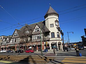
Intersection of Harvard and Beacon Streets in the Coolidge Corner neighborhood of Brookline
|
||
|
||
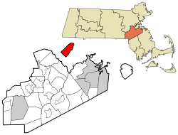
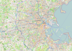
Location as an exclave of Norfolk County in Massachusetts
|
||
| Country | ||
| State | ||
| County | Norfolk | |
| Region | New England | |
| Settled | 1638 | |
| Incorporated | 1705 | |
| Government | ||
| • Type | Representative town meeting | |
| Area | ||
| • Total | 6.8 sq mi (17.7 km2) | |
| • Land | 6.8 sq mi (17.6 km2) | |
| • Water | 0.1 sq mi (0.1 km2) | |
| Elevation | 50 ft (15 m) | |
| Population
(2020)
|
||
| • Total | 63,191 | |
| • Density | 9,292.8/sq mi (3,590.4/km2) | |
| Time zone | UTC−5 (Eastern) | |
| • Summer (DST) | UTC−4 (Eastern) | |
| ZIP Codes |
02445–02447, 02467
|
|
| Area code(s) | 617/857 | |
| FIPS code | 25-09175 | |
| GNIS feature ID | 0619456 | |
Brookline (pronounced BROOK-line) is a town in Massachusetts, United States. It's part of the larger Boston area. Brookline is special because it's an "exclave" of Norfolk County, meaning it's separated from the rest of its county. It's surrounded by six of Boston's neighborhoods, like Brighton and Jamaica Plain, and borders the city of Newton to the west.
Brookline is famous for being the birthplace of John F. Kennedy, who later became a U.S. President. The area was first settled in 1638 and was known as Muddy River. It became its own town called Brookline in 1705.
Over the years, Brookline has worked hard to stay independent from Boston. This led to it becoming an exclave of Norfolk County. Historically, the town has faced challenges with housing rules that made it difficult for some groups of people to live there. This has led to a population that is mostly wealthy.
In the 19th century, new roads and train lines were built in Brookline. Today, Massachusetts Route 9 divides the town. The northern part is more like a city, while the southern part feels more suburban. In 2020, about 63,191 people lived in Brookline. It's the most populated town in Massachusetts that still has a "town" government instead of a "city" government.
Contents
History of Brookline
The land where Brookline is today was once home to Algonquian peoples. European settlers arrived in the early 1600s. It was first an outlying part of Boston called Muddy River. In 1705, it became an independent town named Brookline. The town's name comes from two small rivers or brooks that marked its northern and southern borders.
In the 1800s, some property rules in Brookline made it hard for certain groups, like Black people and Irish immigrants, to buy homes.
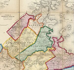
In 1874, the town of Brighton merged with Boston. This changed Brookline's border, cutting it off from the Charles River shoreline. It also put some land north of the Muddy River into Boston. Later, in the 1890s, Frederick Law Olmsted designed the Emerald Necklace park system, which included the Muddy River. This created beautiful parkland for both Boston and Brookline residents.
Brookline has always wanted to stay separate from Boston. In 1873, the town voted against joining Boston. Neighboring towns that connected Brookline to the rest of Norfolk County later joined Boston, making Brookline an exclave.
People have long seen Brookline as a beautiful and green place. In 1841, a writer named Andrew Jackson Downing described the area as a "landscape garden" with charming lanes and lots of trees.
Brookline residents were also among the first to suggest that women should be allowed to vote.
Getting Around Brookline
Two important roads, part of the old Boston Post Road, went through Brookline in the 1670s. Brookline Village was the main shopping area. In 1810, the Boston and Worcester Turnpike, now Massachusetts Route 9, was built, passing through the village center.
Trains arrived in Brookline in the mid-1800s. The Boston and Worcester Railroad was built in the 1830s near the Charles River. This train line is still used today. Another train line, the Highland branch, was built in 1847 and later became the Green Line D branch of the subway.
In 1888, electric streetcar tracks were laid on Beacon Street. These streetcars made it faster and cheaper to travel to downtown Boston. Many apartment buildings were built along these new streetcar lines, turning Brookline into a "streetcar suburb."
Homes and Housing Rules
Brookline has a history of housing rules that limited who could live there. In the early 1900s, Brookline banned the building of "triple-decker" houses. These were popular with immigrant families because they were more affordable.
In 1924, Brookline changed its rules to mostly allow only single-family homes. Many of the apartment buildings you see today were built before this rule change.
More recently, Brookline has continued to make it hard to build new apartment buildings. This has caused housing prices to become very high. In 2023, the average price for a single-family home was over $2.5 million. Because of these high prices, many people who work in Brookline, like teachers and police officers, cannot afford to live there.
Why the Name Brookline?
Brookline was first called Muddy River and was part of Boston until 1705. The name Brookline is said to come from a farm owned by Judge Samuel Sewall. This farm was located near the Muddy River, which was used as the border between Brookline and Boston.
Brookline's Geography
Brookline covers about 6.8 square miles (17.7 square kilometers). Most of this area is land.
The northern part of Brookline, north of the D-line train tracks, is very urban. It's easy to walk around and has good public transportation. This area has a lot of people living close together, similar to busy parts of nearby cities like Cambridge and Somerville. The southern part of Brookline is more spread out with larger homes.
Brookline borders Newton to the west and Boston in all other directions. This means it's not connected to the rest of Norfolk County, making it an "exclave." Brookline became an exclave in 1873 when a nearby town, West Roxbury, joined Boston.
Brookline also separates most of Boston from its western neighborhoods like Allston–Brighton.
Neighborhoods to Explore
Brookline has many different neighborhoods and areas. Some of the well-known ones include:
- Aspinwall Hill
- Brookline Village
- Chestnut Hill (which is also in Newton and Boston)
- Coolidge Corner
- Corey Hill
- Fisher Hill
- Longwood
- Pill Hill
- South Brookline
- Washington Square
Weather in Brookline
Brookline has a humid continental climate. This means it has warm summers and cold winters.
| Climate data for Brookline, MA | |||||||||||||
|---|---|---|---|---|---|---|---|---|---|---|---|---|---|
| Month | Jan | Feb | Mar | Apr | May | Jun | Jul | Aug | Sep | Oct | Nov | Dec | Year |
| Record high °F (°C) | 72.0 (22.2) |
70.0 (21.1) |
89.0 (31.7) |
94.0 (34.4) |
97.0 (36.1) |
100.0 (37.8) |
104.0 (40.0) |
102.0 (38.9) |
102.0 (38.9) |
90.0 (32.2) |
83.0 (28.3) |
76.0 (24.4) |
104.0 (40.0) |
| Mean daily maximum °F (°C) | 36.0 (2.2) |
39.0 (3.9) |
45.0 (7.2) |
56.0 (13.3) |
66.0 (18.9) |
76.0 (24.4) |
82.0 (27.8) |
80.0 (26.7) |
72.0 (22.2) |
61.0 (16.1) |
52.0 (11.1) |
41.0 (5.0) |
58.83 (14.91) |
| Mean daily minimum °F (°C) | 22.0 (−5.6) |
25.0 (−3.9) |
31.0 (−0.6) |
41.0 (5.0) |
50.0 (10.0) |
60.0 (15.6) |
65.0 (18.3) |
65.0 (18.3) |
57.0 (13.9) |
47.0 (8.3) |
38.0 (3.3) |
28.0 (−2.2) |
44.08 (6.71) |
| Record low °F (°C) | −30.0 (−34.4) |
−18.0 (−27.8) |
−8.0 (−22.2) |
11.0 (−11.7) |
31.0 (−0.6) |
41.0 (5.0) |
50.0 (10.0) |
46.0 (7.8) |
34.0 (1.1) |
25.0 (−3.9) |
−2.0 (−18.9) |
−17.0 (−27.2) |
−30.0 (−34.4) |
| Average precipitation inches (mm) | 3.36 (85) |
3.38 (86) |
4.32 (110) |
3.74 (95) |
3.49 (89) |
3.68 (93) |
3.43 (87) |
3.35 (85) |
3.44 (87) |
3.94 (100) |
3.99 (101) |
3.78 (96) |
43.9 (1,120) |
| Source: Weather.com | |||||||||||||
People in Brookline
| Historical population | ||
|---|---|---|
| Year | Pop. | ±% |
| 1790 | 484 | — |
| 1800 | 605 | +25.0% |
| 1810 | 784 | +29.6% |
| 1820 | 900 | +14.8% |
| 1830 | 1,043 | +15.9% |
| 1840 | 1,365 | +30.9% |
| 1850 | 2,516 | +84.3% |
| 1860 | 5,164 | +105.2% |
| 1870 | 6,650 | +28.8% |
| 1880 | 8,057 | +21.2% |
| 1890 | 12,103 | +50.2% |
| 1900 | 19,935 | +64.7% |
| 1910 | 27,792 | +39.4% |
| 1920 | 37,748 | +35.8% |
| 1930 | 47,490 | +25.8% |
| 1940 | 49,786 | +4.8% |
| 1950 | 57,589 | +15.7% |
| 1960 | 54,044 | −6.2% |
| 1970 | 58,886 | +9.0% |
| 1980 | 55,062 | −6.5% |
| 1990 | 54,718 | −0.6% |
| 2000 | 57,107 | +4.4% |
| 2010 | 58,732 | +2.8% |
| 2020 | 63,191 | +7.6% |
| 2022* | 62,535 | −1.0% |
| : * = population estimate. Source: United States Census records and Population Estimates Program data. |
||
In 2010, there were about 58,732 people living in Brookline. Most residents were White (73.3%), followed by Asian (15.6%) and Black (3.4%). About 5% of the population was Hispanic or Latino.
The average age in Brookline was 34 years old. Many people were between 25 and 44 years old (37.3%). About 16.6% of the population was under 18.
The average household income in 2021 was $83,318. For families, the average income was $122,356. About 9.3% of the population lived below the poverty line.
Arts and Culture in Brookline
Brookline is a lively place with a rich culture.
- It's a center for the Jewish community in the Boston area.
- The main office for the Greek Orthodox Archdiocese of America in Boston is located here.
- Puppet Showplace Theater in Brookline Village is New England's only theater just for puppets.
- Brookline has its own Poet Laureates, who are special poets chosen to represent the town.
- There's a large Irish American community in Brookline, similar to Boston and Quincy.
Fun Places to Visit
Here are some historic places you can visit:
- The birthplace of John F. Kennedy is in Brookline. You can visit it from May to September.
- "Fairsted" is the old office of famous landscape architect Frederick Law Olmsted. It's now the Frederick Law Olmsted National Historic Site, with beautiful gardens.
- The John Goddard House, built in 1767, is another historic home.
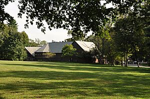
- Larz Anderson Park has the Larz Anderson Auto Museum, which has one of the oldest car collections in the country. It also has Putterham School, a one-room schoolhouse from colonial times.
Other interesting spots include:
- St. Aidan's Church was where John F. Kennedy was baptized. It's now housing.
- The Dutch House was moved to Brookline after the 1893 World's Fair.
- Brookline had two stops on the Underground Railroad, a secret network that helped enslaved people find freedom.
- The Country Club is a famous sports club, known for its golf course. It has hosted major golf tournaments like the U.S. Open.
- Coolidge Corner is a popular shopping and dining area. It has historic buildings like the S.S. Pierce Building and the Coolidge Corner Theatre.
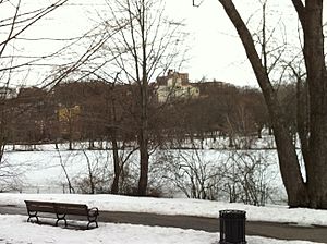
- Part of Frederick Law Olmsted's Emerald Necklace park system, including Olmsted Park, is in Brookline.
- The Puppet Showplace Theatre is one of the oldest puppet theaters in the U.S.
New and Existing Laws
Brookline has made some interesting local laws:
- In 2017, the town decided to celebrate Indigenous Peoples' Day instead of Columbus Day.
- In 2019, Brookline banned plastic bags at grocery stores and other businesses.
- In 2021, Brookline made a law that bans the sale of tobacco and e-cigarettes to anyone born after January 1, 2000. This law was upheld by the highest court in Massachusetts in 2023.
Education in Brookline
Public Schools
Brookline has its own public school system. Brookline High School has students from over 76 countries. Many students from Boston also attend through a program called METCO.
There are eight elementary schools in Brookline: Baker, Florida Ruffin Ridley, Driscoll, Roland Hayes, Lawrence, Lincoln, Pierce, and Runkle. In 2006, there were over 6,000 students in these schools. The school system includes an early learning center, eight K-8 schools, and one high school.
In the 2012–13 school year, about 57.4% of students were White, 18.1% Asian, and 6.4% Black. About 30% of students came from homes where English was not their first language.
Private Schools
Brookline also has several private schools:
- Beaver Country Day School
- Brimmer and May School
- Dexter Southfield School
- Ivy Street School
- Maimonides School
- The Park School
- Saint Mary of the Assumption School
Colleges and Universities
Several colleges and universities are in Brookline:
- Pine Manor College
- Hellenic College and Holy Cross Greek Orthodox School of Theology
- Boston Graduate School of Psychoanalysis
Parts of Boston University, Boston College, and Northeastern University are also located in Brookline.
Transportation and Services
Getting Around Town
Subway and Light Rail
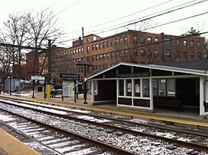
Brookline is served by the MBTA's Green Line trains. The C and D branches run through Brookline, taking people to downtown Boston and to Newton. The B line runs just outside Brookline, near Boston University.
Bus Services
Several MBTA bus routes also serve Brookline:
- Route 51: Cleveland Circle to Forest Hills
- Route 60: Kenmore Square to Chestnut Hill
- Route 65: Kenmore Square to Brighton
- Route 66: Harvard University to Nubian station
- Route 86: Cleveland Circle to Sullivan station
Public Libraries
Brookline has three public libraries:
- Public Library of Brookline (main branch)
- Coolidge Corner Branch Library
- Putterham Branch Library
Fire Department
The Brookline Fire Department (BFD) protects the town with 158 professional firefighters. They operate out of five fire stations and respond to about 8,500 emergency calls each year.
Cemeteries
- The Old Burying Ground (also known as Walnut Street Cemetery), established in 1717.
- Walnut Hills Cemetery, established in 1875.
Famous People from Brookline
Many well-known people have lived in or are from Brookline:
Athletes
- Larry Bird, famous basketball player for the Boston Celtics
- Tom Brady, former quarterback for the New England Patriots
- Kenny Florian, professional mixed martial artist
- Francis Ouimet, amateur golfer who won the U.S. Open in 1913
Politicians and Leaders
- Michael Bloomberg, former mayor of New York City
- Michael Dukakis, former governor of Massachusetts
- John F. Kennedy, 35th President of the United States, born in Brookline
- Robert F. Kennedy, U.S. Attorney General and Senator, brother of JFK, born in Brookline
- Bhumibol Adulyadej, former king of Thailand, lived in Brookline as a baby
Writers and Artists
- Saul Bellow, Nobel Prize-winning novelist
- Ellen Goodman, Pulitzer Prize-winning journalist
- John Hodgman, author and comedian
- Jon Krakauer, author of Into the Wild
- Frederick Law Olmsted, famous landscape architect
- Arnold Schoenberg, composer
- James Taylor, musician and singer
- Mike Wallace, TV journalist from 60 Minutes
- Barbara Walters, TV commentator and journalist
Other Notable People
- Gisele Bündchen, supermodel
- Theo Epstein, baseball executive for the Chicago Cubs
- King Camp Gillette, inventor of the safety razor
- Robert Kraft, owner of the New England Patriots
- Joey McIntyre, member of the band New Kids on the Block
- Conan O'Brien, television host and comedian
- Lawrence Summers, former president of Harvard University
Sister Cities
Brookline is twinned with:
 Quezalguaque, Nicaragua (since 1987)
It is also included under the sister cities for the Commonwealth of Massachusetts: Hokkaidō, Japan (since 1990), and Basel-Stadt, Switzerland.
See also
 In Spanish: Brookline para niños
 | Victor J. Glover |
 | Yvonne Cagle |
 | Jeanette Epps |
 | Bernard A. Harris Jr. |


