West Stewartstown, New Hampshire facts for kids
Quick facts for kids
West Stewartstown, New Hampshire
|
|
|---|---|
 |
|
| Country | United States |
| State | New Hampshire |
| County | Coös |
| Town | Stewartstown |
| Area | |
| • Total | 0.67 sq mi (1.73 km2) |
| • Land | 0.62 sq mi (1.60 km2) |
| • Water | 0.05 sq mi (0.13 km2) |
| Elevation | 1,050 ft (320 m) |
| Population
(2020)
|
|
| • Total | 263 |
| • Density | 424.88/sq mi (164.03/km2) |
| Time zone | UTC-5 (Eastern (EST)) |
| • Summer (DST) | UTC-4 (EDT) |
| ZIP code |
03597
|
| Area code(s) | 603 |
| FIPS code | 33-83620 |
| GNIS feature ID | 0870796 |
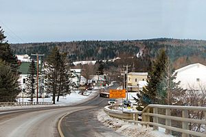
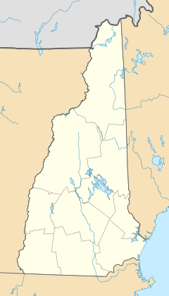
West Stewartstown is a small community in the town of Stewartstown. It is located in Coös County, New Hampshire, in the United States. A "census-designated place" means it's an area that the government counts for population, but it's not a separate city or town.
In 2020, about 263 people lived in West Stewartstown. This number was lower than in 2010, when 386 people lived there.
Where is West Stewartstown?
This community is found in the northwest part of Stewartstown. It sits right next to U.S. Route 3 and the Connecticut River. Across the river is Canaan, Vermont. West Stewartstown is also only about one mile south of the border with Canada.
Route 3 goes south for about 8 miles to Colebrook. It also goes northeast for about 10 miles to Pittsburg.
There are two nearby places where you can cross the border into Canada:
- The Canaan–Hereford Road Border Crossing is about 1.9 miles northwest. You can reach it using Vermont Routes 114 and 141.
- The Beecher Falls–East Hereford Border Crossing is about 2.2 miles northeast. You get there by taking Vermont Route 253.
The United States Census Bureau says that West Stewartstown covers a total area of about 1.73 square kilometers (0.67 square miles). Most of this area, about 1.60 square kilometers (0.62 square miles), is land. The rest, about 0.13 square kilometers (0.05 square miles), is water, which makes up about 7.37% of the total area.
Who Lives in West Stewartstown?
| Historical population | |||
|---|---|---|---|
| Census | Pop. | %± | |
| 2010 | 386 | — | |
| 2020 | 263 | −31.9% | |
| U.S. Decennial Census | |||
In 2010, there were 386 people living here. They lived in 119 households, and 76 of these were families. There were 140 housing units, but 21 of them (15%) were empty.
Most of the people living in West Stewartstown were white (98.7%). A small number were African American (0.3%) or Native American (0.3%). About 0.8% of the people were of two or more races. No one in the community was Hispanic or Latino.
Let's look at the households:
- About 31.9% of households had children under 18 living with them.
- About 45.4% were married couples living together.
- About 9.2% were led by a woman without a husband present.
- About 36.1% were not families.
- About 28.6% of all households were single people.
- About 10.1% were people living alone who were 65 years old or older.
On average, there were 2.39 people in each household and 2.91 people in each family.
Here's a look at the ages of the people in 2010:
- 18.4% were under 18 years old.
- 10.4% were between 18 and 24 years old.
- 19.6% were between 25 and 44 years old.
- 21.9% were between 45 and 64 years old.
- 29.8% were 65 years old or older.
The average age of people in West Stewartstown was 46.8 years. For every 100 females, there were about 94 males. If you looked at just adults (18 and over), for every 100 females, there were about 95.7 males.
From 2011 to 2015, the average yearly income for a household was about $32,083. For a family, the average income was about $45,417. The per capita income, which is the average income per person, was about $18,406.
See also
 In Spanish: West Stewartstown para niños


