Westwood, Kansas facts for kids
Quick facts for kids
Westwood, Kansas
|
|
|---|---|
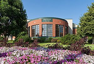
Westwood City Hall (2011)
|
|
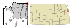
Location within Johnson County and Kansas
|
|
|
|
| Country | United States |
| State | Kansas |
| County | Johnson |
| Incorporated | 1949 |
| Government | |
| • Type | Mayor–Council |
| Area | |
| • Total | 0.41 sq mi (1.07 km2) |
| • Land | 0.41 sq mi (1.07 km2) |
| • Water | 0.00 sq mi (0.00 km2) |
| Elevation | 955 ft (291 m) |
| Population
(2020)
|
|
| • Total | 1,750 |
| • Density | 4,270/sq mi (1,636/km2) |
| Time zone | UTC-6 (CST) |
| • Summer (DST) | UTC-5 (CDT) |
| ZIP code |
66205
|
| Area code | 913 |
| FIPS code | 20-77500 |
| GNIS ID | 485660 |
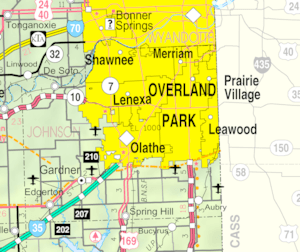
Westwood is a city located in the northeast part of Johnson County, Kansas, in the United States. In 2020, about 1,750 people lived there. It's known for being the second most crowded city in the Kansas City Metropolitan Area.
Contents
History of Westwood
The land where Westwood now stands was once home to the Kansa and Pawnee Native American tribes. In the 1830s, Captain Joseph Parks, a leader of the Shawnee people, helped move Shawnee tribes from Ohio to new lands in Northeast Kansas. For his help, the U.S. Government gave Parks 1,290 acres of land in 1854. This land was located in what is now Johnson and Wyandotte counties.
When Parks passed away in 1859, he didn't leave a will. His family spent 60 years deciding how to divide the land. The area that became Westwood was eventually given to his granddaughter, Catherine Swatzell, and her husband, John. In 1898, the Swatzells built a stone house at 4958 Rainbow. This house is still there today and is seen as the beginning of the Westwood community.
After World War II, the area around the Swatzell home started to grow quickly. People began building new homes as a suburb of Kansas City. Residents first formed a group called the Hudson Mission Homes Association. They worked together to bring streets and utilities like water and electricity to the area.
Westwood officially became a city in 1949. The name "Westwood" was chosen because a successful neighborhood called Westwood, Missouri, was just to the east. Also, the name "Westwood" was already used for several local housing areas and the elementary school, Westwood View.
In 1987, the Westwood Neighborhood Association was created to organize fun community events. Its first president was a 16-year-old resident named Tom Shanks. Their first event was Oktoberfest, held in the park at 50th and Rainbow. This event is still a yearly tradition in Westwood. The city also has its own police department to keep everyone safe.
Geography and Location
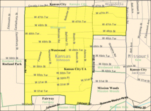
Westwood covers an area of about 0.41 square miles (1.07 square kilometers), and all of it is land. The city's first borders were 47th Street to the north, Rainbow Boulevard to the east, Shawnee Mission Parkway to the south, and Mission Road to the west.
In 1960, Westwood grew by adding Westport Annex and Westport View. This expanded the city's boundaries to include 47th Place, 47th Terrace, and 48th Street, stretching from Rainbow Boulevard to State Line Road. In 1973, the city voted not to join with its neighbor, Westwood Hills, Kansas.
Population Information
| Historical population | |||
|---|---|---|---|
| Census | Pop. | %± | |
| 1950 | 1,581 | — | |
| 1960 | 2,040 | 29.0% | |
| 1970 | 2,383 | 16.8% | |
| 1980 | 1,783 | −25.2% | |
| 1990 | 1,772 | −0.6% | |
| 2000 | 1,533 | −13.5% | |
| 2010 | 1,506 | −1.8% | |
| 2020 | 1,750 | 16.2% | |
| U.S. Decennial Census | |||
2020 Census Details
According to the census from 2020, Westwood had 1,750 people living in 707 households. About 423 of these were families. The city had about 4,268 people per square mile.
Most of the people living in Westwood were White (86.23%). There were also smaller groups of African American, Native American, and Asian residents. About 8.51% of the population identified as Hispanic or Latino.
In terms of households, 29.56% had children under 18 living with them. Most households (62.6%) were married couples. The average household had 2.34 people, and the average family had 2.97 people.
The population's age was spread out. About 22.6% were under 18, and 15.5% were 65 or older. The average age was 36.7 years. Slightly more than half of the population (51%) was female.
The average income for a household in Westwood was $79,955. For families, the average income was $106,250. About 4.8% of the population lived below the poverty line. This included 3.2% of those under 18 and 4.7% of those 65 and older.
2010 Census Details
In the census of 2010, Westwood had 1,506 people living in 693 households. The city had about 3,673 people per square mile.
The racial makeup was mostly White (94.6%). There were also small percentages of African American, Native American, and Asian residents. About 7.7% of the population was Hispanic or Latino.
Out of 693 households, 28.3% had children under 18. About 45.0% were married couples. The average household size was 2.17 people, and the average family size was 2.88 people.
The average age in the city was 38.8 years. About 21.2% of residents were under 18. About 14.8% were 65 or older. The population was 48.0% male and 52.0% female.
See also
 In Spanish: Westwood (Kansas) para niños
 | Bessie Coleman |
 | Spann Watson |
 | Jill E. Brown |
 | Sherman W. White |


