Wheatland, California facts for kids
Quick facts for kids
Wheatland, California
|
|
|---|---|

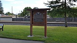
Johnson's Ranch plaque
|
|

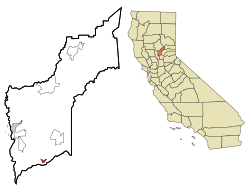
Location in Yuba County and the state of California
|
|
| Country | United States |
| State | California |
| County | Yuba |
| Incorporated | April 23, 1874 |
| Area | |
| • Total | 8.13 sq mi (21.05 km2) |
| • Land | 8.12 sq mi (21.04 km2) |
| • Water | 0.01 sq mi (0.02 km2) 0.45% |
| Elevation | 92 ft (28 m) |
| Population
(2020)
|
|
| • Total | 3,712 |
| • Density | 456.6/sq mi (176.34/km2) |
| Time zone | UTC-8 (Pacific) |
| • Summer (DST) | UTC-7 (PDT) |
| ZIP code |
95692
|
| Area code | 530 |
| FIPS code | 06-85012 |
| GNIS feature ID | 1652652 |
Wheatland is a city in Yuba County, California, United States. It is the second-largest city in the county by how many people live there. In 2010, about 3,456 people lived in Wheatland. This was more than the 2,275 people who lived there in 2000. Wheatland is located about 12.5 miles (20.1 km) southeast of Marysville.
Contents
Where is Wheatland Located?
Wheatland is found at coordinates 39°00′36″N 121°25′23″W.
The city covers a total area of about 1.5 square miles (3.9 square kilometers). Most of this area (99.55%) is land, and a small part (0.45%) is water.
A Look at Wheatland's Past
Wheatland is built on land that was once part of a Mexican land grant called Rancho Johnson. A post office first opened in Wheatland in 1866. The city officially became a city in 1874.
In the 1860s, many Chinese American people lived in Wheatland. However, in February 1886, these residents were forced to leave the town.
In 1888, a very important event happened: Edward Duplex was elected Mayor. He was the first black person to become a mayor in a city in the Western United States. His original barbershop can still be seen on Main Street today.
Wheatland was also where the Hop Riot happened in 1913. This was a sad event in the history of farm workers. Four men died, and a local police officer was shot. The area was put under military control before things calmed down.
Wheatland's Weather
| Climate data for Wheatland, California | |||||||||||||
|---|---|---|---|---|---|---|---|---|---|---|---|---|---|
| Month | Jan | Feb | Mar | Apr | May | Jun | Jul | Aug | Sep | Oct | Nov | Dec | Year |
| Record high °F (°C) | 76 (24) |
83 (28) |
89 (32) |
97 (36) |
105 (41) |
113 (45) |
111 (44) |
112 (44) |
113 (45) |
104 (40) |
89 (32) |
79 (26) |
113 (45) |
| Mean daily maximum °F (°C) | 55 (13) |
62 (17) |
68 (20) |
75 (24) |
83 (28) |
91 (33) |
97 (36) |
96 (36) |
90 (32) |
80 (27) |
65 (18) |
56 (13) |
77 (25) |
| Daily mean °F (°C) | 48 (9) |
53 (12) |
57.5 (14.2) |
64.5 (18.1) |
71.5 (21.9) |
79 (26) |
78 (26) |
79.5 (26.4) |
78 (26) |
68 (20) |
58 (14) |
48 (9) |
65.3 (18.6) |
| Mean daily minimum °F (°C) | 39 (4) |
43 (6) |
46 (8) |
49 (9) |
55 (13) |
60 (16) |
64 (18) |
62 (17) |
59 (15) |
52 (11) |
45 (7) |
40 (4) |
51 (11) |
| Record low °F (°C) | 20 (−7) |
23 (−5) |
26 (−3) |
32 (0) |
38 (3) |
45 (7) |
50 (10) |
45 (7) |
47 (8) |
32 (0) |
27 (−3) |
17 (−8) |
17 (−8) |
| Source: http://www.weather.com/weather/wxclimatology/monthly/graph/USCA0608 | |||||||||||||
Who Lives in Wheatland?
| Historical population | |||
|---|---|---|---|
| Census | Pop. | %± | |
| 1880 | 635 | — | |
| 1890 | 630 | −0.8% | |
| 1900 | 492 | −21.9% | |
| 1910 | 481 | −2.2% | |
| 1920 | 435 | −9.6% | |
| 1930 | 479 | 10.1% | |
| 1940 | 496 | 3.5% | |
| 1950 | 581 | 17.1% | |
| 1960 | 813 | 39.9% | |
| 1970 | 1,280 | 57.4% | |
| 1980 | 1,474 | 15.2% | |
| 1990 | 1,631 | 10.7% | |
| 2000 | 2,275 | 39.5% | |
| 2010 | 3,456 | 51.9% | |
| 2019 (est.) | 3,873 | 12.1% | |
| U.S. Decennial Census | |||
Population in 2010
In 2010, the population of Wheatland was 3,456 people. This means there were about 2,326 people per square mile (898 per square kilometer).
Most people (76.2%) were White. About 17.9% of the people were Hispanic or Latino.
There were 1,219 households in the city. About 44.8% of these households had children under 18 living in them. The average household had 2.84 people.
The median age of people in Wheatland was 33.2 years old. About 29.6% of the population was under 18.
Population in 2000
In 2000, Wheatland had 2,275 people. There were 785 households and 584 families. The population density was about 3,007.5 people per square mile (1,161.2 per square kilometer).
About 74.64% of the people were White. Hispanic or Latino people made up 21.23% of the population.
The average household size was 2.90 people. The average family size was 3.37 people.
The median income for a household in Wheatland was $34,861. This means half of the households earned more than this, and half earned less. About 19.8% of the people in Wheatland lived below the poverty line.
Famous People from Wheatland
- Ann Getty, a person known for giving money to good causes.
- H. Monroe Browne, a diplomat who works with other countries.
- Connie Redbird Pinkerman-Uri, a doctor and a lawyer.
See also
 In Spanish: Wheatland (California) para niños
 | John T. Biggers |
 | Thomas Blackshear |
 | Mark Bradford |
 | Beverly Buchanan |


