Wheaton, Wisconsin facts for kids
Quick facts for kids
Town of Wheaton
|
|
|---|---|

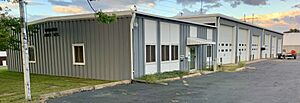
Town hall
|
|

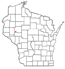
Location of the Town of Wheaton
|
|
| Country | |
| State | |
| County | Chippewa |
| Area | |
| • Total | 54.8 sq mi (142.0 km2) |
| • Land | 54.4 sq mi (140.8 km2) |
| • Water | 0.5 sq mi (1.2 km2) |
| Elevation | 981 ft (299 m) |
| Population
(2010)
|
|
| • Total | 2,701 |
| • Density | 50/sq mi (19.2/km2) |
| Time zone | UTC-6 (Central (CST)) |
| • Summer (DST) | UTC-5 (CDT) |
| Area code(s) | 715 & 534 |
| FIPS code | 55-86537 |
| GNIS feature ID | 1584423 |
| PLSS township | T28N R10W and part of T28N R9W |
The Town of Wheaton is a community in Chippewa County, Wisconsin, in the United States. In 2010, about 2,701 people lived there. This was more than the 2,366 people counted in 2000. Two smaller communities, Old Albertville and Pine Grove, are also part of the town.
Contents
Where is Wheaton Located?
The Town of Wheaton is in the southwest part of Chippewa County. It shares borders with Dunn County to the west and Eau Claire County to the south.
The Chippewa River runs along the southeast edge of the town. Across the river are the cities of Chippewa Falls and Eau Claire, and the village of Lake Hallie. Chippewa Falls also borders Wheaton to the northeast, and Eau Claire borders it to the south by land.
The town covers a total area of about 142 square kilometers (54.8 square miles). Most of this area, about 140.8 square kilometers (54.4 square miles), is land. The rest, about 1.2 square kilometers (0.5 square miles), is water, like rivers or lakes.
Wheaton's Past
The land that became the Town of Wheaton was first mapped out in the fall of 1848. This was done by a team working for the U.S. government. They surveyed the area, which was made up of squares, each about 6 miles by 6 miles.
In 1849, another team walked through the woods and swamps. They marked all the corners of the land sections. After their work, the surveyor described the land near the river. He said that the land east of the Chippewa River was very sandy. It mostly had yellow and pitch pine trees. Near the swamps, there were white pine, birch, and elm trees.
West of the river, in the northwest part of the area, there were sections with aspen trees. The soil there was a mix of sand and loam, which was good for farming. However, these areas did not have much water. The surveyor also noted that the Chippewa River was deep enough for boats all year. But some fast-moving parts of the river made it hard to travel.
People of Wheaton
| Historical population | |||
|---|---|---|---|
| Census | Pop. | %± | |
| 1970 | 1,652 | — | |
| 1980 | 2,017 | 22.1% | |
| 1990 | 2,279 | 13.0% | |
| 2000 | 2,366 | 3.8% | |
| 2010 | 2,701 | 14.2% | |
| 2020 (est.) | 2,833 | 4.9% | |
In 2000, there were 2,366 people living in Wheaton. These people lived in 852 households, and 692 of these were families. The population density was about 43 people per square mile.
Most of the people in Wheaton were White (98.27%). A small number were from other groups, including African American, Native American, Asian, and Pacific Islander. Some people were also of Hispanic or Latino background.
About 36.7% of households had children under 18 living with them. Most households (72.3%) were married couples living together. About 13.3% of households were made up of single individuals.
The average age of people in Wheaton was 38 years old. About 26.1% of the population was under 18. About 9.0% were 65 years old or older.
In 2000, the average income for a household in Wheaton was $52,692 per year. For families, the average income was $55,061. A small number of families (2.0%) and people (3.5%) lived below the poverty line.
Fun Facts About Wheaton
- A fictional character named Recondo (G.I. Joe) is said to be from Wheaton. He is part of the G.I. Joe: A Real American Hero series.
See also

- In Spanish: Wheaton (Wisconsin) para niños
 | Toni Morrison |
 | Barack Obama |
 | Martin Luther King Jr. |
 | Ralph Bunche |

