White Rock, New Mexico facts for kids
Quick facts for kids
White Rock, New Mexico
|
|
|---|---|

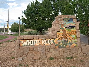
Sign at entrance to White Rock
|
|

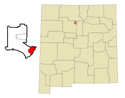
Location of White Rock, New Mexico in Los Alamos County
|
|
| Country | United States |
| State | New Mexico |
| County | Los Alamos |
| Area | |
| • Total | 7.11 sq mi (18.41 km2) |
| • Land | 7.07 sq mi (18.30 km2) |
| • Water | 0.04 sq mi (0.11 km2) |
| Elevation | 6,375 ft (1,943 m) |
| Population
(2020)
|
|
| • Total | 5,852 |
| • Density | 828.19/sq mi (319.76/km2) |
| Time zone | UTC-7 (Mountain (MST)) |
| • Summer (DST) | UTC-6 (MDT) |
| ZIP Code |
87547
|
| Area code(s) | 505 |
| FIPS code | 35-84740 |
| GNIS feature ID | 2409584 |
White Rock is a community in Los Alamos County, New Mexico. It is one of the two main places where people live in the county. The other is Los Alamos, which is the county seat.
White Rock is often called a "bedroom community." This means many people who live there work at the Los Alamos National Laboratory. They live in White Rock and travel to work. You can get to White Rock from other towns in New Mexico using New Mexico State Road 4. Locals sometimes call Los Alamos "the Townsite" or "the Hill."
Contents
White Rock's History
In 1947, a group called the United States Atomic Energy Commission bought land. They wanted to build a town for workers who were helping to build Los Alamos. These workers were not allowed to live inside the main city of Los Alamos.
The town was built very quickly starting in 1949. The goal was to house up to 1,800 people. They built many types of homes, including dorms and houses. They also added a school, a shopping center, and a post office.
By 1950, about 1,000 to 1,200 people lived there. But after 1952, the population started to shrink. This happened because big construction projects were ending. By 1957, most of the homes were empty. The town officially closed in September 1957.
In 1960, the land was offered for new housing. Work on the White Rock we know today began in 1962.
White Rock's Geography
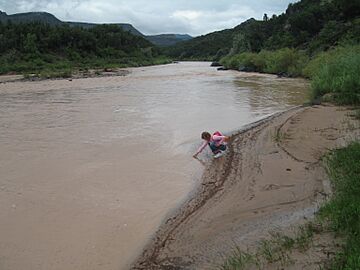
White Rock is in the southeastern part of Los Alamos County. To the east, it borders Santa Fe County. The eastern edge of White Rock follows the Rio Grande river through White Rock Canyon.
The main part of White Rock is about 6,365 feet (1,940 meters) above sea level. This is about 900 feet (274 meters) higher than the river in the canyon. The community also includes a neighborhood called Pajarito Acres.
The town of Los Alamos is about 9 miles (14 km) northwest of White Rock. You can reach it using New Mexico State Roads 4 and 502. There is also a special entrance to Los Alamos National Laboratory from White Rock.
White Rock covers a total area of about 7.1 square miles (18.4 square kilometers). Only a small part of this area, about 0.04 square miles (0.1 square kilometers), is water.
White Rock Canyon
White Rock Canyon is mostly undeveloped and is on the eastern side of the community. It's a popular place for outdoor activities. The canyon was formed by the Rio Grande river flowing through basalt and tuff rock.
The canyon runs from the Otowi Suspension Bridge in the north to Cochiti Dam in the south. Many smaller canyons, like Los Alamos Canyon, also feed into it. White Rock is on the west side of the canyon. Other important places nearby include Bandelier National Monument and San Ildefonso Pueblo.
The canyon is about 1,000 feet (305 meters) deep on average. It offers amazing views and rugged land. You can find rare plants and endangered animals here. The basalt cliffs along the canyon rim are popular for rock climbing.
White Rock Canyon Rim Trail
This trail is great for an easy walk.
- Distance: 2.8 miles (4.5 km) one way
- Elevation: 6,300 to 6,400 feet (1,920 to 1,951 meters)
- Elevation Change: 100 feet (30 meters)
- Fitness Level: Easy
- Seasons: All year
- Trail Surface: Rocks and packed dirt
- Hazards: Cliffs, rattlesnakes
Blue Dot Trail
The Blue Dot Trail starts near the overlook viewing platform. It leads down to the Rio Grande river. Part of the trail goes through a meadow. As you get closer to the river, the rocks change from dark basalt to lighter granite. There's a spring near the river, but the water is not safe to drink.
- Distance: 1.1 miles (1.8 km) one way
- Elevation: 5,450 to 6,250 feet (1,661 to 1,905 meters)
- Elevation Change: 800 feet (244 meters)
- Fitness Level: Strenuous, but short
- Seasons: All year, except after heavy snow
- Trail Surface: Rocky and steep
- Hazards: Cliffs, loose footing, swift river
Red Dot Trail
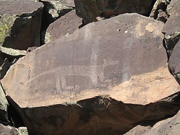
This trail is also known as Pajarito Springs Trail. You can find many ancient rock carvings, called petroglyphs, along this path. These drawings show different styles, from Kokopelli figures to abstract shapes. The local Tewa may have brought some designs from other Native American groups. The trail also passes several springs that form a small creek and waterfall before reaching the Rio Grande.
- Distance: 1.0 mile (1.6 km) one way
- Elevation: 5,500 to 6,300 feet (1,676 to 1,920 meters)
- Elevation Change: 800 feet (244 meters)
- Fitness Level: Strenuous, but short
- Seasons: All year, except after heavy snow
- Trail Surface: Very rocky
- Hazards: Cliffs, loose footing, swift river
River Trail
This trail runs along the river.
- Distance: 3.2 miles (5.1 km) one way
- Elevation: 5,400 to 5,500 feet (1,646 to 1,676 meters)
- Elevation Change: 100 feet (30 meters)
- Fitness Level: Easy
- Skill Level: Some parts need good route-finding skills
- Seasons: All year, except after heavy snow
- Trail Surface: Sand, river stones, and rocks
- Hazards: Swift river
White Rock's Population
| Historical population | |||
|---|---|---|---|
| Census | Pop. | %± | |
| 2020 | 5,852 | — | |
| U.S. Decennial Census | |||
In 2020, the 2020 United States census counted 5,852 people living in White Rock. There were 2,322 households, which are groups of people living together in one home.
About 79% of the people were white. About 17% were Hispanic or Latino.
About 30% of the households had children under 18 years old. Most households (65.8%) were married couples living together. The average household had 2.8 people.
About 22% of the population was under 18 years old. The average age of people in White Rock was 46.5 years.
White Rock Community Plan
The main shopping area in White Rock has been struggling since about 2008. This is partly because people now shop more online or at big stores in nearby towns.
Los Alamos County has started a big project to make the White Rock shopping area better. They are improving roads and other services. They also want to attract new businesses. This effort is guided by the White Rock Master Plan Implementation Committee.
Community Parks and Playgrounds
White Rock has several parks and playgrounds for everyone to enjoy.
Overlook Park
- playground
- 1 youth baseball field (no lights)
- 2 youth baseball fields (with lights)
- 5 softball fields (no lights)
- 1 softball field (with lights)
- 4 soccer fields (no lights)
- 3 picnic areas
- 1 dog park
- 1 RC car track
- 1 viewing platform (the overlook)
Piñon Park
- playground
- 2 full basketball courts
- 3 tennis courts
- 1 skateboard park
- Disc Golf Course
Rover Park
- playground
- 1 full basketball court
- 2 tennis courts
- 1 soccer field (no lights)
Jeffrey Tot Lot
- playground
Mountain Meadows Tot Lot
- playground
Education in White Rock
The schools in White Rock are part of Los Alamos Public Schools. The elementary schools in White Rock are:
- Piñon Elementary School
- Chamisa Elementary School
Older students go to Los Alamos Middle School and Los Alamos High School. These schools are located in the town of Los Alamos.
See also
 In Spanish: White Rock (Nuevo México) para niños
 | William M. Jackson |
 | Juan E. Gilbert |
 | Neil deGrasse Tyson |


