
Los Alamos, New Mexico facts for kids
Quick facts for kids
Los Alamos, New Mexico
|
|
|---|---|

A westward aerial view of Los Alamos
|
|
| Nickname(s):
Atomic City; The Hill;
Site Y; Secret City (past) |
|
| Motto(s):
"Where discoveries are made"
|
|

Location of Los Alamos, New Mexico
|
|

Los Alamos, New Mexico
Location in New Mexico

Los Alamos, New Mexico
Location in the United States
|
|
| Country | |
| State | |
| County | Los Alamos |
| Area | |
| • Total | 11.11 sq mi (28.77 km2) |
| • Land | 11.11 sq mi (28.77 km2) |
| • Water | 0.00 sq mi (0.00 km2) |
| Elevation | 7,300 ft (2,200 m) |
| Population
(2020)
|
|
| • Total | 13,179 |
| • Density | 1,186.44/sq mi (458.09/km2) |
| Time zone | UTC−7 (Mountain (MST)) |
| • Summer (DST) | UTC−6 (MDT) |
| ZIP codes |
87544, 87547
|
| Area code(s) | 505 |
| FIPS code | 35-42320 |
| GNIS feature ID | 2408132 |
Los Alamos (which means The Cottonwoods in Spanish) is a town in Los Alamos County, New Mexico, United States. It is famous as one of the places where the atomic bomb was created. This happened during World War II as part of the secret Manhattan Project at Los Alamos National Laboratory.
The town is built on four flat-topped hills called mesas. These mesas are part of the Pajarito Plateau. In 2020, about 13,200 people lived there. Los Alamos is the main town in its county.
Contents
- Understanding the Name Los Alamos
- A Brief History of Los Alamos
- Exploring the Geography of Los Alamos
- People and Population of Los Alamos
- Culture and Notable People
- Sports and Fun in Los Alamos
- Education in Los Alamos
- Economy and Jobs in Los Alamos
- Getting Around Los Alamos (Transportation)
- VLBA Node
- City Partnerships
- Images for kids
- See also
Understanding the Name Los Alamos
The name Los Alamos comes from the Spanish word for poplar or cottonwood trees. You can also see many quaking aspen trees on the mountainsides above the town. These trees turn beautiful colors in the autumn.
A Brief History of Los Alamos
The area around Los Alamos has been home to people for a very long time. You can find ruins of old Puebloan settlements nearby. These include places like Bandelier National Monument and Tsankawi. People lived here as early as 1150 AD.
Early Settlers and Ranch School Days
The first settlers on the plateau were likely Keres-speaking Native Americans around the 10th century. Later, Tewa settlers came from the Four Corners Region. They built large towns, but left after about 50 years. This was due to attacks from Navajo and Apache groups, and also because of dry weather.
In the late 1800s, homesteaders used the land for ranching. They built simple log cabins and lived there mostly in warm weather. In 1917, a businessman named Ashley Pond II bought land from a homesteader. He started the Los Alamos Ranch School. This school taught young men about ranching and outdoor survival skills.
The Secret City and the Atomic Bomb

In 1943, during World War II, the U.S. government took over the Ranch School and other lands. They needed a quiet, isolated place for a top-secret project. This project was the Manhattan Project, which aimed to build the world's first nuclear weapons.
Research buildings were quickly built. Scientists and engineers from all over the world came to work there. But everything about the town and the project was kept secret. Los Alamos was called "Site Y" by the military. Many people in nearby Santa Fe just called it "The Hill."
Los Alamos was a closed city. You could only enter through two guarded gates. The project's exact location was a big secret. New employees were told to go to an office in Santa Fe. There, a woman named Dorothy McKibbin gave them special passes and directions to "The Hill." Mail was sent to a PO Box in Santa Fe to hide the real location. All mail sent out was checked by military officials.
The public did not know about the Manhattan Project until after the bombing of Hiroshima in 1945. The White House announced it on August 6, 1945.
Los Alamos After World War II
After the war, the laboratory became a government research center. It is now known as Los Alamos National Laboratory. In 1957, the town became open to the public. The first visitor without a special permit was New Mexico Governor Edwin L. Mechem.
Los Alamos was also a big part of the 2023 movie Oppenheimer. Most of the movie's indoor scenes were filmed in the real Los Alamos. However, the town looks very different now than it did in the 1940s. So, the filmmakers built a special set at Ghost Ranch for the outdoor scenes.
Exploring the Geography of Los Alamos
Los Alamos is in northern New Mexico. It sits between the Rio Grande river and the eastern edge of the Valles Caldera. This area is called the Pajarito Plateau. It is about 35 miles (56 km) northwest of Santa Fe. The post office is about 7,320 feet (2,231 meters) above sea level. The total land area is about 11.14 square miles (28.85 square kilometers).
Mesas and Canyons
The town of Los Alamos and the nearby community of White Rock are built on flat mesa tops. These mesas are separated by deep, steep canyons called potreros. This location was chosen because it was hard to reach. This helped keep the Manhattan Project secret.
Los Alamos town is built on four main potreros: Barranca Mesa, North Mesa, Los Alamos Mesa, and South Mesa. The Los Alamos National Laboratory takes up half of South Mesa and other nearby areas. Much of Los Alamos County is part of the Santa Fe National Forest.

Understanding the Climate
Los Alamos has a climate with four clear seasons. Summer days are usually warm, in the 70s°F (low 20s°C) and 80s°F (high 20s°C). It only gets to 90°F (32°C) about 5 days a year.
| Climate data for Los Alamos, New Mexico, 1991–2020 normals, extremes 1918–present | |||||||||||||
|---|---|---|---|---|---|---|---|---|---|---|---|---|---|
| Month | Jan | Feb | Mar | Apr | May | Jun | Jul | Aug | Sep | Oct | Nov | Dec | Year |
| Record high °F (°C) | 65 (18) |
69 (21) |
74 (23) |
80 (27) |
93 (34) |
96 (36) |
98 (37) |
92 (33) |
94 (34) |
82 (28) |
72 (22) |
64 (18) |
98 (37) |
| Mean maximum °F (°C) | 51.9 (11.1) |
56.5 (13.6) |
66.9 (19.4) |
73.6 (23.1) |
81.3 (27.4) |
89.7 (32.1) |
90.2 (32.3) |
86.7 (30.4) |
82.7 (28.2) |
74.9 (23.8) |
62.5 (16.9) |
53.5 (11.9) |
91.7 (33.2) |
| Mean daily maximum °F (°C) | 40.3 (4.6) |
44.5 (6.9) |
53.4 (11.9) |
61.0 (16.1) |
70.2 (21.2) |
80.9 (27.2) |
82.5 (28.1) |
79.5 (26.4) |
74.0 (23.3) |
62.7 (17.1) |
50.1 (10.1) |
40.3 (4.6) |
61.6 (16.5) |
| Daily mean °F (°C) | 30.4 (−0.9) |
34.1 (1.2) |
41.5 (5.3) |
48.2 (9.0) |
57.2 (14.0) |
67.2 (19.6) |
69.6 (20.9) |
67.3 (19.6) |
61.5 (16.4) |
50.6 (10.3) |
39.1 (3.9) |
30.5 (−0.8) |
49.8 (9.9) |
| Mean daily minimum °F (°C) | 20.5 (−6.4) |
23.6 (−4.7) |
29.6 (−1.3) |
35.4 (1.9) |
44.2 (6.8) |
53.5 (11.9) |
56.7 (13.7) |
55.1 (12.8) |
49.1 (9.5) |
38.4 (3.6) |
28.2 (−2.1) |
20.6 (−6.3) |
37.9 (3.3) |
| Mean minimum °F (°C) | 4.8 (−15.1) |
7.5 (−13.6) |
13.7 (−10.2) |
21.4 (−5.9) |
30.5 (−0.8) |
42.0 (5.6) |
49.8 (9.9) |
48.1 (8.9) |
36.6 (2.6) |
22.3 (−5.4) |
11.4 (−11.4) |
3.6 (−15.8) |
0.2 (−17.7) |
| Record low °F (°C) | −18 (−28) |
−17 (−27) |
−3 (−19) |
5 (−15) |
22 (−6) |
28 (−2) |
37 (3) |
38 (3) |
23 (−5) |
6 (−14) |
−14 (−26) |
−13 (−25) |
−18 (−28) |
| Average precipitation inches (mm) | 0.90 (23) |
0.72 (18) |
1.04 (26) |
0.93 (24) |
1.17 (30) |
1.17 (30) |
2.94 (75) |
3.20 (81) |
2.02 (51) |
1.58 (40) |
0.95 (24) |
0.87 (22) |
17.49 (444) |
| Average snowfall inches (cm) | 9.9 (25) |
8.8 (22) |
5.9 (15) |
3.3 (8.4) |
0.1 (0.25) |
0.0 (0.0) |
0.0 (0.0) |
0.0 (0.0) |
0.0 (0.0) |
1.7 (4.3) |
4.4 (11) |
8.0 (20) |
42.1 (107) |
| Average precipitation days (≥ 0.01 in) | 5.5 | 6.5 | 6.5 | 5.5 | 6.5 | 6.7 | 13.0 | 14.6 | 8.5 | 6.5 | 4.6 | 5.7 | 90.1 |
| Average snowy days (≥ 0.1 in) | 3.8 | 4.3 | 2.8 | 1.4 | 0.1 | 0.0 | 0.0 | 0.0 | 0.0 | 0.8 | 2.0 | 4.1 | 19.3 |
| Source: NOAA | |||||||||||||
Discovering Wildlife and Plants
Los Alamos has many different kinds of wildlife and plants. This is because of its unique location and varying elevations. There are six different plant communities in the county. Each one has its own special flora (plants) and fauna (animals).
Ponderosa pine trees are very common in Los Alamos. You can also find shrubs like sagebrush, Gambel oak, and wild rose.
Many mammals live here, such as black bears, elk, mule deer, bobcats, gray foxes, skunks, and chipmunks. Over 200 types of birds have been seen in the area. Some examples are broad-tailed hummingbirds, hairy woodpeckers, zone-tailed hawks, and great horned owls.
Wildfires and Their Impact
Wildfires have happened in the county. The most damaging one for the town was the Cerro Grande Fire in May 2000. It caused about $1 billion in damage and destroyed over 400 homes. The town had to be evacuated for eight days. The fire also caused flash-flooding and erosion.
The Las Conchas Fire in June 2011 burned a much larger area. Los Alamos was evacuated again, but no property in the town was damaged. This fire was the largest recorded wildfire in New Mexico at the time.

| Wildfire (year) | Burned area | Cause |
|---|---|---|
| Water Canyon Fire (1954) | 3,000 acres (10 km2) | trash/construction debris fire |
| La Mesa Fire (1977) | 15,400 acres (60 km2) | human-caused |
| Dome Fire (1996) | 16,500 acres (65 km2) | abandoned campfire |
| Oso Complex Fire (1998) | 5,200 acres (20 km2) | arson |
| Cerro Grande Fire (2000) | 48,000 acres (195 km2) | controlled burn |
| Las Conchas Fire (2011) | 156,800 acres (635 km2) | Power line |
Wildfires change the plant life in the area. New plant species grow to cover the burned areas.
People and Population of Los Alamos
Los Alamos has a unique population compared to other parts of New Mexico. In 2020, the town had 13,179 people. Most residents are white (73.15%), with a significant Asian population (7.96%). About 17.35% of the population is Hispanic or Latino.
The average age in Los Alamos is about 39.6 years old. About 22.8% of the population is under 18. Many adults in Los Alamos have a bachelor's degree or higher (50.6%).
The median household income in Los Alamos is much higher than in the rest of New Mexico. In 2020, it was about $114,034. Los Alamos also has a very low poverty rate, with only about 4.7% of people living below the poverty line.
Population Growth Over Time
| Racial composition | 2010 | 2020 |
|---|---|---|
| White | 85.9% | 73.2% |
| —Non-Hispanic | 74.8% | 67.8% |
| Hispanic or Latino (of any race) | 14.3% | 17.4% |
| Asian | 7.2% | 8% |
| American Indian and Alaska Native | 0.8% | 0.7% |
| Black or African American | 0.6% | 1% |
| Historical population | ||
|---|---|---|
| Year | Pop. | ±% |
| 1970 | 11,310 | — |
| 1980 | 11,039 | −2.4% |
| 1990 | 11,455 | +3.8% |
| 2000 | 11,909 | +4.0% |
| 2010 | 12,019 | +0.9% |
| 2020 | 13,179 | +9.7% |
| Source: U.S. Decennial Census | ||
Culture and Notable People
Los Alamos has been home to many important people, especially scientists.
Famous People from the Manhattan Project
.jpg)
Many brilliant minds worked on the atomic bomb project in Los Alamos. Some key figures include:
- J. Robert Oppenheimer: A theoretical physicist and the first director of the Los Alamos Laboratory.
- Enrico Fermi: An Italian-American physicist, often called the "architect of the nuclear age."
- Richard Feynman: A theoretical physicist who won the Nobel Prize in Physics.
- Hans Bethe: A German-American physicist who also won the Nobel Prize in Physics.
- Edward Teller: A Hungarian-American physicist, sometimes called the "father of the hydrogen bomb."
- Leona Woods: A physicist who helped build the first nuclear chain reaction.
- James Chadwick: A British physicist who discovered the neutron.
Other Notable Residents
Los Alamos has also been home to other famous people:
- Judy Blume: A well-known author of books for children and adults. She lived in Los Alamos and set her novel Tiger Eyes there.
- Kolinda Grabar-Kitarović: The former president of Croatia. She graduated from Los Alamos High School in 1986.
- Michelle Lujan Grisham: The current governor of New Mexico. She was born in Los Alamos.
- Alexandr Wang: An AI entrepreneur who was born in Los Alamos.
Sports and Fun in Los Alamos
The natural landscape of Los Alamos is perfect for many sports and outdoor activities.
Outdoor Adventures
- There are many trails in the canyons and mountains for running, hiking, and mountain biking.
- You can go skiing at the Pajarito Mountain Ski Area from November to April.
- The county has New Mexico's only outdoor ice skating rink that is kept cold by a refrigerator.
- Snowshoeing and cross-country skiing are popular at Valles Caldera National Preserve.
Sporting Events
Los Alamos hosts several sports events, including:
- Tour de Los Alamos (a road cycling race)
- Run the Caldera Marathon
- Pajarito Punishment (a mountain-biking race)
- Los Alamos Triathlon
In 2015, the Manhattan Project National Historical Park was created. It includes sites in Los Alamos, Hanford, Washington, and Oak Ridge, Tennessee.
Education in Los Alamos
Los Alamos Public Schools provides public education from Kindergarten through high school. The school system includes five elementary schools, one middle school, and Los Alamos High School. In 2021, the high school's graduation rate was 93.3%, which is much higher than the New Mexico average.
The University of New Mexico also has a branch campus in Los Alamos.
Economy and Jobs in Los Alamos
Los Alamos is one of the fastest-growing cities in New Mexico.
Income and Wealth
The median household income in Los Alamos is about $98,458. The income per person is $54,067. These numbers are much higher than in the rest of New Mexico. Los Alamos has a high number of millionaire households. This is because many scientists and engineers have worked at Los Alamos National Laboratory for a long time. Only about 6.6% of people live below the poverty line.
Main Employers
Los Alamos National Laboratory is the biggest employer in the area. It has about 10,500 employees. The lab is very important to Los Alamos's economy. About 40% of the lab's employees live in Los Alamos. Others travel from nearby cities like Santa Fe and Albuquerque. Many employees use public transport or carpool to get to work.
Other major employers include Los Alamos County, Los Alamos Public Schools, and Los Alamos Medical Center.
Getting Around Los Alamos (Transportation)
Los Alamos is a bit isolated, meaning it's not easy to get to from everywhere.
Roads
You can only reach Los Alamos by two main roads: NM 4 from the south and NM 502 from the east. NM 502 is used by about 10,000 commuters every day. It connects Los Alamos to other towns and the main highway.
The closest major interstate highway is Interstate 25. It passes near Santa Fe and Albuquerque. There are three roads between White Rock and Los Alamos. After the attacks of September 11, 2001, one of these roads, Pajarito Road, became restricted. Only people with a special lab badge can use it for security reasons.
Public Transport
- Atomic City Transit (local bus service)
- New Mexico Department of Transportation (NMDOT) Park-and-Ride (commuter bus service)
Air Travel
Los Alamos County Airport is the only airport in the county. It is mostly used by small private planes. For national flights, people usually drive to Albuquerque International Sunport, which is about 100 miles (160 km) south.
VLBA Node
Los Alamos is home to one of the ten large radio telescopes that make up the Very Long Baseline Array (VLBA). This array helps scientists study distant objects in space.
City Partnerships
Sister City
Los Alamos has a special friendship with a city in Russia:
 Sarov (Nizhny Novgorod Oblast, Russia)
Coworking Space
In 2016, Los Alamos opened a shared workspace called ProjectY cowork Los Alamos. This space helps entrepreneurs and people who work remotely. It also offers educational programs.
Images for kids
-
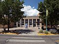
Los Alamos post office, built in 1948

See also
 In Spanish: Los Álamos (Nuevo México) para niños
