Pajarito Plateau facts for kids
The Pajarito Plateau is a special kind of flat, high land in north central New Mexico, United States. It's a volcanic plateau, meaning it was formed by volcanoes. This plateau is part of the Jemez Mountains.
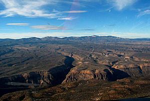
To its west is the Valles Caldera, which is a huge volcanic crater. To its east is the White Rock Canyon of the Rio Grande river. The plateau is home to important places like Bandelier National Monument, the towns of Los Alamos and White Rock, and Los Alamos National Laboratory. The land here ranges from about 5,600 feet (1,700 meters) near the river to about 7,800 feet (2,300 meters) where it meets the mountains.

Contents
How the Plateau Was Formed
The Pajarito Plateau is mostly made of a type of rock called Bandelier Tuff. This rock was created by two huge eruptions from the nearby Valles Caldera. These powerful volcanic blasts happened about 1.6 million and 1.2 million years ago. Each eruption threw out about 300 cubic kilometers of rock!
The orange-pink rock formations you see today are from these eruptions. They are known as the Otowi and Tshirege Members of the Bandelier tuff. This tuff rock sits on top of an older volcanic field. This field used to connect to the Caja del Rio, which is now across the Rio Grande river.
Canyons and Mesas
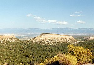
Over a very long time, erosion has carved the plateau. This process has created many deep canyons, some up to 800 feet (240 meters) deep. These canyons cut through the plateau, dividing it into flat-topped hills called mesas.
Many of these mesas rise on one side instead of sloping down on all sides. Because of this, they are sometimes called potreros. Rock climbing is a popular activity here for both locals and visitors. People climb on the basalt cliffs found inside and below the tuff. The tuff itself is too soft to be climbed safely.
Trails and Outdoor Fun
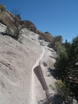
The canyons and mesas are very beautiful. They have many trails for exploring. You can find lots of guidebooks about these trails. Some trails go all the way to the Rio Grande river. Others lead to the edge of the Valles Caldera.
Some of these are long distance trails. A few have even been used for ultramarathons (very long running races) and endurance rides (long horse rides). Popular activities on the trails include walking, running, orienteering (finding your way with a map and compass), rogaining (a longer version of orienteering), mountain biking, and horse riding.
Wildlife of the Plateau
Because of the way the land is shaped and who owns it, the towns of Los Alamos and White Rock are quite close together. Outside of these towns, the plateau is not very crowded. This means there is lots of wildlife! Many different kinds of animals live here.
A large elk herd spends its summers in the Jemez Mountains. In the winter, these elk come down to the Pajarito Plateau. This can sometimes make driving dangerous. Deer, black bears, and coyotes are common. The plateau and mountains also have a small but steady number of mountain lions. These big cats usually run away from people.
Smaller animals like raccoons, skunks, and gophers are also common. Parts of the Bandelier backcountry are closed during certain times of the year. This is to protect nesting bald eagles. The Rio Grande river is an important path for migrating birds. Many birds, especially sandhill cranes, visit the plateau during migration seasons. Three types of hummingbirds are very common in the summer. White Rock Canyon, where the plateau's canyons meet the Rio Grande, is known for its rattlesnakes.
See also
 In Spanish: Meseta del Pajarito para niños
 | Audre Lorde |
 | John Berry Meachum |
 | Ferdinand Lee Barnett |


