Whitefish Lake (Merrill Creek) facts for kids
Quick facts for kids Whitefish Lake |
|
|---|---|
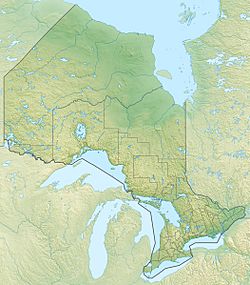
| Location | Cashel portion of Tudor and Cashel, Hastings County and Addington Highlands, Lennox and Addington County, Ontario |
| Coordinates | 44°54′23″N 77°24′18″W / 44.90639°N 77.40500°W |
| Primary inflows | Merrill Creek |
| Primary outflows | Merrill Creek |
| Basin countries | Canada |
| Max. length | 1.1 km (0.68 mi) |
| Max. width | 0.9 km (0.56 mi) |
| Surface elevation | 336 m (1,102 ft) |
Whitefish Lake is a beautiful lake found in the Canadian province of Ontario. It's part of a larger system of waterways that eventually leads to Lake Ontario. This lake sits right on the border between two different areas: Tudor and Cashel in Hastings County and Addington Highlands in Lennox and Addington County.
Discover Whitefish Lake
Whitefish Lake is a natural body of water that plays an important role in the local environment. It's a great example of the many lakes that make up the stunning landscape of Ontario.
Where is Whitefish Lake Located?
This lake is about 1.1 kilometers (0.7 miles) long and 0.9 kilometers (0.6 miles) wide. It sits at an elevation of 336 meters (1,102 feet) above sea level.
You can find Whitefish Lake about 11 kilometers (6.8 miles) northeast of a small community called Gunter. It's also about 18 kilometers (11 miles) northwest of another community named Cloyne. Most of the lake is in Addington Highlands, but a small part of its western tip reaches into Tudor and Cashel.
How Water Flows Through Whitefish Lake
The main stream that flows into and out of Whitefish Lake is called Merrill Creek. Water enters the lake from the north, coming from a smaller body of water known as Little Merrill Lake.
Merrill Creek then flows out of Whitefish Lake from the west. This creek continues its journey, connecting to Partridge Creek. From there, the water travels into the Skootamatta River and then into the Moira River. Finally, the Moira River empties into the Bay of Quinte on Lake Ontario, near the city of Belleville. This shows how all these waterways are connected in a large drainage basin.
 | May Edward Chinn |
 | Rebecca Cole |
 | Alexa Canady |
 | Dorothy Lavinia Brown |


