Whitlock Valley facts for kids
Quick facts for kids Whitlock Valley |
|
|---|---|
| Length | 22 mi (35 km) |
| Width | 9 mi (14 km) |
| Geography | |
| Population centers | Duncan, AZ, Safford, AZ |
| Borders on | Whitlock Mountains-W Black Hills (Greenlee County)-N Peloncillo Mountains-E San Simon Valley-SW & S |
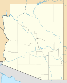
The Whitlock Valley is a small valley located in southeastern Arizona, United States. It sits between three mountain ranges. This valley is special because it is an endorheic area. This means that any rain or water that falls here stays within the valley and does not flow out to the ocean. Instead, the water collects in a small dry lake called Parks Lake.
The valley is named after Captain James H. Whitlock. He was a commander during the Battle of Mount Gray in 1864, which happened close to the valley. The Whitlock Valley is near the White Mountains and south of the Gila River. It also connects to the San Simon Valley to the southwest.
Contents
Exploring Whitlock Valley
How Water Flows in the Valley
The Gila River flows to the west, but it has to curve around the Black Hills (Greenlee County). The Whitlock Valley drains its water south from these hills. This water then joins the northern part of the San Simon Valley. Here, the San Simon River forms a flat, dry lake area called a playa. From there, it continues northwest towards the Gila River.
A water divide is like a hidden line that separates where water flows. In Whitlock Valley, this divide creates Parks Lake at the southern end.
Size and Location
Whitlock Valley runs mostly from north to south. It is about 22 miles (35 km) long. On its western side, you'll find the Whitlock Mountains. To the east, the valley is bordered by the northern part of the Peloncillo Mountains (Cochise County). These mountains are about 8 miles wide. The northern Peloncillo Mountains also mark the border between Graham County and Greenlee County in Arizona.
Parks Lake and Whitlock Cienega
Parks Lake is the lowest point in the southern part of Whitlock Valley. It is a dry lake for most of the year. To the west of Parks Lake are the southern Whitlock Mountains. On the southeastern side of these mountains, you can find Whitlock Cienega. A "cienega" is a wet, marshy area, often with springs. Whitlock Cienega is located at 32°33′10″N 109°20′7″W / 32.55278°N 109.33528°W.
Around Parks Lake, you might find special plants that like lakebeds and marshy areas. One example is a type of sedge called Schoenoplectus pungens. Parks Lake is located at 32°34′04″N 109°18′11″W / 32.5678°N 109.3031°W.
Part of the Madrean Sky Islands
The Whitlock Valley is part of a unique area called the Madrean Sky Islands. This region stretches across southeastern Arizona and southwestern New Mexico. The "sky islands" are tall, isolated mountains that rise like islands from the desert floor. They have cooler, wetter climates than the surrounding desert, allowing different plants and animals to live there.
The southern part of Whitlock Valley drains into the northeast area of San Simon Creek. This connection is important for the water flow in this special desert region.
 | Dorothy Vaughan |
 | Charles Henry Turner |
 | Hildrus Poindexter |
 | Henry Cecil McBay |


