Wilkie Sugar Loaf trail facts for kids
Quick facts for kids Wilkie Sugar Loaf trail |
|
|---|---|

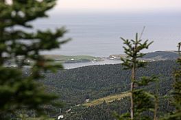
View from Wilkie Sugar Loaf trail
|
|
| Length | About 3.2 kilometres (2.0 mi) (return) |
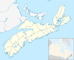
| Location | Cape Breton Highlands |
| Trailheads | Bay St. Lawrence Road - 46°57'11.76"N, 60°27'39.66"W (N46 57.196 W060 27.661) |
| Use | Hiking |
| Elevation gain/loss | 350 metres (1,150 ft) |
| Highest point | Wilkie Sugar Loaf, 411.8 |
| Difficulty | Easy to strenuous |
| Season | Early spring to autumn |
| Sights | Cape Breton Highlands, Cabot Strait |
| Hazards | Severe weather American black bear Tick-borne diseases Mosquitos Biting flies Steep grades |
The Wilkie Sugar Loaf Trail is an exciting hiking path in northern Cape Breton Island, Nova Scotia, Canada. This trail takes you all the way to the top of Wilkie Sugar Loaf, a mountain that stands 411.8 metres (1,351 ft) tall in the beautiful Cape Breton Highlands. It's a great adventure for anyone who loves nature and amazing views!
Contents
Exploring the Wilkie Sugar Loaf Trail
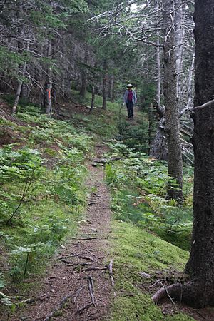
This trail is about 3.2 kilometres (2 mi) long if you go up and back down. It's mostly a steady climb, going up over 350 metres (1,150 ft) to the very top of Wilkie Sugar Loaf. People have been hiking this trail since at least 1969, and probably even longer!
Amazing Views from the Top
When you reach the summit, you'll find two different spots to enjoy incredible views:
- South-Western View: From here, you can see the Pollets Cove-Aspy Fault Wilderness Area. You'll also spot the Cape Breton Highlands National Park far away to the south. Look closer, and you'll see Aspy Harbour, the beach at Cabots Landing, and the villages of Cape North and Dingwall.
- Northern View: This side offers a look at the hills to the north. You can also see the small towns of Bay St. Lawrence and St. Margaret Village. Beyond them, you'll see the open Gulf of St. Lawrence. On a super clear day, you might even see Newfoundland across the Cabot Strait, which is about 115 kilometres (71 mi) away!
How to Find the Trail
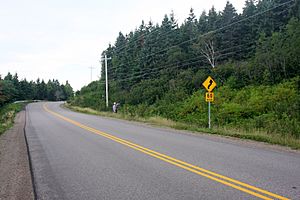
You can get to the Wilkie Sugar Loaf Trail from the Bay St. Lawrence Road. It's about 1.15 kilometres (0.71 mi) north of the entrance to Cabots Landing Provincial Park. The start of the trail is marked by orange flagging tape and two yellow stones. Remember, this trail is on private land, but local volunteers help keep it in great shape for everyone to enjoy.
The Cape Breton Highlands 3 Peaks Challenge
The Wilkie Sugar Loaf Trail is a popular spot for the yearly Hike the Highlands Festival. Since 2007, it has been a key part of this fun event.
A Tough Challenge for Hikers
On July 17, 2010, the Wilkie Sugar Loaf Trail was one of three mountains featured in the very first Cape Breton Highlands 3 Peaks Challenge. In this challenge, teams of four hikers tried to climb Franey, Wilkie Sugar Loaf, and Acadien mountains all in one day!
The 5th Annual Cape Breton Highlands 3 Peaks Challenge took place on July 19, 2014. This time, 24 teams hiked Roberts Mountain, Wilkie Sugar Loaf Mountain, and Franey Mountain in a single day. The teams actually voted Wilkie Sugar Loaf as the toughest mountain to climb! To get ready for this big event, the Wilkie Sugar Loaf trail was cleared and re-marked in early July 2014.
 | Madam C. J. Walker |
 | Janet Emerson Bashen |
 | Annie Turnbo Malone |
 | Maggie L. Walker |


