Wind Fell facts for kids
Quick facts for kids Wind Fell |
|
|---|---|
 |
|
| Highest point | |
| Elevation | 665 m (2,182 ft) |
| Prominence | 90 m (300 ft) |
| Listing | Tu,Sim, D,sHu,GT,DN |
| Geography | |
| Location | Dumfries and Galloway, Scottish Borders, Scotland |
| Parent range | Ettrick Hills, Southern Uplands |
| OS grid | NT 17897 06166 |
| Topo map | OS Landranger 79 |
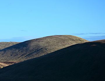
Wind Fell is a hill in the Ettrick Hills range, which is part of the Southern Uplands of Scotland. It stands 665 meters (about 2,182 feet) tall. The border between Dumfries and Galloway and the Scottish Borders goes right across this hill.
Many people enjoy hiking here. The hill is close to the Southern Upland Way, a long-distance walking path. Hikers often climb Wind Fell along with other hills nearby.
Where is Wind Fell Located?
Wind Fell is found in the beautiful Ettrick Hills. These hills are part of the larger Southern Uplands region in Scotland. This area is known for its rolling hills and green landscapes.
The hill sits right on the border. This means that one side of Wind Fell is in Dumfries and Galloway. The other side is in the Scottish Borders. It is interesting how a single hill can be in two different areas!
How Can You Explore Wind Fell?
Wind Fell is a popular spot for walkers and hikers. It is very close to the Southern Upland Way. This is a famous walking route that stretches across Scotland. Because of this, many people use parts of the Southern Upland Way to reach Wind Fell.
Most people who climb Wind Fell do not just climb it alone. They often climb it as part of a longer walk. This walk usually includes other hills that are close by. This makes for a great day out exploring the Scottish countryside.
 | Aaron Henry |
 | T. R. M. Howard |
 | Jesse Jackson |

