Windermere Hills facts for kids
Quick facts for kids Windermere Hills |
|
|---|---|
| Highest point | |
| Elevation | 2,167 m (7,110 ft) |
| Naming | |
| Etymology | Named for Windermere, a small town in England. |
| Geography | |
| Country | United States |
| State | Nevada |
| District | Elko County |
| Range coordinates | 41°14′35.718″N 114°44′24.135″W / 41.24325500°N 114.74003750°W |
| Topo map | USGS Holborn |
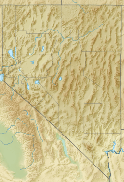
The Windermere Hills are a mountain range located in Elko County, Nevada. This range is found in the northeastern part of Nevada, just northeast of the town of Wells, Nevada. The highest point in the Windermere Hills reaches about 2,167 meters (7,109 feet) above sea level.
What are the Windermere Hills?
The Windermere Hills are a group of mountains and hills. They are part of the larger Great Basin region, which covers much of Nevada. This area is known for its many mountain ranges separated by wide valleys.
Where are the Windermere Hills located?
The Windermere Hills are in Elko County, which is in the northeastern part of Nevada. When the name "Windermere Hills" was officially approved in 1967, its borders were clearly described.
- To the north, the hills are bordered by Thousand Springs Creek.
- To the south, they are next to the Southern Pacific railway line.
- The Union Pacific railway line forms their western boundary.
- An unnamed valley lies to the east of the hills.
How did the Windermere Hills get their name?
The Windermere Hills were named after a small town in England called Windermere. This is a common way for places to get their names, often reflecting the heritage or interests of the people who explored or settled the area.
 | Shirley Ann Jackson |
 | Garett Morgan |
 | J. Ernest Wilkins Jr. |
 | Elijah McCoy |


