Windigo Lake facts for kids
Quick facts for kids Windigo Lake |
|
|---|---|
| Location | Sawyer County, Wisconsin, United States |
| Coordinates | 45°55′49″N 91°28′12″W / 45.93028°N 91.47000°W |
| Type | freshwater |
| Basin countries | United States |
| Max. length | approx. 1 mi (1.6 km) |
| Max. width | approx. 1 mi (1.6 km) |
| Surface area | 529.6 acres (214.3 ha) |
| Max. depth | 51 ft (16 m) |
| Water volume | 7,256 acre⋅ft (8,950,000 m3) |
| Shore length1 | 9 mi (14.4 km) |
| Surface elevation | 1,292 ft (394 m) |
| 1 Shore length is not a well-defined measure. | |
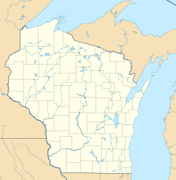
Windigo Lake is a beautiful freshwater lake in north central Wisconsin, United States. It's located in Sawyer County, near the town of Bass Lake.
The lake has an interesting, uneven shape with many peninsulas and bays. It's about one mile (1.6 km) wide and one mile long. Windigo Lake covers about 530 acres (2.1 km²) and is up to 51 feet (15.5 m) deep. Its shoreline stretches for about 9 miles (14.4 km).
Windigo Lake is special because it doesn't have any clear rivers flowing into or out of it. This type of lake is called a seepage lake. It gets its water mostly from rain and groundwater.
The lake is about six miles (9.7 km) south of Hayward, a main town in the area. Many people have seasonal cabins and homes around the lake. There's also a public boat launch on the southeastern side. Windigo Lake is a popular spot for vacations. Visitors come from cities like Minneapolis-St. Paul, Milwaukee, and Chicago to enjoy the lake.
What's in a Name?
Windigo Lake gets its name from "Windigo," a word from Ojibwa and Ottawa Native American stories. A Windigo is a mythical creature.
But the lake hasn't always been called Windigo Lake! In 1831, an explorer named Henry Schoolcraft visited the area. He called it "Lac des Isles," which means "Lake of the Isles" in French. The next year, Captain James Allen, who was with Schoolcraft, made a detailed map. On his map, he also called it "Lake of the Isles."
The Wisconsin Department of Natural Resources once listed "Bass Lake" as another name for Windigo Lake. The Sawyer County Historical Society also says that Windigo Lake was known as "Bass Lake" in the past.
A Look Back in Time
Long before Europeans arrived, the Ojibwa Native Americans lived around Windigo Lake. The first Europeans known to visit this area were Pierre-Esprit Radisson and Médard des Groseilliers around 1659. They traveled from Lake Superior and stayed at a Native American village near Lac Courte Oreilles.
Windigo Lake was an important part of a travel route for Native Americans and early traders. They used it to go from Lac Courte Oreilles (which connects to the Chippewa River) to the Namekagon River (which connects to the St. Croix River). To do this, they would travel through Windigo Lake and Grindstone Lake, then cross a short land path called the Namekagon Portage.
Another explorer, Jonathan Carver, passed through the area in 1767. He traveled through what is now Windigo Lake on June 29, 1767. He was on his way from the village at Lac Courte Oreilles to the Namekagon River.
Later, in 1831, Henry Schoolcraft also used this route. He described going from the St. Croix River watershed to the Chippewa River watershed. He did this by going up the Namekagon River, crossing the Namekagon Portage, and then passing through Windigo Lake (which he called Lac des Isles) and Grindstone Lake.
 | Janet Taylor Pickett |
 | Synthia Saint James |
 | Howardena Pindell |
 | Faith Ringgold |


