Wolcott, Colorado facts for kids
Quick facts for kids
Wolcott, Colorado
|
|
|---|---|

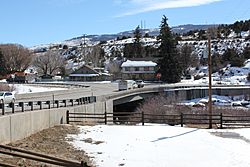
Bridge over the Eagle River in Wolcott.
|
|

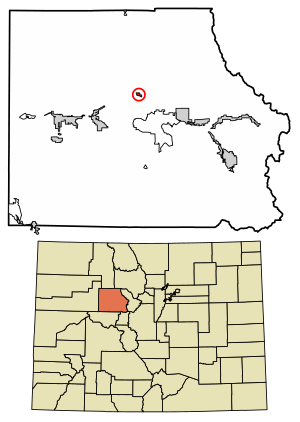
Location of the Wolcott CDP in Eagle County, Colorado.
|
|
| Country | |
| State | |
| County | Eagle County |
| Government | |
| • Type | unincorporated town |
| Area | |
| • Total | 0.385 sq mi (0.996 km2) |
| • Land | 0.369 sq mi (0.956 km2) |
| • Water | 0.015 sq mi (0.040 km2) |
| Elevation | 7,044 ft (2,147 m) |
| Population
(2020)
|
|
| • Total | 20 |
| • Density | 52/sq mi (20/km2) |
| Time zone | UTC-7 (MST) |
| • Summer (DST) | UTC-6 (MDT) |
| ZIP Code |
81655
|
| Area code(s) | 970 |
| GNIS feature | 2583318 |
Wolcott is a small community in Eagle County, Colorado, United States. It is known as an unincorporated town, which means it doesn't have its own local government like a city or town would. Instead, it's managed by the county.
Wolcott is also a census-designated place (CDP). This is a special area defined by the United States Census Bureau just for counting people. It helps them collect information about smaller communities. Wolcott has its own post office with the ZIP Code 81655. In 2020, only 20 people lived in the Wolcott CDP.
Wolcott's History
The Wolcott Post Office has been open since 1889. This means people have been sending and receiving mail there for over 130 years! The community got its name from Edward O. Wolcott. He was an important person who served as a United States Senator for Colorado.
Where is Wolcott?
Wolcott is located in the middle of Eagle County. It sits in the valley of the Eagle River. This river flows west and eventually joins the larger Colorado River.
Major roads pass right through Wolcott. U.S. Route 6 follows the river through the community. Interstate 70, a big highway, runs along the southern edge of Wolcott. You can get to Wolcott from Exit 157 on I-70.
Both I-70 and US-6 can take you to other nearby towns. They lead about 7 miles east to Edwards. If you go west, they lead about 10 miles to Eagle, which is the main town for Eagle County. Colorado State Highway 131 also goes through Wolcott and heads north about 72 miles to Steamboat Springs.
The Wolcott CDP covers a total area of about 0.996 square kilometers (0.385 square miles). A small part of this area, about 0.040 square kilometers (0.015 square miles), is water.
How Many People Live in Wolcott?
The United States Census Bureau first officially counted Wolcott as a CDP for the United States Census 2010. Here's how the population has changed:
| Wolcott CDP, Colorado | ||
|---|---|---|
| Year | Pop. | ±% |
| 2010 | 15 | — |
| 2020 | 20 | +33.3% |
| Source: United States Census Bureau | ||
See also
 In Spanish: Wolcott (Colorado) para niños
 | Shirley Ann Jackson |
 | Garett Morgan |
 | J. Ernest Wilkins Jr. |
 | Elijah McCoy |


