Edwards, Colorado facts for kids
Quick facts for kids
Edwards, Colorado
|
|
|---|---|

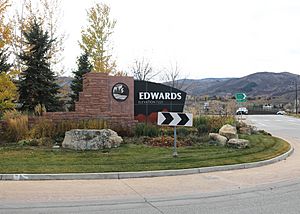
Roundabout in Edwards near Interstate 70.
|
|

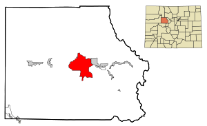
Location of the Edwards CDP in Eagle County, Colorado.
|
|
| Country | |
| State | |
| County | Eagle County |
| Government | |
| • Type | unincorporated town |
| Area | |
| • Total | 26.789 sq mi (69.382 km2) |
| • Land | 26.636 sq mi (68.988 km2) |
| • Water | 0.152 sq mi (0.394 km2) |
| Elevation | 7,569 ft (2,307 m) |
| Population
(2020)
|
|
| • Total | 11,246 |
| • Density | 419.806/sq mi (162.088/km2) |
| Time zone | UTC-7 (MST) |
| • Summer (DST) | UTC-6 (MDT) |
| ZIP Code |
81632
|
| Area code(s) | 970 |
| GNIS feature | 2408049 |
Edwards is a community in Eagle County, Colorado, United States. It is known as an unincorporated town and a census-designated place (CDP). This means it's a recognized community with a post office and a counted population, even though it doesn't have its own city government.
Edwards is an important town in its local area. The Edwards, CO Micropolitan Statistical Area is centered here. In 2020, about 11,246 people lived in Edwards. The local Edwards Metropolitan District helps provide services to the community.
Contents
History of Edwards
The Edwards Post Office first opened its doors in 1883. The community was named after Melvin Edwards, who was a local postal official.
Exploring Edwards' Geography
Edwards is located in the valley of the Eagle River. It also stretches south into the valleys of Lake Creek and Colorow Creek. These valleys are at the northern end of the Sawatch Range mountains.
To the east of Edwards, you'll find the town of Avon. Major roads like U.S. Route 6 and Interstate 70 run through the area. Interstate 70, which has an exit at 163 for Edwards, makes it easy to travel to nearby cities.
- Vail is about 14 miles (23 km) to the east.
- Denver is about 110 miles (177 km) to the east.
- Eagle is about 17 miles (27 km) to the west.
- Glenwood Springs is about 47 miles (76 km) to the west.
The total area of Edwards is about 26.8 square miles (69.4 square kilometers). A small part of this area, about 0.15 square miles (0.39 square kilometers), is water.
Education in Edwards
Edwards offers many educational options for students.
Schools for All Ages
The Eagle County School District Re-50J serves the Edwards community. Here, students can attend:
- An elementary school
- A middle school
- Two high schools
- A charter school
There is also a private school, Vail Christian High School, located in Edwards.
Higher Learning Opportunities
For students interested in college, Colorado Mountain College has its Vail Valley campus right in Edwards.
Population of Edwards
The United States Census Bureau first officially defined Edwards as a census-designated place for the United States Census 2000. The population has grown over the years.
| Edwards CDP, Colorado | ||
|---|---|---|
| Year | Pop. | ±% |
| 2000 | 8,257 | — |
| 2010 | 10,266 | +24.3% |
| 2020 | 11,246 | +9.5% |
| Source: United States Census Bureau | ||
Skiing and Snowboarding Near Edwards
Edwards is a great spot for people who love to ski and snowboard. It's very close to some famous ski resorts:
- Beaver Creek Resort is only about 4 miles (6.4 km) to the east.
- Vail is about 14.5 miles (23.3 km) to the east.
See also
 In Spanish: Edwards (Colorado) para niños
 | Frances Mary Albrier |
 | Whitney Young |
 | Muhammad Ali |


