Woodlands County facts for kids
Quick facts for kids
Woodlands County
|
|
|---|---|

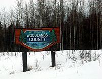
Welcome sign
|
|

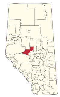
Location within Alberta
|
|
| Country | Canada |
| Province | Alberta |
| Region | Central Alberta |
| Census division | 13 |
| Established | 1994 |
| Incorporated | 1999 (County) |
| Area
(2021)
|
|
| • Land | 7,599.52 km2 (2,934.19 sq mi) |
| Population
(2021)
|
|
| • Total | 4,558 |
| • Density | 0.6/km2 (2/sq mi) |
| Time zone | UTC−7 (MST) |
| • Summer (DST) | UTC−6 (MDT) |
Woodlands County is a special kind of area in north-central Alberta, Canada, managed by its own local government. It's part of a larger region called Census Division No. 13. The main office for Woodlands County is right next to the town of Whitecourt. There's also another office in a smaller community called Fort Assiniboine.
Contents
Exploring Woodlands County
Woodlands County is a large area with different types of communities. These include towns, hamlets, and other smaller places.
Towns and Hamlets
|
The following larger communities are surrounded by Woodlands County:
|
The following smaller communities, called hamlets, are located within Woodlands County:
|
Other Localities
Many other smaller places, known as localities, are also found within Woodlands County.
|
|
Population and Area

In 2021, Statistics Canada counted the people living in Woodlands County. The total population was 4,558. These people lived in 1,739 homes out of 1,991 available homes. This number was a small decrease from the 4,744 people who lived there in 2016.
Woodlands County covers a large area of land, about 7,599.52 square kilometers (or 2,934.2 square miles). Because the population is spread out over such a big area, the population density is quite low. This means there are not many people living in each square kilometer. In 2021, there were only about 0.6 people per square kilometer.
Education
Students in Woodlands County attend schools that are part of the Pembina Hills Public Schools system. This school system was created in 1995 when three smaller school districts joined together.
 | John T. Biggers |
 | Thomas Blackshear |
 | Mark Bradford |
 | Beverly Buchanan |

