Woodstock, Minnesota facts for kids
Quick facts for kids
Woodstock, Minnesota
|
|
|---|---|

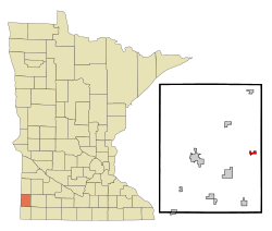
Location of Woodstock, Minnesota
|
|
| Country | United States |
| State | Minnesota |
| County | Pipestone |
| Platted | September 1879 |
| Incorporated | July 11, 1892 |
| Area | |
| • Total | 0.539 sq mi (1.397 km2) |
| • Land | 0.539 sq mi (1.397 km2) |
| • Water | 0.000 sq mi (0.000 km2) |
| Elevation | 1,821 ft (555 m) |
| Population
(2020)
|
|
| • Total | 110 |
| • Estimate
(2022)
|
110 |
| • Density | 204.08/sq mi (78.73/km2) |
| Time zone | UTC−6 (Central (CST)) |
| • Summer (DST) | UTC−5 (CDT) |
| ZIP Code |
56186
|
| Area code(s) | 507 |
| FIPS code | 27-71680 |
| GNIS feature ID | 2397373 |
| Sales tax | 6.875% |
Woodstock is a small city in Pipestone County, Minnesota, United States. In 2020, about 110 people lived there.
Contents
History of Woodstock
Woodstock was first planned out in September 1879. It was named after another town, Woodstock, Illinois. A post office has been open in Woodstock since 1879. The city officially became a town on July 11, 1892.
Where is Woodstock Located?
Woodstock is located in the state of Minnesota. According to the United States Census Bureau, the city covers a total area of about 0.539 square miles (1.397 square kilometers). All of this area is land.
Population of Woodstock
The population of Woodstock has changed over the years. Here is a look at how many people have lived in the city during different census years:
| Historical population | |||
|---|---|---|---|
| Census | Pop. | %± | |
| 1900 | 211 | — | |
| 1910 | 226 | 7.1% | |
| 1920 | 277 | 22.6% | |
| 1930 | 235 | −15.2% | |
| 1940 | 253 | 7.7% | |
| 1950 | 277 | 9.5% | |
| 1960 | 213 | −23.1% | |
| 1970 | 217 | 1.9% | |
| 1980 | 180 | −17.1% | |
| 1990 | 159 | −11.7% | |
| 2000 | 132 | −17.0% | |
| 2010 | 124 | −6.1% | |
| 2020 | 110 | −11.3% | |
| 2022 (est.) | 110 | −11.3% | |
| U.S. Decennial Census 2020 Census |
|||
What Was Woodstock's Population in 2010?
In 2010, the city of Woodstock had 124 people living there. These people lived in 55 different households. About 30 of these households were families.
The city had a population density of about 238.5 people per square mile. There were 70 housing units in total. This means there were about 134.6 housing units for every square mile.
Who Lives in Woodstock?
Most of the people in Woodstock were White (98.4%). A small number were Native American (0.8%) or Asian (0.8%).
About 27.3% of households had children under 18 living with them. Nearly half (49.1%) were married couples. A small number of households had a single parent. About 36.4% of all households were individuals living alone. Some of these individuals (20%) were 65 years old or older.
The average household had 2.25 people. The average family had 2.90 people. The median age in the city was 45 years old.
- 20.2% of residents were under 18 years old.
- 8% were between 18 and 24 years old.
- 21.8% were between 25 and 44 years old.
- 31.5% were between 45 and 64 years old.
- 18.5% were 65 years old or older.
The number of males and females in Woodstock was equal. Both groups made up 50.0% of the population.
See also
In Spanish: Woodstock (Minnesota) para niños
 | May Edward Chinn |
 | Rebecca Cole |
 | Alexa Canady |
 | Dorothy Lavinia Brown |

