Woodstown, New Jersey facts for kids
Quick facts for kids
Woodstown, New Jersey
|
|
|---|---|
|
Borough
|
|
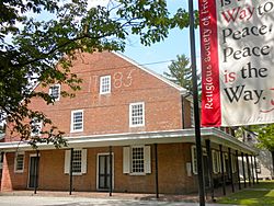
Woodstown Friends Meetinghouse
|
|
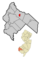
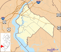
Woodstown highlighted in Salem County. Inset map: Salem County highlighted in the State of New Jersey.
|
|
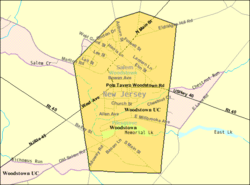
Census Bureau map of Woodstown, New Jersey
|
|
| Country | |
| State | |
| County | |
| Incorporated | July 26, 1882 |
| Government | |
| • Type | Borough |
| • Body | Borough Council |
| Area | |
| • Total | 1.61 sq mi (4.18 km2) |
| • Land | 1.57 sq mi (4.08 km2) |
| • Water | 0.04 sq mi (0.10 km2) 2.47% |
| Area rank | 437th of 565 in state 13th of 15 in county |
| Elevation | 49 ft (15 m) |
| Population
(2020)
|
|
| • Total | 3,678 |
| • Estimate
(2023)
|
3,728 |
| • Rank | 423rd of 565 in state 7th of 15 in county |
| • Density | 2,335.4/sq mi (901.7/km2) |
| • Density rank | 265th of 565 in state 2nd of 15 in county |
| Time zone | UTC−05:00 (Eastern (EST)) |
| • Summer (DST) | UTC−04:00 (Eastern (EDT)) |
| ZIP Code |
08098
|
| Area code(s) | 856 exchange: 769 |
| FIPS code | 3403382720 |
| GNIS feature ID | 0885452 |
| Website | |
Woodstown is a small town, called a borough, located in Salem County, New Jersey. In 2020, about 3,678 people lived here. This was a small increase from 3,505 people in 2010.
Woodstown became an official borough on July 26, 1882. It was formed from parts of Pilesgrove Township. The town is named after an early settler named Jackanias Wood.
Contents
Geography of Woodstown
Woodstown covers about 1.62 square miles (4.18 square kilometers). Most of this area is land, with a small part being water.
Woodstown is special because it's a "doughnut town." This means it's a town completely surrounded by another town, which is Pilesgrove Township. Woodstown is the main business area, while Pilesgrove Township is more focused on farming.
Woodstown's Population
| Historical population | |||
|---|---|---|---|
| Census | Pop. | %± | |
| 1880 | 490 | — | |
| 1890 | 1,516 | 209.4% | |
| 1900 | 1,371 | −9.6% | |
| 1910 | 1,613 | 17.7% | |
| 1920 | 1,589 | −1.5% | |
| 1930 | 1,832 | 15.3% | |
| 1940 | 2,027 | 10.6% | |
| 1950 | 2,345 | 15.7% | |
| 1960 | 2,942 | 25.5% | |
| 1970 | 3,137 | 6.6% | |
| 1980 | 3,250 | 3.6% | |
| 1990 | 3,154 | −3.0% | |
| 2000 | 3,136 | −0.6% | |
| 2010 | 3,505 | 11.8% | |
| 2020 | 3,678 | 4.9% | |
| 2023 (est.) | 3,728 | 6.4% | |
| Population sources: 1880–1890 1890–2000 1890–1920 1890–1910 1910–1930 1900–1990 2000 2010 2020 |
|||
In 2010, there were 3,505 people living in Woodstown. The population included people from various backgrounds. About 82% were White, and 11% were Black or African American. There were also smaller groups of Native American, Asian, and other races. About 5.5% of the population was Hispanic or Latino.
The average age of people in Woodstown in 2010 was 39 years old.
Education in Woodstown
Students in Woodstown attend public schools through the Woodstown-Pilesgrove Regional School District. This district serves students from pre-kindergarten all the way to twelfth grade. It includes students from both Woodstown and Pilesgrove Township.
The district has four schools:
- William Roper Early Childhood Learning Center (PreK-K)
- Mary S. Shoemaker Elementary School (grades 1-5)
- Woodstown Middle School (grades 6-8)
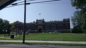
- Woodstown High School (grades 9-12)
Some students from nearby towns like Alloway Township, Oldmans Township, and Upper Pittsgrove Township also attend Woodstown High School.
Transportation in Woodstown
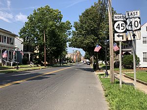
Woodstown has several important roads. U.S. Route 40 goes through the borough from east to west. Route 45 goes from south to north.
For public transportation, NJ Transit offers bus service. You can take a bus between Salem and Philadelphia on the 401 route. There's also a local bus, the 468 route, that runs between Penns Grove and Woodstown.
A freight train line, called the Salem Branch, also runs through the borough. This line is used to transport goods.
Notable People from Woodstown
Many interesting people have connections to Woodstown:
- Teyona Anderson (born 1989), who won America's Next Top Model (season 12).
- David Bailey, a politician who represents the 3rd legislative district in the New Jersey General Assembly.
- Isaac Ambrose Barber (1852–1909), who was a U.S. Congressman from Maryland.
- Mario Cerrito (born 1984), a filmmaker known for horror movies.
- Isaiah D. Clawson (1820–1879), who represented New Jersey in the United States House of Representatives.
- Fred Drains (born 1971), an American-born basketball player who also played in Sweden.
- Rachel Davis DuBois (1892–1993), an educator and activist who worked for human rights.
- Hilly Flitcraft (1923–2003), a baseball pitcher who played for the Philadelphia Phillies.
- Elwood L. Haines (1893–1949), who was a Bishop of the Episcopal Diocese of Iowa.
- Irv Halter (born 1954), a retired United States Air Force major general.
- Tara LaRosa (born 1978), a mixed martial arts fighter.
- Everett Shinn (1876–1953), a realist painter known for his work with the Ashcan School.
See also
 In Spanish: Woodstown para niños
 | Emma Amos |
 | Edward Mitchell Bannister |
 | Larry D. Alexander |
 | Ernie Barnes |


