Upper Pittsgrove Township, New Jersey facts for kids
Quick facts for kids
Upper Pittsgrove Township, New Jersey
|
|
|---|---|
|
Township
|
|
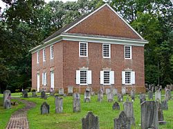
Pittsgrove Presbyterian Church
|
|
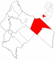
Upper Pittsgrove Township highlighted in Salem County. Inset map: Salem County highlighted in the State of New Jersey.
|
|
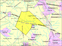
Census Bureau map of Upper Pittsgrove Township, New Jersey
|
|
| Country | |
| State | |
| County | |
| Incorporated | March 10, 1846 |
| Government | |
| • Type | Township |
| • Body | Township Committee |
| Area | |
| • Total | 40.39 sq mi (104.60 km2) |
| • Land | 40.24 sq mi (104.23 km2) |
| • Water | 0.15 sq mi (0.38 km2) 0.36% |
| Area rank | 54th of 565 in state 3rd of 15 in county |
| Elevation | 131 ft (40 m) |
| Population
(2020)
|
|
| • Total | 3,432 |
| • Estimate
(2023)
|
3,464 |
| • Rank | 430th of 565 in state 8th of 15 in county |
| • Density | 85.3/sq mi (32.9/km2) |
| • Density rank | 545th of 565 in state 12th of 15 in county |
| Time zone | UTC−05:00 (Eastern (EST)) |
| • Summer (DST) | UTC−04:00 (Eastern (EDT)) |
| ZIP Code |
08318 – Elmer
|
| Area code(s) | 856 |
| FIPS code | 3403375110 |
| GNIS feature ID | 1723212 |
| Website | |
Upper Pittsgrove Township is a small community in Salem County, New Jersey. It is a type of local government called a township. In 2020, about 3,432 people lived here.
The township was officially created on March 10, 1846. It was formed from parts of Pittsgrove Township. Later, in 1893, a part of Upper Pittsgrove Township became the town of Elmer.
The name "Pittsgrove" comes from William Pitt, 1st Earl of Chatham. He was an important person who supported the American colonies a long time ago.
Upper Pittsgrove Township is known as a "dry town." This means that most stores cannot sell alcohol. However, there are a few places, like a winery and a distillery, where alcohol is available.
Contents
Exploring Upper Pittsgrove Township
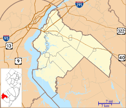
Upper Pittsgrove Township covers about 40.39 square miles (104.60 square kilometers). Most of this area is land. It has a lot of active farms and preserved farmland. In fact, it leads New Jersey in how much farmland it has! The Salem River also starts its journey right here in the township.
Nearby Communities and Borders
There are many small communities and places within Upper Pittsgrove Township. Some of these include Daretown, Monroeville, and Whig Lane.
The township shares its borders with several other towns. In Salem County, it borders Alloway Township, Elmer, Pilesgrove Township, and Pittsgrove Township. It also borders Upper Deerfield Township in Cumberland County. In Gloucester County, it borders Elk Township, Franklin Township, and South Harrison Township.
Population Over Time
| Historical population | |||
|---|---|---|---|
| Census | Pop. | %± | |
| 1850 | 1,656 | — | |
| 1860 | 2,082 | 25.7% | |
| 1870 | 2,087 | 0.2% | |
| 1880 | 2,073 | −0.7% | |
| 1890 | 1,923 | −7.2% | |
| 1900 | 1,725 | * | −10.3% |
| 1910 | 1,754 | 1.7% | |
| 1920 | 1,724 | −1.7% | |
| 1930 | 1,899 | 10.2% | |
| 1940 | 1,925 | 1.4% | |
| 1950 | 2,204 | 14.5% | |
| 1960 | 2,715 | 23.2% | |
| 1970 | 2,884 | 6.2% | |
| 1980 | 3,139 | 8.8% | |
| 1990 | 3,140 | 0.0% | |
| 2000 | 3,468 | 10.4% | |
| 2010 | 3,505 | 1.1% | |
| 2020 | 3,432 | −2.1% | |
| 2023 (est.) | 3,464 | −1.2% | |
| Population sources: 1850–2000 1850–1920 1850–1870 1850 1870 1880–1890 1890–1910 1910–1930 1940–2000 2000 2010 2020 * = Lost territory in previous decade. |
|||
The number of people living in Upper Pittsgrove Township has changed over the years. In 1850, there were 1,656 residents. By 2020, the population had grown to 3,432 people.
Who Lives Here?
Based on the 2010 census, there were 3,505 people living in the township. Most residents, about 94.89%, identified as White. About 2.17% were Black or African American. A small number of people were Native American or Asian. About 3.02% of the population identified as Hispanic or Latino.
The average household had about 2.73 people. Families were a bit larger, with an average of 3.17 people. About 22.4% of the population was under 18 years old. About 15.7% were 65 years or older. The median age was 43.7 years.
Education for Kids
Students in Upper Pittsgrove Township attend public schools through the Upper Pittsgrove School District. This district has one school, the Upper Pittsgrove School. It serves students from pre-kindergarten up to eighth grade. In the 2021–22 school year, about 322 students were enrolled. There were 34 teachers, meaning about 9.5 students per teacher.
For high school, students go to Woodstown High School in Woodstown. This high school also serves students from Pilesgrove Township and Woodstown. Students from Alloway Township and Oldmans Township also attend. In the 2021–22 school year, Woodstown High School had 559 students.
Getting Around Upper Pittsgrove
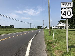
The township has many miles of roads. Some are maintained by the local government, some by Salem County, and others by the state of New Jersey.
Major Roads and Highways
- State Route 77 runs through the middle of the township for about 7.6 miles.
- U.S. Route 40 (also called Harding Highway) crosses the township for about 10 miles. It goes through Elmer borough and then continues.
- County Route 553 (Buck Road) cuts through the eastern part of the township.
- County Route 581 (Commissioners Pike) enters from the west and heads north.
Pole Tavern Circle
A special spot is the Pole Tavern Circle. This is a traffic circle where several important roads meet. These include U.S. Route 40 and State Route 77. The circle is named after a "liberty pole" that stood there during the American Revolutionary War. A large historic cannon has been at this spot since 1913.
Public Transportation
NJ Transit offers bus service in the area. The 410 bus route connects Bridgeton to Philadelphia, passing through Upper Pittsgrove.
Local Attractions
- Monroeville Vineyard & Winery is a local winery located in the township.
Famous People from Upper Pittsgrove
People who have lived in or are connected to Upper Pittsgrove include:
- Roscoe Lockwood (1875–1960), a rower who competed in the 1900 Summer Olympics.
See also
 In Spanish: Municipio de Upper Pittsgrove para niños
 | Chris Smalls |
 | Fred Hampton |
 | Ralph Abernathy |


