
Wye Valley Walk facts for kids
Quick facts for kids Wye Valley Walk |
|
|---|---|

Part of the Wye Valley Walk following the former Lydbrook Junction to Monmouth Railway
|
|
| Length | 219 km (136 mi) |
| Designation | Long-distance trail |
| Trailheads | Chepstow Plynlimon |
| Use | Hiking |
| Highest point | Plynlimon, 752 m (2,467 ft) |
| Season | All year |
The Wye Valley Walk (Welsh: Llwybr Dyffryn Gwy) is a super long walking path. It stretches across parts of Wales and England. This amazing trail follows the path of the beautiful River Wye. It's a great way to explore the countryside and see lots of cool places!
Contents
The Wye Valley Walk: A Journey Through Time
The Wye Valley Walk first opened in 1975. Back then, it was a 14-mile (23 km) stretch between St. Arvans and Monmouth. Over the next few years, more parts were added. By 1981, it had grown to 34 miles (55 km) long.
During the 1980s, even more sections were connected. These new parts linked places like Ross-on-Wye, Hay-on-Wye, and Rhayader. This made the walk 112 miles (180 km) long! It stretched from near the mouth of the river at Chepstow in Monmouthshire all the way to Rhayader in Mid Wales.
In September 2002, the path got its final extension. It now starts or finishes in Coed Hafren. The path even goes near the source of the River Wye on Plynlimon near Aberystwyth. Today, the Wye Valley Walk is a massive 136 miles (219 km) long!
Exploring the Wye Valley Walk
The Wye Valley Walk is easy to follow. You will see circular yellow arrows and signs. These signs show the path's special logo, which is a leaping salmon. Most of the path follows public rights of way. This means people have a legal right to walk there. Some parts are "permissive paths." This means the landowners have given permission for walkers to use them. On parts of Plynlimon, you have a "right to roam." This lets you walk freely across open countryside.
The route takes you through many interesting towns and areas. These include Chepstow and the beautiful Wye Valley AONB. You will also pass through Tintern, Monmouth, Ross-on-Wye, and Symonds Yat. Further along, you'll reach Hereford, Hay-on-Wye, Builth Wells, Rhayader, and Llangurig. The walk finishes at Plynlimon.
The Wye Valley Walk can be split into 17 smaller sections. However, many people choose to walk the entire path in seven day-long sections. You can start from Chepstow and walk to Plynlimon, or go the other way around!
Planning Your Adventure: Sections of the Walk
Here are the typical day-long sections of the Wye Valley Walk. These are described in "The Wye Valley Walk" guide.
Day 1: Chepstow to Monmouth
- Section 1: Chepstow Castle to Tintern Abbey – 6 miles (10 km)
- Section 2: Tintern Abbey to Monmouth – 10 miles (16 km)
Day 2: Monmouth to Ross-on-Wye
- Section 1: Monmouth to Symonds Yat – 6 miles (10 km)
- Section 2: Symonds Yat to Kerne Bridge – 8 miles (13 km)
- Section 3: Kerne Bridge to Ross-on-Wye – 6 miles (10 km)
Day 3: Ross-on-Wye to Hereford
- Section 1: Ross-on-Wye to Fownhope – 11 miles (18 km)
- Section 2: Fownhope to Hereford – 7 miles (11 km)
Day 4: Hereford to Hay-on-Wye
- Section 1: Hereford to Byford – 10 miles (16 km)
- Section 2: Byford to Bredwardine – 5 miles (8 km)
- Section 3: Bredwardine to Hay-on-Wye – 9 miles (14 km)
Day 5: Hay-on-Wye to Builth Wells
- Section 1: Hay-on-Wye to Glasbury – 5 miles (8 km)
- Section 2: Glasbury to Erwood – 9 miles (14 km)
- Section 3: Erwood to Builth Wells – 7 miles (11 km)
Day 6: Builth Wells to Rhayader
- Section 1: Builth Wells to Newbridge-on-Wye – 7 miles (11 km)
- Section 2: Newbridge-on-Wye to Rhayader – 10 miles (16 km)
Day 7: Rhayader to Plynlimon
- Section 1: Rhayader to Llangurig – 12 miles (19 km)
- Section 2: Llangurig to Rhyd-y-benwch (Plynlimon) – 12 miles (19 km)
Amazing Places You'll See
The Wye Valley Walk passes by some really cool and historic places. Keep an eye out for these notable landmarks:
- Chepstow Castle;
- Tintern Abbey;
- Goodrich Castle;
- Capler Camp.
Getting There: Train Stations Near the Walk
You can use trains to get to or from the Wye Valley Walk. Transport for Wales provides services to these stations:
- Chepstow railway station
- Hereford railway station
- Builth Road railway station
Images for kids
-

The southern end of the path, near Chepstow Castle
-
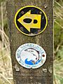
Waymark signs on the path
-
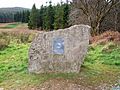
The northern end of the path


