Wymeswold facts for kids
Quick facts for kids Wymeswold |
|
|---|---|
 |
|
| Population | 1,296 |
| District |
|
| Shire county | |
| Region | |
| Country | England |
| Sovereign state | United Kingdom |
| Post town | LOUGHBOROUGH |
| Postcode district | LE12 |
| Dialling code | 01509 |
| Police | Leicestershire |
| Fire | Leicestershire |
| Ambulance | East Midlands |
| EU Parliament | East Midlands |
| UK Parliament |
|
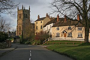
Wymeswold (pronounced wymes-wold) is a lovely village in Leicestershire, England. It is located in the northern part of Leicestershire. You can find it northeast of the town of Loughborough.
About 1,000 people call Wymeswold home. In 2011, a count showed 1,296 residents. The village is close to other places like Prestwold and Burton on the Wolds. It is also near Nottinghamshire villages such as Rempstone and Willoughby on the Wolds.
Contents
Wymeswold: A Village in Leicestershire
Exploring Wymeswold's Past
Wymeswold has an interesting history. Long ago, in the 1800s, there was a school on Elm Street. A man named Thomas Rossell Potter ran it. Later, in the 1970s, the village grew. The school then moved to a new spot south of the village.
Wymeswold was also once home to RAF Wymeswold, an air force base. There is a special memorial at the village pharmacy. It reminds everyone of a sad event from November 25, 1943. A Wellington bomber plane crashed nearby during a training flight. Six crew members died right away. A seventh person passed away a few days later. Only one trainee survived the crash.
The old airstrip from RAF Wymeswold is still there. It is not used for planes anymore. Instead, people use it for fun "experience" days with fast cars. Some local people are not happy about the noise this makes. The former airfield is also where Airbossworld Kitepark is located.
Life in Wymeswold Today
Wymeswold is a lively village with many things to do. You can find a greengrocer and a general store for your shopping. There is also a special shop for pine furniture and gifts. If you get hungry, there are two pubs, The Three Crowns and The Windmill. The Hammer and Pincers is a nice restaurant. The Three Crowns was even named "Village Pub of the Year" in 2010!
The village has many clubs and groups for everyone. You can join the Wymeswold Historical Organisation (WHO) to learn about the past. There are also Guide and Scout groups for young people. If you like to be active, you can take dancing, aerobics, or karate classes. Sports fans can join bowls, cricket, cycling, and football clubs.
Fun Events and Activities
Wymeswold hosts two popular events in the summer. These events help raise money for good causes. In mid-May, there is the Wymeswold Duck Race. People watch toy ducks race down the water! In mid-June, you can visit the Wymeswold Open Gardens. People open their beautiful gardens for everyone to see.
The Wymeswold Running Club also organizes a 5-mile road race called the 'Waddle'. This race happens on the same day as the Duck Race.
The village post office closed in 2008. But don't worry, you can still send mail! A smaller post office service is now available inside The Three Crowns pub.
At the southern edge of the village, there is a fun area called the 'Washdyke'. It has play equipment for kids and a BMX track for bikes. There's also a football pitch and a community orchard.
St Mary's Church: A Historic Building
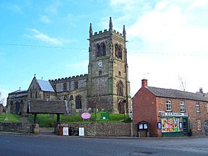
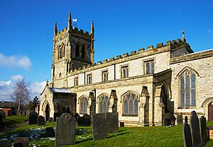
St Mary's Church is a very old and important building in Wymeswold. It was fixed up in 1844 by a famous architect named A. W. N. Pugin. Inside the church, you can see the Leeke memorial. This memorial remembers Judge William Leeke, who was an important person in Wymeswold in the 1600s. His wife gave the church some special silver items. These items are now kept safe in the Charnwood museum.
The church also has amazing windows. These windows were made by a company called John Hardman Studios in Birmingham.
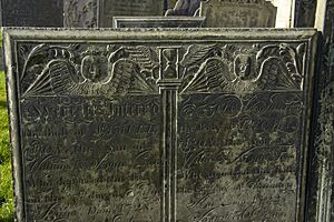
In the churchyard, you can see many special gravestones made of Swithland slate. Wymeswold was a center for carving this type of slate. Famous carvers like William Charles, the Winfields, and Roworth lived here.
A man named Henry Alford was the Vicar (a type of church leader) of Wymeswold from 1835 to 1853. He wrote many of his famous hymns while living in the village.
See also
 In Spanish: Wymeswold para niños
 | Lonnie Johnson |
 | Granville Woods |
 | Lewis Howard Latimer |
 | James West |


