Yr Arddu (South) facts for kids
Quick facts for kids Yr Arddu |
|
|---|---|

Yr Arddu from the Rhyd Road
|
|
| Highest point | |
| Elevation | 388 m (1,273 ft) |
| Parent peak | Moelwyn Mawr |
| Naming | |
| Language of name | Welsh |
| Geography | |
| Location | Gwynedd, Wales |
| Parent range | Snowdonia |
| OS grid | SH627462 |
| Topo map | OS Landranger 124, Explorer OL17 |
| Climbing | |
| Easiest route | Hike |
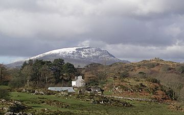
Yr Arddu is a big hill found in Snowdonia, a beautiful national park in Wales. It's important not to mix it up with another hill called Yr Arddu (North), which is taller and closer to Snowdon. This hill is about 2.5 kilometers (1.5 miles) southeast of the village of Beddgelert. It's also just over 1 kilometer (0.6 miles) from the well-known mountain, Cnicht.
Yr Arddu is a tough, rocky hill with many places where rocks stick out and form steep cliffs. You can find a small lake called Llyn yr Arddu on the side of the hill. The part of the hill that people usually call the top is 388 meters (1,273 feet) high. However, the very highest point, called Cerrig-y-Myllt, is 463 meters (1,519 feet) high. This higher point is found above two smaller lakes on the northern side of the hill.
Contents
What Makes Yr Arddu So Rocky?
How Volcanoes Shaped Yr Arddu
The rocky look of Yr Arddu is because of ancient lava and volcanic ash. These materials were formed during the Ordovician period, which was a very long time ago. Back then, the area we now call Snowdonia had many volcanoes erupting.
Yr Arddu is a great place to see evidence of these old volcanoes. The rocks here, known as the Yr Arddu Tuffs, might be some of the first volcanic rocks from the Snowdon Volcanic Group. This group shows how much volcanic activity happened in this region.
Why Is Yr Arddu a Special Place?
Protecting Nature at Yr Arddu
The entire hill of Yr Arddu is a Site of Special Scientific Interest (SSSI). This means it's a special area protected by the Countryside Council for Wales. It's protected because it has important rocks, plants, or animals that need to be kept safe. This helps to preserve its unique natural features for the future.
How to Explore Yr Arddu
Finding Your Way Up the Hill
Many people start their hike to Yr Arddu from a path that leaves a small road. This road connects the villages of Nantmor and Nant Gwynant. The path goes along a valley called Blaen Nanmor. However, the last 0.5 kilometers (about 0.3 miles) of the climb don't have clear paths marked on maps.
Another way to start is from the Nantmor Mountain Centre at Gelli-Iago. From there, a marked path goes southeast. You can then find a rough path that goes from west of Clogwyn Coch up to the two small lakes. It's also possible to approach the hill from its western side, which is a bit harder, leading up to the small lake, Llyn yr Arddu.

