Zanskar Range facts for kids

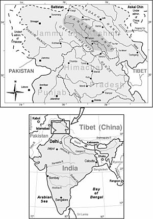
The Zanskar Range is a long mountain chain in the Himalayas. It stretches across a large area, mainly in the northern parts of India. This range acts like a natural wall, separating different regions. For example, it divides Ladakh from the valleys of Kashmir and the Chenab River.
It also forms a boundary between the Ladakh area and other parts of the state, like the Jammu region and the Vale of Kashmir.
Contents
About the Zanskar Range
The Zanskar Range is a very important part of the huge Himalayan mountain system. It has many tall peaks and deep valleys.
Tall Peaks and Passes
One of the highest mountains in this range is Mount Nun Kun, which is about 23,000 feet (7,000 meters) high. Many mountain passes are found here. These passes are like natural gates that connect different areas. For instance, the Marbal Pass and the Zojila Pass (about 13,000 feet or 4,000 meters high) help people travel between Ladakh and Kashmir.
Important Rivers
Many rivers begin their journey in the Zanskar Range. These rivers flow northwards and eventually join the mighty Indus River. Some of these rivers include:
- Hanle River
- Khurna River
- Zanskar River
- Suru River (Indus)
- Shingo River
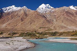
The Zanskar River itself is a major river that flows through the heart of the range.
Zanskar Range in Himachal Pradesh
The Zanskar Range also extends into the Indian state of Himachal Pradesh. Here, it separates the Kinnaur region from Spiti. Some of the highest peaks in Himachal Pradesh are part of the Zanskar Range.
Images for kids
-
The Zanskar River meeting the Indus.
-
A row of Chorten (or Stupa) at the village of Purne. These have special meaning in Tibetan Buddhism.
 | William Lucy |
 | Charles Hayes |
 | Cleveland Robinson |


