Suru River (Indus) facts for kids
Quick facts for kids Suru River/ سرو دریا |
|
|---|---|

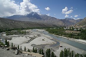
Suru River at Kargil town
|
|

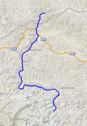
Course of the Suru
|
|
| Country | India |
| Union Territory | Ladakh |
| District | Kargil |
| Physical characteristics | |
| Main source | 33°49′59″N 76°13′07″E / 33.832917°N 76.21861°E Panzella glacier, Pensi La Kargil, India 4,555 m (14,944 ft) |
| River mouth | 34°44′46″N 76°12′57″E / 34.746134°N 76.215927°E Indus River at Nurla, Marol, Skardu, Pakistan 2,528 m (8,294 ft) |
| Length | 185 km (115 mi) |
The Suru River (Hindi: सुरु) is an important river in the Kargil district of Ladakh, India. It is a major branch of the Indus River.
Contents
Where the Suru River Flows
The Suru River is about 185 kilometers (115 miles) long. It starts from the Panzella glacier, which is located near the Pensi La mountain pass. This area is also close to the Drang-Drung Glacier. Interestingly, another river called the Stod River also begins from the Drang Drung Glacier, but it flows in the opposite direction from the Suru River.
River's Journey
The source of the Suru River is about 142 kilometers (88 miles) south of Kargil town. It is also about 79 kilometers (49 miles) north of Zanskar. The city of Srinagar is located much further west, about 331 kilometers (206 miles) away.
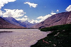
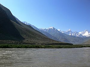
The Suru River forms the western and northern edge of the Zanskar Range of mountains. From where it starts, the river flows westwards. It follows the Kargil-Zanskar Road, creating a beautiful area known as the Suru Valley. This valley is surrounded by the towering peaks of the Nun Kun mountain.
Joining Other Streams
The Suru River collects water from the Nun Kun mountain range. A smaller stream called "Shafat Nala" joins the Suru River at the green pastures of Gulmatango. This stream comes from the Shafat Glacier.
The Suru River then flows north through a deep, narrow canyon. It reaches Kargil town, where it is joined by the Botkul River. The Botkul River also starts from a glacier. Further north, about 7 kilometers (4 miles) from Kargil town, the Dras River meets the Suru River at a place called Kharul. The Dras River itself is fed by the Shingo River.
After this, the Suru River flows into the area known as Pakistani Administered Kashmir. It eventually joins the mighty Indus River at a place called Nurla.
Life Along the Suru River
The entire journey of the Suru River is within the Kargil district. It passes through several towns like Tongul, Suru, Grantung, Goma, and Kharul. Kargil town is the biggest city located right on the banks of the Suru River. It is also the second-largest city in the entire Ladakh region, after Leh.
Long ago, a part of the famous ancient Silk Road used to follow the Suru River. This old trade route connected Kargil with Skardu. However, this road is now closed because of the Line of Control, which is a boundary between different areas.
Fun Activities on the River
The Suru River is a great place for river rafting adventures. During the summer months, many people enjoy rafting on its waters. The Suru Valley is a popular starting point for these rafting trips. It also serves as a base for mountaineering expeditions to the impressive Nun Kun mountain range.
Farming in the Valley
Ladakh has a very dry climate, so farming is not easy there. However, the river valleys, like the Suru Valley, are different. The Suru River provides water for irrigation through canals, which helps farmers grow crops. The main crops grown in the Suru Valley include barley, buckwheat, turnips, and mustard.
 | Audre Lorde |
 | John Berry Meachum |
 | Ferdinand Lee Barnett |


