
Étang Saumâtre facts for kids
Quick facts for kids Étang Saumâtre |
|
|---|---|

View from space
|
|
| Location | Plaine du Cul-de-Sac |
| Coordinates | 18°35′51″N 72°00′53″W / 18.59750°N 72.01472°W |
| Type | Salt lake |
| Basin countries | Haiti Dominican Republic |
| Max. length | 29 km (18 mi) |
| Max. width | 9.7 km (6.0 mi) |
| Surface area | 170 km2 (66 sq mi) |
Étang Saumâtre is the biggest lake in Haiti. It's also known as Lake Azuei. In the Dominican Republic, people call it Lago del Fondo. Long ago, the Taíno people named it Yainagua. This lake is special because its water is a bit salty, not completely fresh like many other lakes. It's the second largest lake on the island of Hispaniola, right after Lake Enriquillo.
Contents
Where is Étang Saumâtre?
This large lake is found in a dry area called the Plain of the Cul-de-Sac. It is about 29 kilometers (18 miles) east of Port-au-Prince, which is the capital city of Haiti. The lake is located in Haiti's Ouest Department.
The eastern side of Étang Saumâtre forms part of the border between Haiti and the Dominican Republic. The Dominican city of Jimaní is very close to the southeastern end of the lake, less than 1 kilometer away.
The lake stretches about 22 kilometers (14 miles) from its northwest to its southeast end. At its widest point, it measures about 12 kilometers (7.5 miles) across. The total area of the lake is around 170 square kilometers (66 square miles).
What's the Water Like?
The water in Étang Saumâtre is a beautiful dark blue color. It is a salt-water lake, but it's not as salty as the ocean. Its saltiness, or salinity, is about one-fifth (1/5) the saltiness of sea water. This means it's a bit salty, but not as much as the ocean.
Only a few small rivers flow into this lake. This is one reason why its water is not completely fresh.
Animals and Plants of the Lake
Étang Saumâtre is a home or a stopping point for many different animals. Many water birds come to the lake to find food. You might even spot beautiful flamingos here!
The lake is also home to American crocodiles. These amazing reptiles live in and around the water. You can also find some types of fish, like tilapia, swimming in the lake.
Since the area around the lake is quite dry, the plants are not very tall or thick. You will mostly see cacti and small shrubs growing there.
Images for kids
-
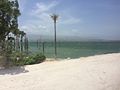
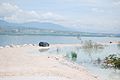
Etang Saumâtre, also known as Lake Azuei, is the largest lake in Haiti. Its waters are mostly brackish, and like its neighbour Lake Enriquillo, it is expanding.
-
Hispaniola border road


See also
 In Spanish: Laguna del Fondo para niños
