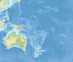
2021 Kermadec Islands earthquakes facts for kids
| UTC time | 2021-03-04 17:41:25 |
|---|---|
| 2021-03-04 19:28:31 | |
| ISC event | 619918377 |
| 619916487 | |
| USGS-ANSS | ComCat |
| ComCat | |
| Local date | March 5, 2021 |
| Local time | 06:41:25 NZDT |
| 08:28:31 NZDT | |
| Magnitude | Mw 7.4 |
| Mw 8.1 | |
| Depth | 55.6 km (35 mi) |
| 19.4 km (12 mi) | |
| Epicenter | 29°44′06″S 177°16′55″W / 29.735°S 177.282°W |
| Fault | Kermadec-Tonga subduction zone |
| Type | Megathrust |
| Areas affected | New Zealand; Pacific islands |
| Total damage | Limited |
| Max. intensity | VIII (Severe) |
| Tsunami | Yes (0–1 m) |
| Foreshocks | Yes |
| Aftershocks | Yes, strongest being Mw 6.5 |
| Casualties | 0 |
The 2021 Kermadec Islands earthquakes were a series of strong earthquakes that happened near the Kermadec Islands. These islands are a part of New Zealand. The main earthquake had a magnitude of 8.1. It happened on March 4, 2021, at 7:28 PM UTC.
This big earthquake was followed by a smaller one, measuring 6.1. Before the main quake, there was also a magnitude 7.4 earthquake. Another strong earthquake, measuring 7.3, happened off the coast of New Zealand's North Island a few hours earlier. This one was not related to the Kermadec quakes.
Contents
Understanding Plate Tectonics
The Earth's surface is made of huge pieces called tectonic plates. These plates are always moving, very slowly. Where these plates meet, they can rub against each other. This rubbing can cause earthquakes.
The Kermadec-Tonga Subduction Zone
The Kermadec Islands are located near a special area called the Kermadec-Tonga subduction zone. This zone is where two big plates meet: the Australian Plate and the Pacific Plate.
At this boundary, the Pacific Plate is denser. This means it dives, or subducts, underneath the less dense Australian Plate. This movement is what causes many earthquakes in the region.
The Earthquakes of 2021
Several earthquakes happened around the Kermadec Islands in March 2021. They caused shaking and led to tsunami warnings.
The Main Earthquake
The strongest earthquake had a magnitude of 8.1. It happened on March 5, 2021, at 8:28 AM New Zealand Daylight Time (NZDT). This quake was a megathrust earthquake. This means it happened where one tectonic plate slides under another. The area that broke during this earthquake was about 175 kilometers (109 miles) long and 75 kilometers (47 miles) wide.
Earlier Shakes
Less than two hours before the main 8.1 quake, a magnitude 7.4 earthquake occurred. This was considered a foreshock, meaning it happened before the biggest earthquake.
About six hours before the main quake, a separate magnitude 7.3 earthquake struck. This one was about 100 kilometers (62 miles) off the east coast of New Zealand's North Island. Many people across New Zealand felt this earthquake. Experts believe this quake was a separate event and not directly linked to the Kermadec quakes. A small flood warning was issued after this quake, but it was later removed.
Impact and Damage
Luckily, there were no reports of serious damage or injuries from these earthquakes. However, a camera on Raoul Island, which monitors a volcano, stopped working after the quakes.
Tsunami Warnings and Effects
A tsunami is a series of very large ocean waves. They are usually caused by big earthquakes under the sea. The main 8.1 magnitude earthquake caused tsunami warnings across the Pacific Ocean. These warnings reached as far away as Peru. New Zealand's North Island was especially at risk.
Evacuations and Wave Heights
Thousands of people in New Zealand moved to higher ground to stay safe. New Zealand's NEMA warned that the first tsunami waves would reach New Zealand around 9:49 AM local time. They expected some flooding along the West Coast.
Later, the tsunami threat for land was lowered to a "Beach and Marine threat." This meant people should stay out of the water and off beaches. The waves measured were about 35–40 centimeters (14–16 inches) high at East Cape. They were about 15–20 centimeters (6–8 inches) high at Great Barrier Island. Waves of 64 centimeters (25 inches) were reported in Norfolk Island. Unfortunately, the monitoring equipment on Raoul Island was damaged, so tsunami heights there could not be measured.
See also
 In Spanish: Terremoto de las islas Kermadec de 2021 para niños
 | William M. Jackson |
 | Juan E. Gilbert |
 | Neil deGrasse Tyson |


