Abingdon, Virginia facts for kids
Quick facts for kids
Abingdon
|
|||||
|---|---|---|---|---|---|
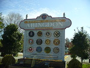
Abingdon Welcome Sign
|
|||||
|
|||||
| Motto(s):
Honor Pro Antiquis, Fides Pro Futuris
|
|||||
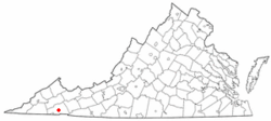
Location in Virginia
|
|||||
| Country | United States | ||||
| State | Virginia | ||||
| County | Washington | ||||
| Founded | 1776 | ||||
| Area | |||||
| • Total | 8.06 sq mi (20.87 km2) | ||||
| • Land | 8.05 sq mi (20.85 km2) | ||||
| • Water | 0.01 sq mi (0.02 km2) | ||||
| Elevation | 2,087 ft (636 m) | ||||
| Population
(2020)
|
|||||
| • Total | 8,376 | ||||
| • Estimate
(2019)
|
7,867 | ||||
| • Density | 1,039/sq mi (377.38/km2) | ||||
| Time zone | UTC−5 (EST) | ||||
| • Summer (DST) | UTC−4 (EDT) | ||||
| ZIP codes |
24210-24212
|
||||
| Area code(s) | 276 | ||||
| FIPS code | 51-00148 | ||||
| GNIS feature ID | 1498444 | ||||
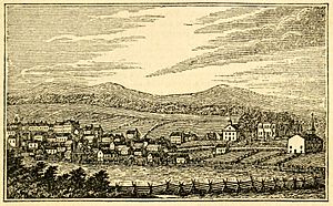
Abingdon is a town in Virginia, United States. It is the main town in Washington County, Virginia. Abingdon is about 133 miles southwest of Roanoke. In 2020, about 8,376 people lived there.
The town has many important historical places. It also has a lively arts and crafts scene. You can find galleries and museums along Main Street. Abingdon is part of a larger area known as the Tri-Cities region.
Contents
History of Abingdon
Long ago, different groups of indigenous people lived in this area. These included the Chisca and Xualae tribes. Later, in the late 1600s, the Cherokee Nation lived here. Their land stretched across parts of Tennessee, Virginia, Kentucky, North Carolina, and Georgia.
Between 1748 and 1750, a man named Thomas Walker explored the land where Abingdon is now. This area was on a major road that went through the wilderness. Walker called this land the Wolf Hill Tract. Today, the town has wolf sculptures placed around it. These sculptures were sold to raise money for the town.
By the 1770s, many settlers, mostly from Scotland and Ireland, moved to the area. In 1774, a fort called Black's Fort was built. It protected settlers from attacks by the Cherokee people. The Cherokee had joined with the British during the American Revolutionary War. Settlers would hide in the fort when there was danger.
The area was a good place for trade. This is because two major Native American trails crossed there. In 1776, Black's Fort became the main town for the new Washington County. In 1778, the town was officially named Abingdon. It might have been named after Abingdon-on-Thames in England. This was the hometown of Martha Washington's family.
In 1824, the Abingdon Male Academy opened. It was a school for boys. It closed in 1905. Today, the building is home to the William King Museum of Art. A school for women, Martha Washington College, was open from 1860 to 1932. The building is now a hotel called the Martha Washington Inn.
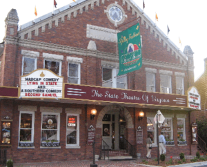
The Barter Theatre opened in Abingdon in 1933. This was during the Great Depression. It is now the longest-running professional theater in the United States. It is even the state theater of Virginia!
Abingdon is the end point of the Virginia Creeper Trail. This trail is 35 miles long. People can walk, bike, or ride horses on it. The Historical Society of Washington County is also in Abingdon. It helps people learn about the history of the area.
Several historic places in Abingdon are listed on the National Register of Historic Places. These include the Abingdon Historic District and White's Mill.
Climate in Abingdon
| Climate data for Abingdon, Virginia (1991–2020 normals, extremes 1969–present) | |||||||||||||
|---|---|---|---|---|---|---|---|---|---|---|---|---|---|
| Month | Jan | Feb | Mar | Apr | May | Jun | Jul | Aug | Sep | Oct | Nov | Dec | Year |
| Record high °F (°C) | 77 (25) |
80 (27) |
85 (29) |
91 (33) |
91 (33) |
99 (37) |
99 (37) |
100 (38) |
97 (36) |
90 (32) |
82 (28) |
78 (26) |
100 (38) |
| Mean maximum °F (°C) | 65.7 (18.7) |
68.7 (20.4) |
74.8 (23.8) |
82.5 (28.1) |
85.2 (29.6) |
89.6 (32.0) |
90.2 (32.3) |
89.6 (32.0) |
88.0 (31.1) |
81.4 (27.4) |
73.8 (23.2) |
66.0 (18.9) |
91.7 (33.2) |
| Mean daily maximum °F (°C) | 44.9 (7.2) |
48.4 (9.1) |
57.0 (13.9) |
67.7 (19.8) |
75.2 (24.0) |
81.8 (27.7) |
84.7 (29.3) |
83.9 (28.8) |
79.1 (26.2) |
68.8 (20.4) |
57.4 (14.1) |
47.8 (8.8) |
66.4 (19.1) |
| Daily mean °F (°C) | 34.5 (1.4) |
37.5 (3.1) |
44.9 (7.2) |
54.4 (12.4) |
62.8 (17.1) |
70.3 (21.3) |
73.5 (23.1) |
72.6 (22.6) |
67.0 (19.4) |
55.7 (13.2) |
45.1 (7.3) |
37.6 (3.1) |
54.7 (12.6) |
| Mean daily minimum °F (°C) | 24.1 (−4.4) |
26.6 (−3.0) |
32.9 (0.5) |
41.1 (5.1) |
50.4 (10.2) |
58.8 (14.9) |
62.3 (16.8) |
61.3 (16.3) |
54.9 (12.7) |
42.7 (5.9) |
32.8 (0.4) |
27.3 (−2.6) |
42.9 (6.1) |
| Mean minimum °F (°C) | 5.0 (−15.0) |
9.7 (−12.4) |
16.4 (−8.7) |
26.2 (−3.2) |
34.8 (1.6) |
47.3 (8.5) |
53.2 (11.8) |
52.6 (11.4) |
41.9 (5.5) |
28.1 (−2.2) |
18.7 (−7.4) |
12.0 (−11.1) |
1.9 (−16.7) |
| Record low °F (°C) | −21 (−29) |
−17 (−27) |
−6 (−21) |
12 (−11) |
27 (−3) |
35 (2) |
42 (6) |
37 (3) |
28 (−2) |
18 (−8) |
6 (−14) |
−12 (−24) |
−21 (−29) |
| Average precipitation inches (mm) | 3.80 (97) |
3.85 (98) |
4.46 (113) |
4.42 (112) |
4.39 (112) |
4.26 (108) |
4.69 (119) |
3.84 (98) |
3.32 (84) |
2.78 (71) |
3.25 (83) |
4.21 (107) |
47.27 (1,201) |
| Average snowfall inches (cm) | 4.8 (12) |
3.9 (9.9) |
1.4 (3.6) |
0.1 (0.25) |
0.0 (0.0) |
0.0 (0.0) |
0.0 (0.0) |
0.0 (0.0) |
0.0 (0.0) |
trace | trace | 2.3 (5.8) |
12.5 (31.55) |
| Average precipitation days (≥ 0.01 in) | 12.6 | 11.7 | 12.9 | 12.2 | 12.8 | 12.1 | 12.3 | 10.7 | 8.9 | 9.0 | 9.8 | 12.8 | 136.8 |
| Average snowy days (≥ 0.1 in) | 2.9 | 1.8 | 0.9 | 0.2 | 0.0 | 0.0 | 0.0 | 0.0 | 0.0 | 0.0 | 0.2 | 1.7 | 7.7 |
| Source: NOAA (snow/snow days 1981–2010) | |||||||||||||
Geography of Abingdon
Abingdon is located at 36°42′35″N 81°58′32″W / 36.70972°N 81.97556°W.
The United States Census Bureau says the town covers about 8.3 square miles (21.6 km2). All of this area is land.
The town sits in the Great Appalachian Valley. It is between two parts of the Holston River, called the Middle Fork and the North Fork.
People of Abingdon (Demographics)
| Historical population | |||
|---|---|---|---|
| Census | Pop. | %± | |
| 1870 | 715 | — | |
| 1880 | 1,064 | 48.8% | |
| 1890 | 1,674 | 57.3% | |
| 1900 | 1,306 | −22.0% | |
| 1910 | 1,757 | 34.5% | |
| 1920 | 2,532 | 44.1% | |
| 1930 | 2,877 | 13.6% | |
| 1940 | 3,158 | 9.8% | |
| 1950 | 4,709 | 49.1% | |
| 1960 | 4,758 | 1.0% | |
| 1970 | 4,376 | −8.0% | |
| 1980 | 4,318 | −1.3% | |
| 1990 | 7,003 | 62.2% | |
| 2000 | 7,780 | 11.1% | |
| 2010 | 8,191 | 5.3% | |
| 2020 | 8,376 | 2.3% | |
| source: | |||
In 2020, there were 8,376 people living in Abingdon. There were 3,726 households. This means there were about 1,039 people per square mile.
About 18.2% of the people were under 18 years old. About 23.4% were 65 years or older. The average age in Abingdon was 42 years.
Education in Abingdon
Students in Abingdon go to schools run by Washington County Public Schools. These include:
- Abingdon Elementary
- Watauga Elementary
- Greendale Elementary
- E.B. Stanley Middle School
- Abingdon High School
For higher education, there are several options:
- Virginia Highlands Community College is in Abingdon. It offers 2-year degrees.
- Emory & Henry College is a college located seven miles outside of town.
- The Southwest Virginia Higher Education Center is also in Abingdon. It lets students take college courses and earn degrees from many different universities.
Fun Places to Visit in Abingdon
- William King Museum of Art: This museum has amazing art exhibits. It also offers classes and workshops.
- Abingdon Historic District: This area has many old buildings. Some date back to the late 1700s. You can see the Abingdon Arts Depot, the Barter Theatre, and the Martha Washington Inn.
- The Historical Society of Washington County, Virginia: This place helps keep the history of Southwest Virginia alive. It has thousands of books and old pictures.
- Barter Theatre: This is Virginia's official state theater. It's one of the oldest professional theaters in the country. Famous actors like Gregory Peck performed here before they became big stars!
- Overmountain Victory National Historic Trail: This trail starts in Abingdon. It follows the path of American patriots during the Revolutionary War.
- Virginia Creeper Trail: This is a 34.3-mile trail where you can walk, bike, or ride horses. It goes from Abingdon to Whitetop, Virginia.
- The Virginia Highlands Festival: This big event started in 1948. It lasts for 16 days and celebrates Appalachian arts and crafts.
- The Crooked Road: Virginia's Heritage Music Trail: This trail explores the mountain regions of Virginia. It celebrates the traditional music of the mountain people.
- Southwest Virginia Cultural Center & Marketplace: This is a visitor center, a place for music, and a market for local artists.
- St. Thomas Episcopal Church: This is a historic church located near where Black's Fort used to be.
Famous People from Abingdon
Many interesting people have lived in or come from Abingdon:
- Three Virginia governors lived here: Wyndham Robertson, David Campbell, and John B. Floyd.
- Robert Armstrong (1792–1854): An army officer.
- Francis Preston Blair (1791–1876): A journalist and politician.
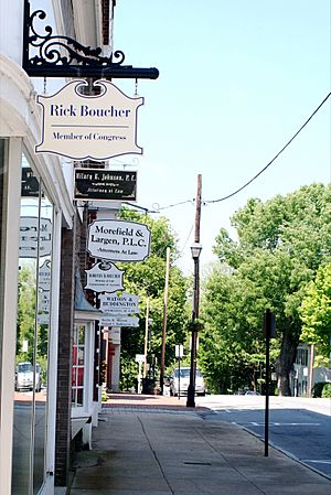
- Rick Boucher (born 1946): A U.S. Congressman who served for many years.
- Scott Cooper (born 1970): A film director.
- Frances Fisher (born 1954): An American actress who worked at the Barter Theatre.
- Joseph E. Johnston (1807–1891): A Confederate general during the American Civil War. He lived in Abingdon as a boy.
- Eric McClure (1978–2021): A NASCAR driver.
- Steven Jay Williams (born 1974): A famous YouTuber with millions of subscribers.
See Also
 In Spanish: Abingdon (Virginia) para niños
 | May Edward Chinn |
 | Rebecca Cole |
 | Alexa Canady |
 | Dorothy Lavinia Brown |


