
Adrian, Oregon facts for kids
Quick facts for kids
Adrian, Oregon
|
|
|---|---|

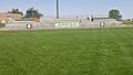
Event at school grounds in Adrian
|
|

Location in Oregon
|
|
| Country | United States |
| State | Oregon |
| County | Malheur |
| Incorporated | 1972 |
| Area | |
| • Total | 0.24 sq mi (0.63 km2) |
| • Land | 0.24 sq mi (0.63 km2) |
| • Water | 0.00 sq mi (0.00 km2) |
| Elevation | 2,225 ft (678 m) |
| Population
(2020)
|
|
| • Total | 157 |
| • Density | 643.44/sq mi (248.28/km2) |
| Time zone | UTC-7 (Mountain) |
| • Summer (DST) | UTC-6 (Mountain) |
| ZIP code |
97901
|
| Area code(s) | 541 |
| FIPS code | 41-00500 |
| GNIS feature ID | 1135989 |
Adrian is a small city in Malheur County, Oregon, in the United States. It is located near where the Snake River and the Owyhee River meet. In 2020, about 157 people lived there. Adrian is part of the larger Ontario area, which includes parts of Idaho.
Contents
History of Adrian

In 1913, a railroad company called the Oregon Short Line Railroad built a new railway line into this part of Oregon. There was already a post office called Riverview on the east side of the Snake River. The railroad wanted a different name for their station on the west side.
Reuben McCreary, who planned the town, suggested the name Adrian. He chose this name to honor his hometown, Adrian, Illinois. The Riverview post office moved across the river in 1915. Its name officially changed to Adrian in 1919.
For a long time, people thought the city was named after a sheep rancher named James Adrian. But he did not arrive in the area until 1916. This was after the town was already being planned.
Adrian is also located on a path of the historic Oregon Trail. This was a longer route that pioneers used to avoid crossing the dangerous Snake River.
Geography of Adrian
Adrian is a small city. According to the United States Census Bureau, the city covers about 0.24 square miles (0.63 square kilometers) of land. There is no water area within the city limits.
Climate in Adrian
Adrian has a semi-arid climate. This means it is generally dry, but not as dry as a desert. It gets some rain, but not a lot. Summers are usually hot and dry, while winters are cooler.
| Climate data for Adrian, Oregon (Owyhee Dam), 1991–2020 normals, extremes 1935–present | |||||||||||||
|---|---|---|---|---|---|---|---|---|---|---|---|---|---|
| Month | Jan | Feb | Mar | Apr | May | Jun | Jul | Aug | Sep | Oct | Nov | Dec | Year |
| Record high °F (°C) | 67 (19) |
70 (21) |
81 (27) |
92 (33) |
102 (39) |
110 (43) |
112 (44) |
111 (44) |
103 (39) |
93 (34) |
80 (27) |
70 (21) |
112 (44) |
| Mean maximum °F (°C) | 54.7 (12.6) |
60.0 (15.6) |
70.7 (21.5) |
81.8 (27.7) |
91.7 (33.2) |
99.0 (37.2) |
105.7 (40.9) |
103.5 (39.7) |
96.6 (35.9) |
84.9 (29.4) |
66.8 (19.3) |
56.8 (13.8) |
106.2 (41.2) |
| Mean daily maximum °F (°C) | 39.8 (4.3) |
47.3 (8.5) |
57.4 (14.1) |
64.7 (18.2) |
74.6 (23.7) |
83.5 (28.6) |
94.8 (34.9) |
93.2 (34.0) |
82.5 (28.1) |
67.5 (19.7) |
50.4 (10.2) |
40.4 (4.7) |
66.3 (19.1) |
| Daily mean °F (°C) | 30.5 (−0.8) |
35.7 (2.1) |
43.5 (6.4) |
49.6 (9.8) |
58.4 (14.7) |
65.5 (18.6) |
74.7 (23.7) |
73.2 (22.9) |
63.8 (17.7) |
51.5 (10.8) |
38.3 (3.5) |
30.8 (−0.7) |
51.3 (10.7) |
| Mean daily minimum °F (°C) | 21.2 (−6.0) |
24.1 (−4.4) |
29.5 (−1.4) |
34.6 (1.4) |
42.2 (5.7) |
47.5 (8.6) |
54.5 (12.5) |
53.2 (11.8) |
45.1 (7.3) |
35.6 (2.0) |
26.1 (−3.3) |
21.2 (−6.0) |
36.2 (2.4) |
| Mean minimum °F (°C) | 7.9 (−13.4) |
13.8 (−10.1) |
20.6 (−6.3) |
25.5 (−3.6) |
32.1 (0.1) |
39.4 (4.1) |
47.8 (8.8) |
45.0 (7.2) |
35.6 (2.0) |
24.4 (−4.2) |
14.5 (−9.7) |
9.2 (−12.7) |
3.2 (−16.0) |
| Record low °F (°C) | −22 (−30) |
−13 (−25) |
11 (−12) |
14 (−10) |
24 (−4) |
34 (1) |
35 (2) |
35 (2) |
27 (−3) |
11 (−12) |
−4 (−20) |
−16 (−27) |
−22 (−30) |
| Average precipitation inches (mm) | 1.06 (27) |
0.71 (18) |
0.77 (20) |
0.84 (21) |
1.14 (29) |
0.85 (22) |
0.39 (9.9) |
0.21 (5.3) |
0.40 (10) |
0.54 (14) |
0.77 (20) |
1.09 (28) |
8.77 (224.2) |
| Average snowfall inches (cm) | 2.1 (5.3) |
0.6 (1.5) |
0.1 (0.25) |
0.0 (0.0) |
0.0 (0.0) |
0.0 (0.0) |
0.0 (0.0) |
0.0 (0.0) |
0.0 (0.0) |
0.0 (0.0) |
0.1 (0.25) |
3.1 (7.9) |
6.0 (15) |
| Average precipitation days (≥ 0.01 in) | 9.2 | 7.3 | 7.9 | 8.2 | 8.6 | 5.3 | 2.6 | 1.9 | 3.2 | 4.8 | 8.1 | 10.0 | 77.1 |
| Average snowy days (≥ 0.1 in) | 1.0 | 0.7 | 0.1 | 0.0 | 0.0 | 0.0 | 0.0 | 0.0 | 0.0 | 0.0 | 0.2 | 1.6 | 3.6 |
| Source 1: NOAA | |||||||||||||
| Source 2: National Weather Service | |||||||||||||
People of Adrian
| Historical population | |||
|---|---|---|---|
| Census | Pop. | %± | |
| 1980 | 162 | — | |
| 1990 | 131 | −19.1% | |
| 2000 | 147 | 12.2% | |
| 2010 | 177 | 20.4% | |
| 2020 | 157 | −11.3% | |
| U.S. Decennial Census | |||
Adrian is a small community. In 2020, the population was 157 people. The number of people living in Adrian has changed over the years. For example, in 2010, there were 177 people.
Most people living in Adrian are White. Some residents are of Hispanic or Latino background. There are also smaller groups of Native American and Asian people.
The average age in Adrian in 2010 was about 44 years old. About 22% of the people were under 18 years old. About 23% were 65 years or older.
Education in Adrian
Adrian is part of the Adrian School District. Students in Adrian attend local schools.
- Adrian Elementary and Middle School
- Adrian High School
Transportation in Adrian
Several important roads either start, end, or pass through Adrian. These highways help people travel to and from the city.
- Idaho Route 18
- Oregon Route 201
- Oregon Route 452
- Oregon Route 453
- Oregon Route 454
Images for kids
-
The football field at Adrian High School

See also
 In Spanish: Adrian (Oregón) para niños
