
Aguiguan facts for kids
.JPG)
Satellite view, with Naftan Rock visible to the southwest
|
|
 |
|
| Geography | |
|---|---|
| Location | Pacific Ocean |
| Coordinates | 14°51′13″N 145°33′34″E / 14.85361°N 145.55944°E |
| Archipelago | Northern Mariana Islands |
| Area | 7.01 km2 (2.71 sq mi) |
| Length | 4.7 km (2.92 mi) |
| Width | 1.8 km (1.12 mi) |
| Highest elevation | 157 m (515 ft) |
| Administration | |
|
United States
|
|
| Commonwealth | Northern Mariana Islands |
| Demographics | |
| Population | - uninhabited - (2010) |
Aguiguan (also known as Aguigan or Aguihan) is a small island shaped like a bean. It is made of coral and is part of the Northern Mariana Islands chain in the Pacific Ocean. This island is about 8 kilometers (5 miles) southwest of Tinian. The water between them is called the Tinian Channel. Aguiguan and Tinian Island together form Tinian Municipality. This is one of the four main political areas in the Northern Marianas.
Contents
Island History: Who Ruled Aguiguan?

It is thought that European explorers first saw Aguiguan during the Spanish trip led by Ferdinand Magellan. Later, in 1669, a Spanish missionary named Diego Luis de San Vitores visited the island.
From the 1500s until 1899, Aguiguan was part of the Spanish Mariana Islands. Then, Spain sold the Northern Marianas to the German Empire. Under German rule, it was part of German New Guinea.
During World War I, the Empire of Japan took control of Aguiguan. It became part of their South Seas Mandate. In World War II, the Imperial Japanese Army had soldiers stationed on Aguiguan. These soldiers are famous because they surrendered to the Allied forces on September 4, 1945. This was two days after Japan officially surrendered on the USS Missouri (BB-63). This surrender was special because it was the only one hosted by a U.S. Coast Guard Cutter. The ship was called USCG 83525. US Navy Admiral Marshall R. Greer accepted the surrender from Japanese Second Lieutenant Kinichi Yamada.
After World War II, the United States took control of Aguiguan. It was managed as part of the Trust Territory of the Pacific Islands. Since 1978, the island has been part of the Commonwealth of the Northern Mariana Islands.
Exploring Aguiguan's Geography
.jpg)
Aguiguan is a small island, only about 7 square kilometers (2.7 square miles) in size. It is 4.7 kilometers (2.9 miles) long and 1.8 kilometers (1.1 miles) wide. People call it "Goat Island" because many wild goats live there. These goats have eaten much of the island's natural plants.
No people live on Aguiguan. Visitors rarely go there because it is surrounded by very steep cliffs. However, a study in 2002 found some native animals on the island. These include the Mariana fruit bat, the Polynesian sheath-tailed bat, and the Micronesian megapode Megapodius laperouse.
Naftan Rock: A Nearby Landmark

About 1 kilometer (0.6 miles) off the southwest coast of Aguiguan is Naftan Rock. This rock stands 18 meters (59 feet) tall.
Important Bird Area: A Home for Birds
Aguiguan and Naftan Rock are recognized as an Important Bird Area (IBA) by BirdLife International. This means they are very important places for birds. Many types of birds live here, such as:
- Micronesian megapodes
- White-throated ground doves
- Mariana fruit doves
- Mariana swiftlets
- Micronesian myzomelas
- Rufous fantails
- Aguiguan reed warblers
- Golden and Saipan white-eyes
- Micronesian starlings
Aguiguan is also a breeding ground for seabirds. About 120 pairs of brown boobies and 450 pairs of brown noddies have been seen there. Naftan Rock is home to thousands of seabirds.
Images for kids
-
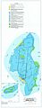
Map of soil types on the islands of Taipan and Aguijan
See also
 In Spanish: Aguiján para niños
