
Alamo, Nevada facts for kids
Quick facts for kids
Alamo, Nevada
|
|
|---|---|
 |
|

Alamo, Nevada
Location in Nevada

Alamo, Nevada
Location in the United States
|
|
| Country | United States |
| State | Nevada |
| County | Lincoln |
| Area | |
| • Total | 6.35 sq mi (16.45 km2) |
| • Land | 6.35 sq mi (16.45 km2) |
| • Water | 0.00 sq mi (0.00 km2) |
| Elevation | 3,458 ft (1,054 m) |
| Population
(2020)
|
|
| • Total | 785 |
| • Density | 123.62/sq mi (47.73/km2) |
| Time zone | UTC−8 (Pacific (PST)) |
| • Summer (DST) | UTC−7 (PDT) |
| ZIP codes |
89001
|
| FIPS code | 32-00500 |
| GNIS feature ID | 2583909 |
Alamo is a small, unincorporated town in Lincoln County, Nevada. It is located about 90 miles (145 km) north of Las Vegas along U.S. Route 93. As of the 2020 census, Alamo had a population of 785 people.
Contents
History of Alamo, Nevada
Alamo got its post office in 1905. The community was named to remember the Battle of the Alamo. Many of the first people to settle here were Mormons.
Because of the religious beliefs of its early settlers, Alamo has traditionally not allowed alcohol sales. Many residents are members of The Church of Jesus Christ of Latter-day Saints. Their faith teaches them to avoid alcohol. In 2022, the town considered letting gas stations and supermarkets sell alcohol. However, they still wanted to keep bars from opening.
Geography and Landscape
Alamo is located in the Pahranagat Valley. The main way people make a living here is through ranching. A popular nearby spot is the Pahranagat National Wildlife Refuge. This refuge is a great place to see local wildlife.
Between Alamo and the town of Rachel, you can find something special. It is the site of the Devonian Alamo Impact Breccia. This is evidence of an ancient meteor impact.
The U.S. Census Bureau says that the Alamo area covers about 78.4 square kilometers (30.3 sq mi). All of this area is land.
Climate in Alamo
Alamo has a desert climate. Summers are very hot, and winters are cool. The area gets very little rain throughout the year.
| Climate data for Alamo, Nevada (Elevation 3,449ft) | |||||||||||||
|---|---|---|---|---|---|---|---|---|---|---|---|---|---|
| Month | Jan | Feb | Mar | Apr | May | Jun | Jul | Aug | Sep | Oct | Nov | Dec | Year |
| Record high °F (°C) | 76 (24) |
83 (28) |
85 (29) |
95 (35) |
105 (41) |
112 (44) |
114 (46) |
116 (47) |
108 (42) |
100 (38) |
86 (30) |
76 (24) |
116 (47) |
| Mean daily maximum °F (°C) | 51.2 (10.7) |
56.3 (13.5) |
64.5 (18.1) |
74.4 (23.6) |
82.9 (28.3) |
93.1 (33.9) |
100.1 (37.8) |
96.5 (35.8) |
90.3 (32.4) |
77.9 (25.5) |
64.2 (17.9) |
54.2 (12.3) |
75.5 (24.2) |
| Mean daily minimum °F (°C) | 21.2 (−6.0) |
25.4 (−3.7) |
29.6 (−1.3) |
36.6 (2.6) |
42.9 (6.1) |
49.8 (9.9) |
57.3 (14.1) |
55.5 (13.1) |
46.3 (7.9) |
37.5 (3.1) |
28.3 (−2.1) |
23.7 (−4.6) |
37.9 (3.3) |
| Record low °F (°C) | −9 (−23) |
−6 (−21) |
11 (−12) |
14 (−10) |
20 (−7) |
25 (−4) |
40 (4) |
33 (1) |
24 (−4) |
11 (−12) |
7 (−14) |
0 (−18) |
−9 (−23) |
| Average precipitation inches (mm) | 0.65 (17) |
0.64 (16) |
0.69 (18) |
0.56 (14) |
0.49 (12) |
0.16 (4.1) |
0.57 (14) |
0.71 (18) |
0.27 (6.9) |
0.53 (13) |
0.45 (11) |
0.55 (14) |
6.27 (159) |
| Average snowfall inches (cm) | 3.6 (9.1) |
1.2 (3.0) |
0.8 (2.0) |
0.3 (0.76) |
0.1 (0.25) |
0 (0) |
0 (0) |
0 (0) |
0 (0) |
0 (0) |
0.2 (0.51) |
1.3 (3.3) |
7.4 (19) |
| Source: The Western Regional Climate Center | |||||||||||||
Population of Alamo
| Historical population | |||
|---|---|---|---|
| Census | Pop. | %± | |
| 2020 | 785 | — | |
| U.S. Decennial Census | |||
As of 2020, 785 people live in Alamo.
Tourism and Attractions
Alamo is a popular stop for tourists and truckers. Many people travel through Alamo on their way from Las Vegas to northern Nevada and Idaho. The area has several interesting attractions. These include nearby warm springs and the wildlife refuge.
Alamo is also close to the famous Extraterrestrial Highway and Area 51. Gas stations in Alamo often sell fun items related to aliens. There are two truck stops, the Alamo Sinclair and the Ash Springs Shell. They have large areas for diesel trucks. Alamo also has two motels, the Alamo Inn and Sunset View Inn, where visitors can stay.
Transportation in Alamo
The town has a small airport called Alamo Landing Field.
Education in Alamo
The Lincoln County School District provides public education in Alamo. Its main offices are in Panaca, Nevada. There are three schools in the valley that serve students from kindergarten through high school.
| School | Grades |
|---|---|
| Pahranagat Valley Elementary School | K–5 |
| Pahranagat Valley Middle School | 6-8 |
| Pahranagat Valley High School | 9-12 |
Religious Groups
Alamo has three different religious denominations with their own churches:
- Christian Bible Fellowship Church
- The Church of Jesus Christ of Latter-day Saints, whose members were among the first settlers here
- Trinity Assembly of God
Community Services
Alamo offers several important services to its residents. It has a local police force and a volunteer fire department. Phone and internet services are available. There is also a medical clinic and a public library. The Pahranagat Valley Federal Credit Union helps residents with their banking needs. Alamo's first radio station, KQLN 91.3 FM, started broadcasting in 2010 but stopped in 2013.
Images for kids
-
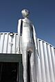
A shop near Alamo selling alien-themed items.

See also
 In Spanish: Álamo (Nevada) para niños
