Aldingham facts for kids
Quick facts for kids Aldingham |
|
|---|---|
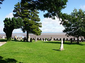
 Graveyard of St Cuthbert's Church |
|
| Population | 1,105 (2011) |
| OS grid reference | SD2871 |
| Civil parish |
|
| District |
|
| Shire county | |
| Region | |
| Country | England |
| Sovereign state | United Kingdom |
| Post town | ULVERSTON |
| Postcode district | LA12 |
| Dialling code | 01229 |
| Police | Cumbria |
| Fire | Cumbria |
| Ambulance | North West |
| EU Parliament | North West England |
| UK Parliament |
|
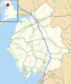
Aldingham is a small village in Cumbria, England. It's located on the coast of the Furness peninsula, right next to Morecambe Bay. It's about 8 kilometers (5 miles) east of Barrow-in-Furness and 6 kilometers (4 miles) south of Ulverston. The area around Aldingham, called its civil parish, includes several other villages like Baycliff, Dendron, Leece, Gleaston, Newbiggin, Roosebeck, and Scales. In 2011, about 1,105 people lived in the parish.
Aldingham's Past
Aldingham has a long history. It was mentioned in the Domesday Book, which was a big survey of England made in 1086. At that time, Aldingham was a separate area owned by a local person named Ernulf. The name "Aldingham" probably comes from an old English phrase meaning "home of Alda's family or followers."
Local stories say that Aldingham used to be much bigger. People believed it was almost a mile long, but that parts of it were washed away by the sea over time.
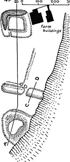
From the early 1100s, Aldingham was an important place for local lords. They built two early manor houses about a mile south of the current village. The first one you can still see is called Aldingham Motte. It started as a round fort before 1102 and was later made into a "motte and bailey" castle. This type of castle has a mound (motte) with a tower and a walled courtyard (bailey). You can still see its remains on a sandy cliff overlooking Morecambe Bay.
A bit further north, near Moat Farm, there's a rectangular moat. This likely shows where a hall from the 1200s once stood. The lords probably left this spot when they moved further inland to Gleaston in the 1300s.
St Cuthbert's Church
At the heart of Aldingham village, right by the bay, stands St Cuthbert's Church. An old record in Durham Cathedral mentions Aldingham as one of the places where the relics (special items) of Saint Cuthbert were kept in 875. This was when monks were running away from Danish Vikings. Saint Cuthbert owned land nearby, but we don't know if his possessions reached Aldingham.
The church building itself dates back to the mid-1100s. Parts were added in the 1200s, and the tower was built in 1350. The church was also repaired many times in the 1800s and again in 1932. In the eastern wall of the church, there's a small hole, about 5 inches by 3 inches (127 mm by 76 mm), that goes all the way through the wall. People believe this hole was once a place where people with leprosy could watch church services without having to enter the building.
Aldingham Hall
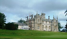
The large building across from the church is called Aldingham Hall. This grand building has no connection to the old lords of the manor. It was started in 1846 by Dr. John Stonard, who was the local church leader. It took four years to build. Sadly, Dr. Stonard died in 1849 and never saw it finished. He left the hall to his manservant, Edward Jones Schollick. It's said that Schollick had saved his master's life on the dangerous sands of Morecambe Bay.
Edward Jones Schollick became a generous person in the community. He was involved in building ships and mining iron ore. However, he wasn't very popular and moved to Australia in 1876. Since then, Aldingham Hall has been used as a place for people to recover from illness, and now it's a home for older people.
Aldingham Civil Parish
The civil parish of Aldingham covers the same area as the old church parish. It's about 18 square kilometers (7 square miles). To the south and west, it borders Barrow Borough, and to the north, it borders the parish of Urswick. The eastern edge of the parish goes quite a way into Morecambe Bay.
The parish has a council with eight members. It's divided into two areas called "wards." The North Ward includes Aldingham, Baycliff, Scales, and smaller areas like Sunbrick. The South Ward includes Dendron, Gleaston, Leece, Newbiggin, and Roosebeck. The North Ward elects three members to the parish council, and the South Ward elects five.
Nearby Places
 |
Scales | Baycliff | Morecambe Bay |  |
| Gleaston | Morecambe Bay | |||
| Newbiggin | Morecambe Bay | Morecambe Bay |
 | Aurelia Browder |
 | Nannie Helen Burroughs |
 | Michelle Alexander |


