Allgood, Alabama facts for kids
Quick facts for kids
Allgood, Alabama
|
||
|---|---|---|
|
||

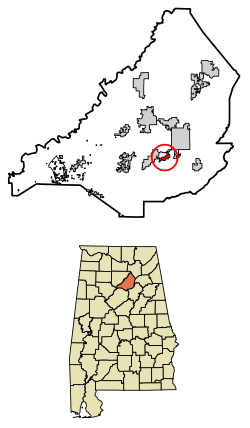
Location of Allgood in Blount County, Alabama.
|
||
| Country | United States | |
| State | Alabama | |
| County | Blount | |
| Area | ||
| • Total | 1.04 sq mi (2.69 km2) | |
| • Land | 1.04 sq mi (2.69 km2) | |
| • Water | 0.00 sq mi (0.00 km2) | |
| Elevation | 787 ft (240 m) | |
| Population
(2020)
|
||
| • Total | 548 | |
| • Density | 527.43/sq mi (203.70/km2) | |
| Time zone | UTC-6 (Central (CST)) | |
| • Summer (DST) | UTC-5 (CDT) | |
| ZIP code |
35013
|
|
| Area codes | 205, 659 | |
| FIPS code | 01-01396 | |
| GNIS feature ID | 0113021 | |
| Website | https://www.townofallgoodal.com/ | |
Allgood is a small town in Blount County, Alabama, United States. It used to be known as Chepultepec. In 2020, about 548 people lived there.
Contents
History of Allgood
The town of Allgood has an interesting history behind its name. Some people say the name comes from a family called Allgood. They were early settlers from South Carolina who moved to the area in the early 1800s.
However, another story says the town's first name was Chepultepec. This name might have come from the Battle of Chapultepec during the Mexican–American War.
In December 1915, the name was changed to "Allgood." A local company that made lime found that customers had trouble spelling Chepultepec. This made it hard for them to get repeat business. So, the lime manufacturer convinced the local postmaster to change the town's name. The postmaster then gave the town his own last name, Allgood.
The town officially became a town (was incorporated) in 1959. In 2010, Allgood became the first place in Alabama where most of the people were of Hispanic background.
Geography of Allgood
Allgood is located in the southern-central part of Blount County. It sits in a valley called Murphree Valley. To the southeast, you can see Straight Mountain. To the northwest are Red Mountain and Sand Mountain.
Alabama State Route 75 goes through the town. If you go northeast on this road for about 3 miles (5 km), you'll reach Oneonta. Oneonta is the county seat, which means it's where the county government is located. If you go southwest for about 38 miles (61 km), you'll get to Birmingham.
The U.S. Census Bureau says that Allgood covers a total area of about 1.0 square mile (2.6 square kilometers). All of this area is land, with no water.
Population and People
Allgood's Population Over Time
| Historical population | |||
|---|---|---|---|
| Census | Pop. | %± | |
| 1960 | 147 | — | |
| 1970 | 272 | 85.0% | |
| 1980 | 387 | 42.3% | |
| 1990 | 464 | 19.9% | |
| 2000 | 629 | 35.6% | |
| 2010 | 622 | −1.1% | |
| 2020 | 548 | −11.9% | |
| U.S. Decennial Census | |||
Allgood first appeared on the U.S. Census in 1960 as an official town. The table shows how the number of people living in Allgood has changed over the years.
2020 Census Information
The 2020 United States census collected information about the people living in Allgood.
| Race | Num. | Perc. |
|---|---|---|
| White (not Hispanic) | 233 | 42.52% |
| Black or African American (not Hispanic) | 7 | 1.28% |
| Native American | 1 | 0.18% |
| Asian | 2 | 0.36% |
| Pacific Islander | 1 | 0.18% |
| Other/Mixed | 17 | 3.1% |
| Hispanic or Latino | 287 | 52.37% |
In 2020, there were 548 people living in Allgood. These people lived in 208 households, and 152 of these were families.
Historical Census Records
Before Allgood was officially a town, the area around it was counted in census records as a "precinct." A precinct is a small area used for voting and counting people. The precinct that included Allgood was first listed in the 1890 U.S. Census as Chepultepec. In 1950, its name was changed to Allgood.
Notable People from Allgood
- Miles C. Allgood – He was a U.S. Representative for Alabama's 5th congressional district. This means he was elected to represent Alabama in the U.S. Congress from 1923 to 1935.
- Albert A. Murphree – He was a president of two important universities. He led Florida State University from 1897 to 1909 and then became president of the University of Florida from 1909 to 1927.
See also
 In Spanish: Allgood para niños
 | Mary Eliza Mahoney |
 | Susie King Taylor |
 | Ida Gray |
 | Eliza Ann Grier |


